Wildfires raging across Northern California have left at least 17 people dead and destroyed more than 3,500 homes and businesses throughout California’s wine country since Sunday.
Spurred by powerful winds, more than a dozen wildfires have forced thousands of people out of their homes and destroyed California wineries in the Northern California region.
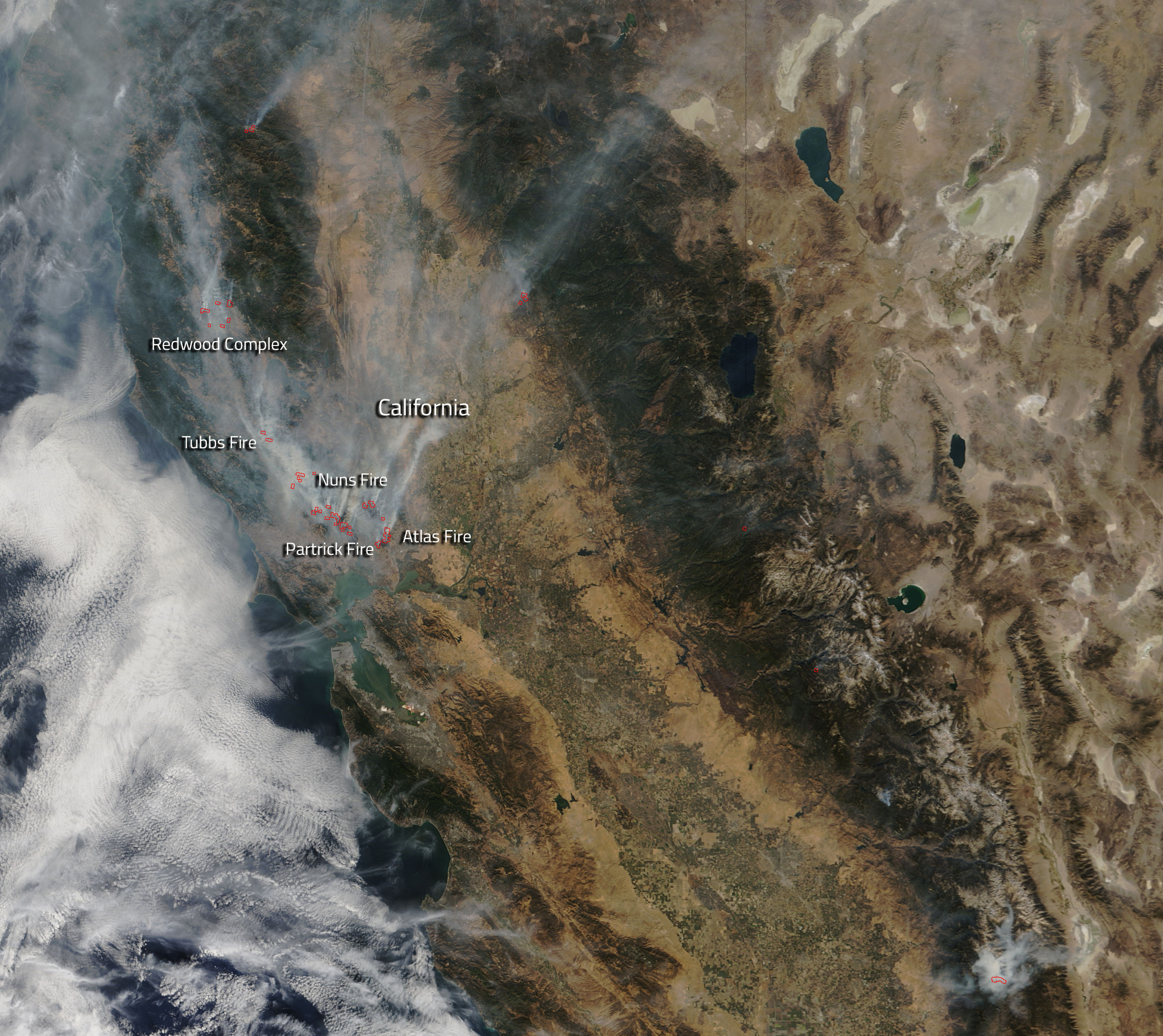
A photo from NASA showing the California wildfires from space reveals actively burning “hot spots,” which are outlined in red. The hot spots on the map are peppered throughout Northern California, including areas surrounding Napa, Calistoga and Mendocino County.
NASA’s Terra satellite took the photo of the California wildfires from space, and highlighted the hot spots using an instrument that detected higher temperatures in those areas.
See how the California wildfires look from space above.
More Must-Reads from TIME
- Donald Trump Is TIME's 2024 Person of the Year
- Why We Chose Trump as Person of the Year
- Is Intermittent Fasting Good or Bad for You?
- The 100 Must-Read Books of 2024
- The 20 Best Christmas TV Episodes
- Column: If Optimism Feels Ridiculous Now, Try Hope
- The Future of Climate Action Is Trade Policy
- Merle Bombardieri Is Helping People Make the Baby Decision
Write to Mahita Gajanan at mahita.gajanan@time.com