The U.S. fired 59 Tomahawk cruise missiles at a Syrian airbase early Friday in response to what it believes was a Syrian-regime-ordered chemical attack that killed more than 80 people in the country’s northwestern region earlier this week.
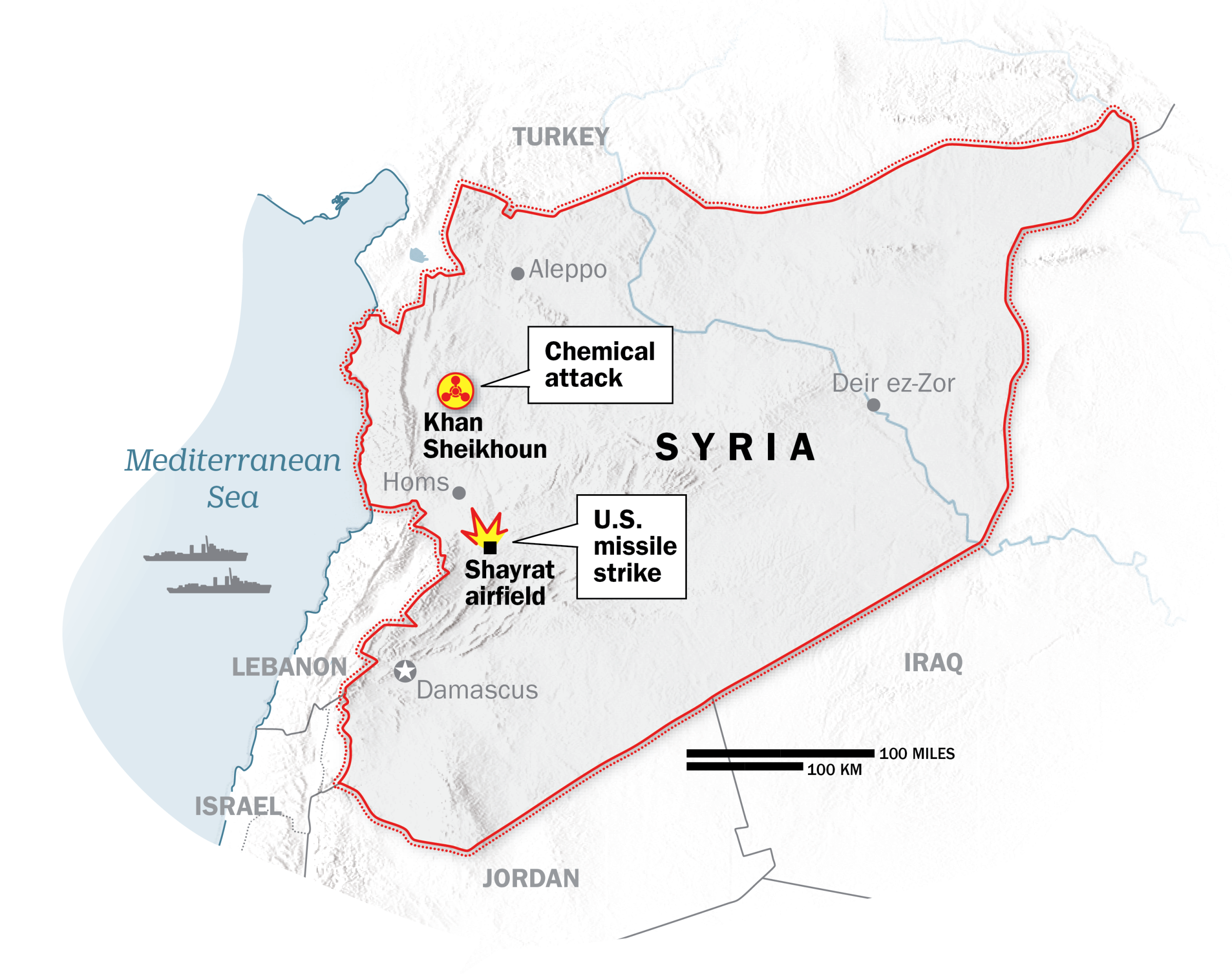
The strike, which was launched from two Navy destroyers in the Mediterranean Sea, targeted the Shayrat air base in Homs, western Syria. A Pentagon spokesperson said U.S. intelligence determined that the air crafts carrying the chemical weapons departed from the air field, which is located about 86 miles from Khan Sheikhoun, the town where the deadly chemical attack occurred.
The Syrian military reported that the U.S. assault killed at least seven people and caused significant damage, according to the Associated Press. The Pentagon says it was careful to avoid civilians. Russia, meanwhile, disputes the effectiveness of the attack and called the strike an “aggression against a sovereign state in violation of international law.”
This map shows the location of the Shayrat air base along with the town of Khan Sheikhoun.
More Must-Reads from TIME
- Introducing the 2024 TIME100 Next
- The Reinvention of J.D. Vance
- How to Survive Election Season Without Losing Your Mind
- Welcome to the Golden Age of Scams
- Did the Pandemic Break Our Brains?
- The Many Lives of Jack Antonoff
- 33 True Crime Documentaries That Shaped the Genre
- Why Gut Health Issues Are More Common in Women
Contact us at letters@time.com