Scientists have discovered signs of water on Mars, which adds to the speculation that life could survive on the planet. NASA discussed the discovery Monday morning.
NASA says the new findings published Monday “provide the strongest evidence yet that liquid water flows intermittently on present-day Mars,” the agency said in a statement.
NASA announced that by using an imaging spectrometer on NASA’s Mars Reconnaissance Orbiter (MRO), researchers were able to detect “signatures of hydrated minerals on slopes where mysterious streaks are seen on the Red Planet.” The dark streaks ebb and flow over time and change during different seasons. The downward flows have been thought in the past to relate to liquid water.
It’s long been thought that Mars had bodies of water that are now frozen, the New York Times reports. In the new study, researchers were able to identify signs of hydrated salts at multiple locations, which suggests some sort of presence of liquid water. “Mars is not the dry arid planet that we through of in the past,” said Jim Green, director of planetary science at NASA Headquarters. “Under certain circumstances, liquid water has been found on Mars.”
“We found the hydrated salts only when the seasonal features were widest, which suggests that either the dark streaks themselves or a process that forms them is the source of the hydration. In either case, the detection of hydrated salts on these slopes means that water plays a vital role in the formation of these streaks,” said lead study author Lujendra Ojha of the Georgia Institute of Technology in Atlanta in a statement. Ojha’s report was published Monday in the journal Nature Geoscience.
The briefing includes a question-and-answer session, and the public can send in their own questions over social media using the hashtag #AskNASA.
Photos from the Curiosity Rover’s First 2 Incredible Years on Mars
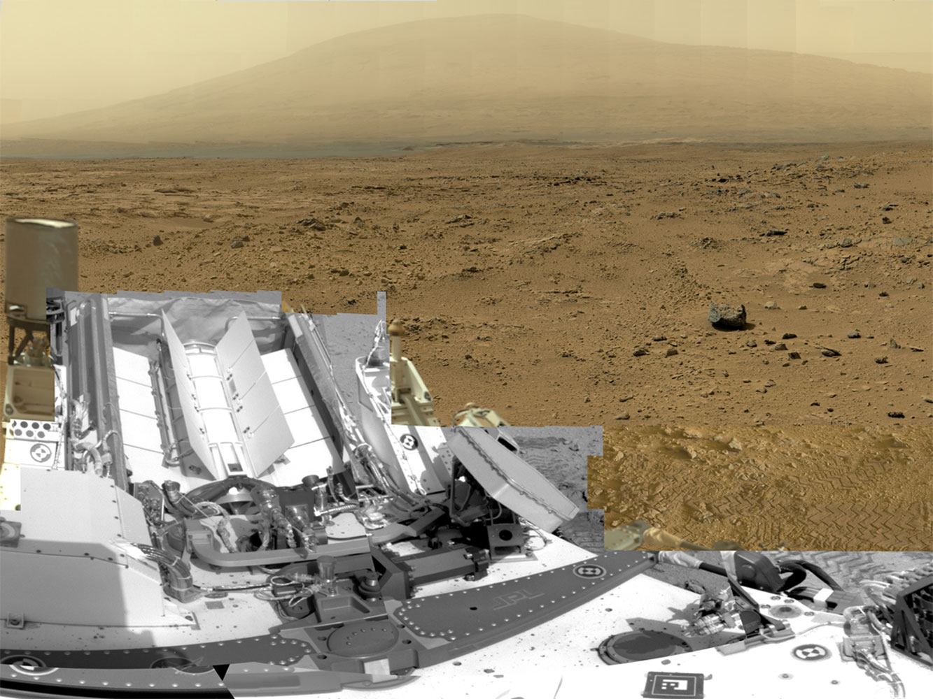
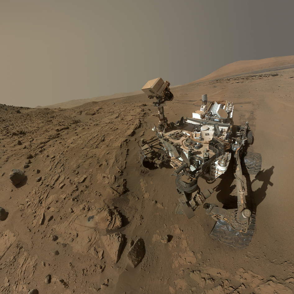
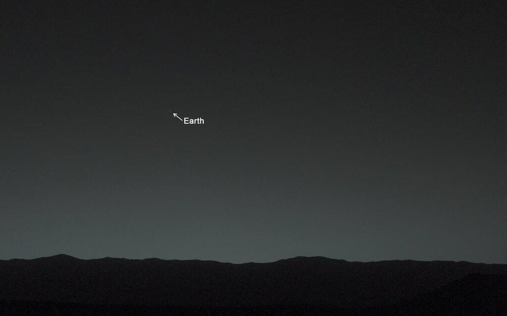
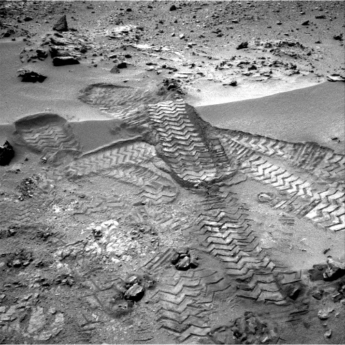
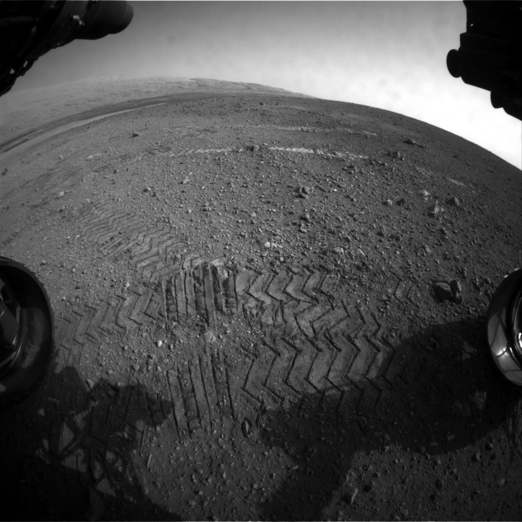
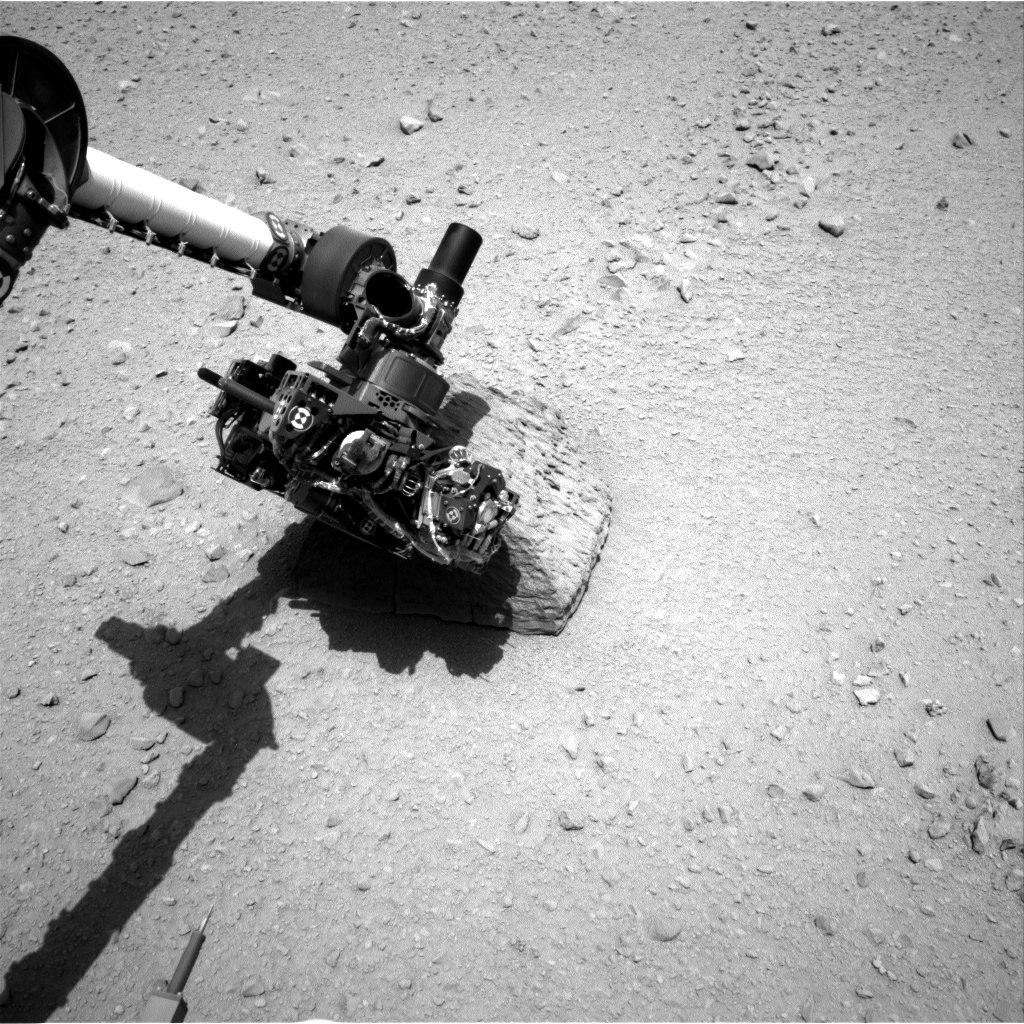
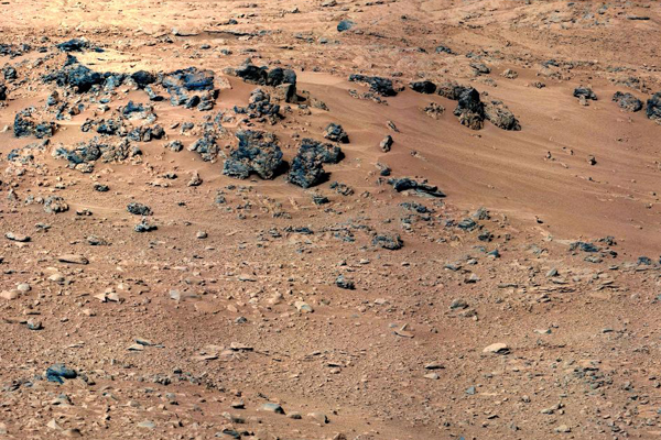
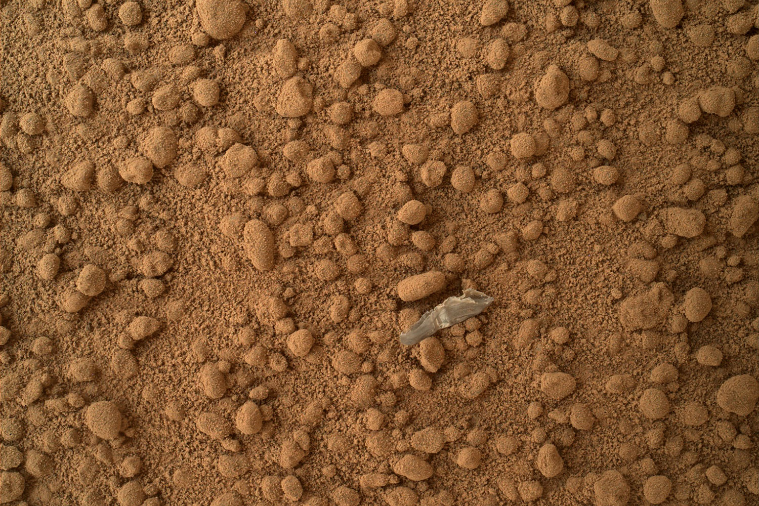
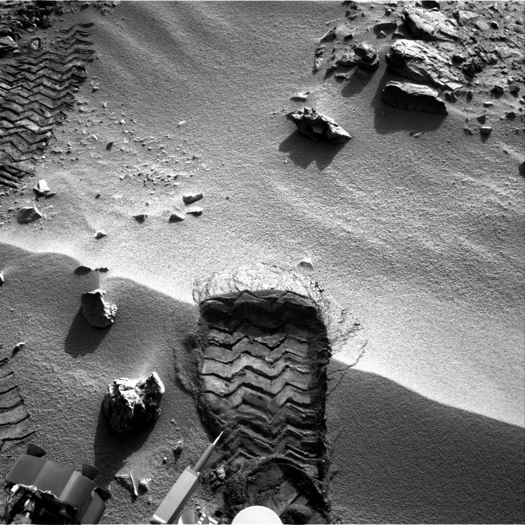
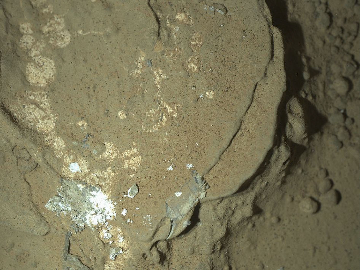
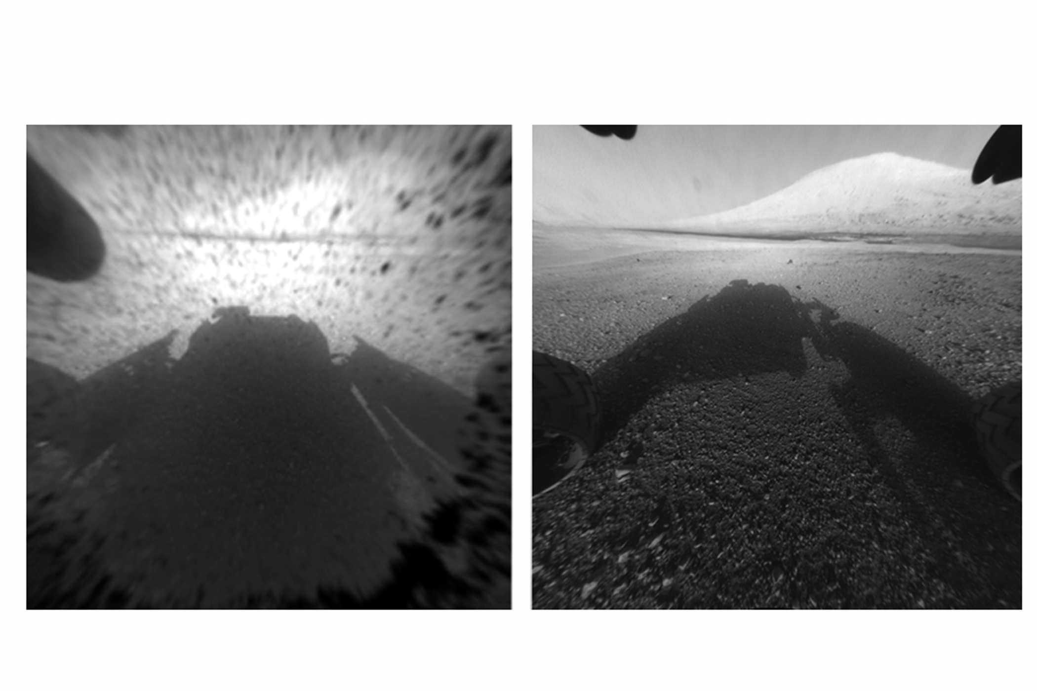
A full-circle view released by NASA on June 20, 2013, combined nearly 900 images taken by NASA's Curiosity Mars rover, generating a panorama with 1.3 billion pixels in the full-resolution version. The view is centered toward the south, with north at both ends. It shows NASA's Mars rover Curiosity at the 'Rocknest' site where the rover scooped up samples of windblown dust and sand.NASA/JPL-Caltech/MSSS/EPANASA's Mars Curiosity Rover captures a selfie to mark a full Martian year -- 687 Earth days -- spent exploring the Red Planet.NASA/JPLA detailed telephoto view from Curiosity shows Mount Sharp. The rover was expected to reach the 3.4-mile-high peak in February 2013, and the layered surface of the mountain should yield information to scientists on the planet's geological history. University of Arizona/JPL-Caltech/NASAThe Mar's Curiosity Rover's first photo of earth from the surface of Mars via TwitterNASACuriosity's tracks was taken by Navcam onboard NASA's Mars rover Curiosity, on Nov. 18 2012.University of Arizona/JPL-Caltech/NASATracks from NASA's Curiosity Mars rover on Aug. 22, 2012 on Mars. NASA said the rover moved forward 15 feet, then rotated 120 degrees before reversing 8.2 feet during its first planned movement.NASA/JPL-Caltech/MSSS/EPAThe highest point on Mount Sharp is visible from the Curiosity rover on Aug. 18, 2012. The Martian mountain rises 3.4 miles above the floor of Gale Crater. Geological deposits near the base of Mount Sharp are the destination of Curiosity's Mars mission.NASA/JPL-Caltech/MSSS/EPAThis image shows the robotic arm of NASA's Mars rover Curiosity with the first rock touched by an instrument on the arm. JPL-Caltech/NASAThis patch of windblown sand and dust downhill from a cluster of dark rocks is the "Rocknest" site, which was the location for the first use of the scoop on the arm of Curiosity.JPL-Caltech/MSSS/NASAA small bright object on the ground beside the rover at the "Rocknest" site. The rover team has assessed this object as debris from the spacecraft, possibly from the events of landing on Mars. NASANASA's Mars rover Curiosity cut a wheel scuff mark into a wind-formed ripple at the "Rocknest" site to examine the particle-size of the ripple. For scale, the width of the wheel track is about 16 inches (40 centimeters).JPL-Caltech/NASAA Martian rock illuminated by white-light LEDs is part of the first set of nighttime images taken by the Mars Hand Lens Imager camera. NASAWhen the rover landed, it sent images from one of the hazard-avoidance cameras. The image at left was taken before the camera's dust cover was removed, the image on the right was taken after. These engineering cameras are located at the rover's base, and are lower-resolution than the color images produced by the rover's mast.
University of Arizona/JPL-Caltech/NASANASA's Curiosity rover and its parachute are seen by NASA's Mars Reconnaissance Orbiter as Curiosity descends to the surface around 10:32 p.m. PDT, Aug. 5, or 1:32 a.m. EDT, Aug. 6, 2012. The rover is equipped with a nuclear-powered lab capable of vaporizing rocks and ingesting soil, measuring habitability, and whether Mars ever had an environment able to support life.University of Arizona/JPL-Caltech/NASA