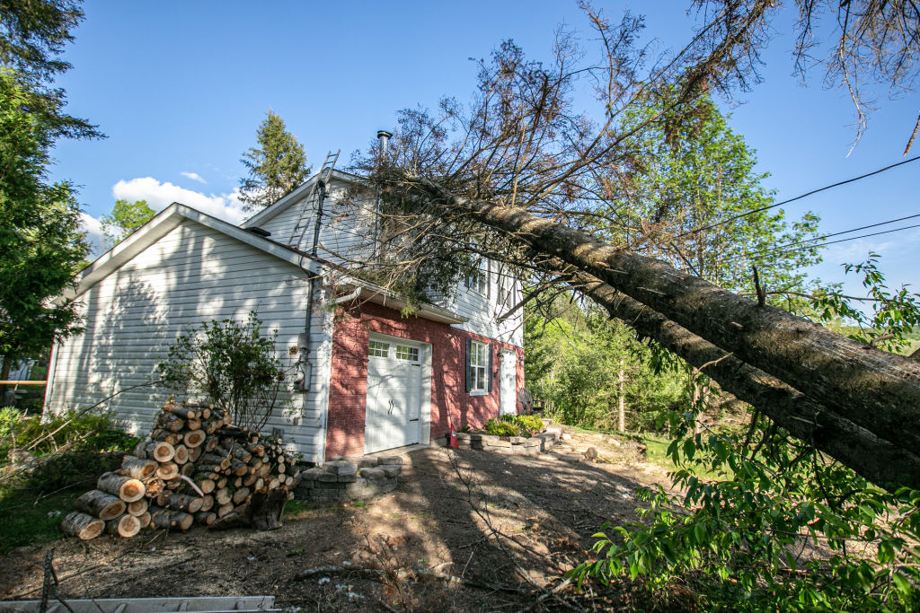
The weather—our universal go-to for easy small talk—seems to be getting weirder. On the one hand, climate change is certainly to blame. On the other, our heightened awareness of the state of our planet, along with better technology to track extreme weather, is also making us pay closer attention to what’s happening outside our window. Meanwhile, new ways of talking that better reflect our anthropogenic epoch are catching on.
“Every weather event that occurs now is playing out in a different background state,” says Jeff Masters, meteorologist for Yale Climate Connections and co-founder of Weather Underground. “We’re now in a totally new climate. The climate of the 21st century has a lot more heat energy in it.”
This means more extreme weather events in the form of wetter hurricanes, hotter heat waves, and more devastating droughts. As Craig Celements, professor of meteorology at San Jose University, notes: “Most of the phenomena that we associate with extreme weather and climate change already exist, but it’s the range of scales and extremes that are changing.”
Experts say this will continue to change in the years to come. “The climate system is in a state of flux as it adapts to a new equilibrium—that is, having more available heat and having to find ways to move or transport this added energy—and in any system, that’s when the ‘weird’ happens,” says Jill Trepanier, associate professor at Louisiana State University and an expert in extreme climatic and weather phenomena.
And we’re figuring how to talk about these changes in real time. So, from “bomb cyclones” and “cold dunkelflautes” to “flash droughts” and “firenados” these are the weird and wacky, sometimes wonderful, sometimes wretched, weather terms you should know.
Bomb cyclone
Front and center of many North American minds’ right now is the Christmas “bomb cyclone” which the National Weather Service has dubbed a “once in a generation winter storm.” Not to be confused with a regular Nor’easter (simply a storm along the East Coast), a bomb cyclone is defined by the Merriam-Webster dictionary as “a powerful, rapidly intensifying storm associated with a sudden and significant drop in atmospheric pressure.” Specifically, 24 millibars in 24 hours, according to the U.S. National Oceanic and Atmospheric Administration (NOAA). And this precise moment where the pressure drops dramatically, turning a winter storm into a bomb cyclone, is known as bombogenesis. The ingredients needed to create this change in pressure are cold, dry air moving from north to south and moist, warm air coming up from the tropics; when these two fronts clash, a storm is born.
The first known usage of the term “bomb cyclone,” according to Merriam-Webster, was in 1987—born out of an 1980 research paper in which meteorologists were trying to describe the intensity of non-summer storms. And while these types of extreme storms certainly existed before then, and have been around since, experts are now studying how climate change may now be creating more opportunities for these to brew or become stronger.
Winter storms that form over the Great Lakes, for example, which are warmer now, can become snowier (this is known as the lake effect). But because winter storms can form under a variety of circumstances it’s harder to predict and say definitively how climate change plays a part in a specific event. One big question being studied at the moment is to what extent a warmer Arctic is disrupting weather patterns at lower latitudes.
Polar vortex
The polar vortex is not a new phenomenon. According to NOAA, it’s thought the term first appeared in an 1853 edition of the magazine Living Age. More recently though, for many people, a record-breaking cold January in 2014—when temperatures in New York City dropped to just 4°F—was likely the first time they’d heard of it.
So what is it? The polar vortex is an area of low air pressure that constantly swirls around the north and south poles. Typically, these strong, icy-cold wind currents are locked high up in the stratosphere by the jet stream—a permanent west-to-east current of wind that encircles the Earth. Every now and then though, there’s a wobble in the North Pole vortex—most commonly during the winter in the Northern Hemisphere—which causes the winds to break into the lower atmosphere, sending frigid temperatures south, sometimes as far as Florida.
Scientists are now studying how climate change is disrupting the jet stream. The polar regions are warming quicker than the rest of the planet, making the difference in temperatures less extreme. This is causing the jet stream to meander more, which can trigger more extreme bouts of weather—from cold fronts to drought.
Cold dunkelflaute
Everyone loves a fun, descriptive German word—including the renewable energy industry.
Cold dunkelflaute translates to “dark doldrums,” and describes a period of time, common across Europe in the winter, during which there is little-to-no wind or sun from which to generate energy. According to a recent study, cold dunkelflaute lasts a total of some 150 to 300 hours between November and January each year in Europe. Better understanding these events should help the renewable energy industry strengthen grid resilience to withstand the challenges of intermittent power sources like solar and wind.
Derecho
Not really a tornado, and definitely not a hurricane, derechos are powerful thunderstorm complexes with incredibly strong winds that often leave behind a path of destruction. The term dates back to 1888 when Dr. Gustavus Hinrichs, a professor of physics at the University of Iowa, used it in a paper to describe a thunderstorm with straight winds (unlike a tornado which rotates). Derived from Spanish, derecho can translate to “straight ahead.”
Today, scientists are piecing together how climate change may be making these storms stronger. It seems many highly destructive derechos coincide with extreme heat. While more research is still needed, the initial thinking is that hotter temperatures are making derechos more intense, longer-lasting, and less predictable in terms of timing and location.

Gray swan
This is a term used by scientists to describe an incredibly rare, extreme event, statistically speaking. (In contrast, a “black swan” would be an unprecedented, entirely unpredictable, event.) And as climate change makes so-called “once in a century” events more likely to happen more frequently than once every 100 years, experts are increasingly trying to determine how much of a role rising global temperatures are making certain extreme weather events more likely. This is known as climate attribution science.
Take the 2021 Pacific Northwest heat wave. A study published in November determined that this was a “gray swan” event made possible by a series of unlikely weather conditions happening all at once. As the lead author of the paper told Politico’s E&E, while moments like these are statistically unlikely, based on how the climate is changing, they’re becoming “physically conceivable and also potentially predictable for the present or the future.”
Weather whiplash
This past summer offered a true lesson in this concept. In July, historic flooding in Kentucky left many without power right before they were hit by soaring temperatures and humidity. Other occurrences of drought-then-flooding happened in Texas, Yellowstone, and Death Valley. And the U.S. isn’t alone: For one example, Pakistan’s overwhelming flooding this past year came after record-breaking, drought-intensifying heat. And while intense rains may sound like a welcome reprieve from dry weather, they often exacerbate existing ecological and humanitarian challenges.
Atmospheric lake
Maybe you’ve heard of atmospheric rivers? These are narrow, dense bands of wet air that weave like a river through the atmosphere. Now there are atmospheric lakes. Scientists coined this term just last year when they documented instances of “compact, slow-moving, moisture-rich pools” of water vapor that detach from atmospheric rivers to create their own smaller, slower weather system. These dense “lakes”—wet enough to dump rain—typically start over the western Indian Ocean and then travel across Africa.
Meteorologists still don’t know for sure why these lakes detach from the rivers. Because they move so slowly, one theory is that any wind generated by the “rivers” could help to propel the “lakes” to separate. Or, climate change and its impact on regional or global wind patterns could be responsible.
Firenado
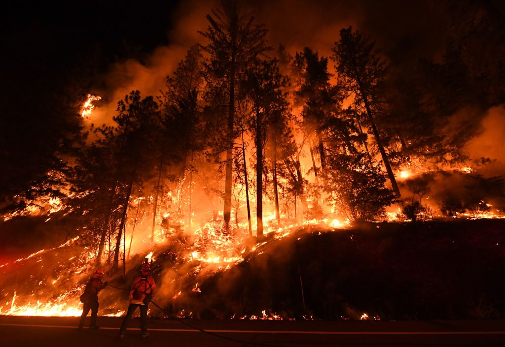
Firenados are exactly what they sound like, and equally as terrifying: fire+tornado, i.e., flaming columns of rotating fire, often erupting during a wildfire when intense heat rises and combines with turbulent winds up to 100 mph. One of the first major instances of a firenado was documented in Australia in 2003. In the U.S., these flaming twisters gained notoriety in 2018 during California’s Carr fire. Then in 2020, the National Weather Service’s Reno office in Nevada issued the country’s first ever firenado warning. They’re perhaps one of the most apocalyptic representations of the anthropocene.

Heatflation
This term was coined by Grist staff writer Kate Yoder this year, to describe scenarios “when hot temperatures send prices soaring.” The term quickly gained popularity with mainstream U.S. media and caught on as far away as France, India, and Malaysia. With more extreme heat, drought, and wildfires, it’s becoming more of a seasonal thing for crops to get destroyed and lumber to get burned down, causing scarcity that drives up prices.
Meanwhile development continues in parts of the U.S. prone to hurricanes, like the Gulf Coasts of Texas and Florida, those susceptible to wildfires, like the wildland-urban interface regions of California, Arizona, and Nevada. But, because of these risks, homeowner’s insurance policy costs are rising, driving further “heatflation.”
Flash drought
A flash drought is the “rapid onset or intensification of drought” when a period of lower-than-normal precipitation rates combines with extreme heat and wind. They typically develop quickly over the course of a month or less—making it nearly impossible for a community to properly prepare for the impact of suddenly withered crops and dried up wells. One recent study found that over a third of all flash droughts that occurred globally in the past 20 years, developed over the course of just five days.
One of the most well-known instances of a flash drought was in 2012 when the central U.S. experienced its driest summer on record since 1895. The drought, which began in May, rapidly intensified and hit its peak in mid-July, affecting around 76% of cropland.
Bonus: space hurricane
While not really in the same category as the other words on this list, we couldn’t resist including this newly coined name for a spectacular, cyclone-like aurora first described in a study last year.
This December, researchers shed further light on where and how these celestial phenomena “rain” down electrons as they rotate around a central eye: they form higher up than regular aurora, for example, and can spin for eight hours rather than mere minutes.
Space hurricanes can also give us a greater understanding about our planet’s relationship to the sun. As the Washington Post describes: “The identification of this new type of aurora highlights another highway that solar particles can ride and transfer large amounts of energy into Earth’s system.”
More Must-Reads from TIME
- Caitlin Clark Is TIME's 2024 Athlete of the Year
- Where Trump 2.0 Will Differ From 1.0
- Is Intermittent Fasting Good or Bad for You?
- The 100 Must-Read Books of 2024
- Column: If Optimism Feels Ridiculous Now, Try Hope
- The Future of Climate Action Is Trade Policy
- FX’s Say Nothing Is the Must-Watch Political Thriller of 2024
- Merle Bombardieri Is Helping People Make the Baby Decision
Contact us at letters@time.com