The first named storm of hurricane season—Tropical Storm Arthur—formed off of Florida’s east coast Saturday and is strengthening as it approaches North Carolina’s Outer Banks as of Monday morning.
The storm is moving at 14 mph in a north-northeast direction with maximum sustained winds of 45 mph and is about 85 miles south-southwest of Morehead City, North Carolina as of 5 a.m. E.T., according to the National Hurricane Center.
A tropical storm warning has been issued for parts of the North Carolina coast, with the threat of 1-3 inches of rain, high winds, and “life-threatening” ocean currents.
Arthur is expected to “move near or just east of the coast of North Carolina on Monday,” the NHC says. The wind speeds are forecasted to get stronger in the next 24 hours and Arthur will likely slow down and lose its tropical characteristics on Tuesday.
The official start of hurricane season may be June 1 but it is not uncommon to have tropical activity this early, according to AccuWeather meteorologist Courtney Travis.
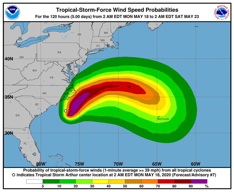
Arthur is expected to drop anywhere from one to three inches of rain over coastal North Carolina tonight and Monday with higher amounts in some areas.
Swells created by Arthur are already affecting parts of the “southeast U.S. coast and are expected to spread northward from Florida to the mid-Atlantic states over the next few days,” according to the National Hurricane Center. They could cause “life-threatening surf and rip current conditions.”
More Must-Reads from TIME
- Caitlin Clark Is TIME's 2024 Athlete of the Year
- Where Trump 2.0 Will Differ From 1.0
- Is Intermittent Fasting Good or Bad for You?
- The 100 Must-Read Books of 2024
- Column: If Optimism Feels Ridiculous Now, Try Hope
- The Future of Climate Action Is Trade Policy
- FX’s Say Nothing Is the Must-Watch Political Thriller of 2024
- Merle Bombardieri Is Helping People Make the Baby Decision
Write to Sanya Mansoor at sanya.mansoor@time.com