International borders are often delineated by far more than lines on a map. In the most extreme cases, these differences between countries or the borders themselves are so distinct they are distinguishable from space. From imbalances in development to the construction of new walls or the lasting effects of old ones. Below are a few instances where astronauts on the International Space Station (ISS) have been able to point their cameras toward earth and create striking images of the world’s borders that, at times, say much about the countries they separate.
North Korea
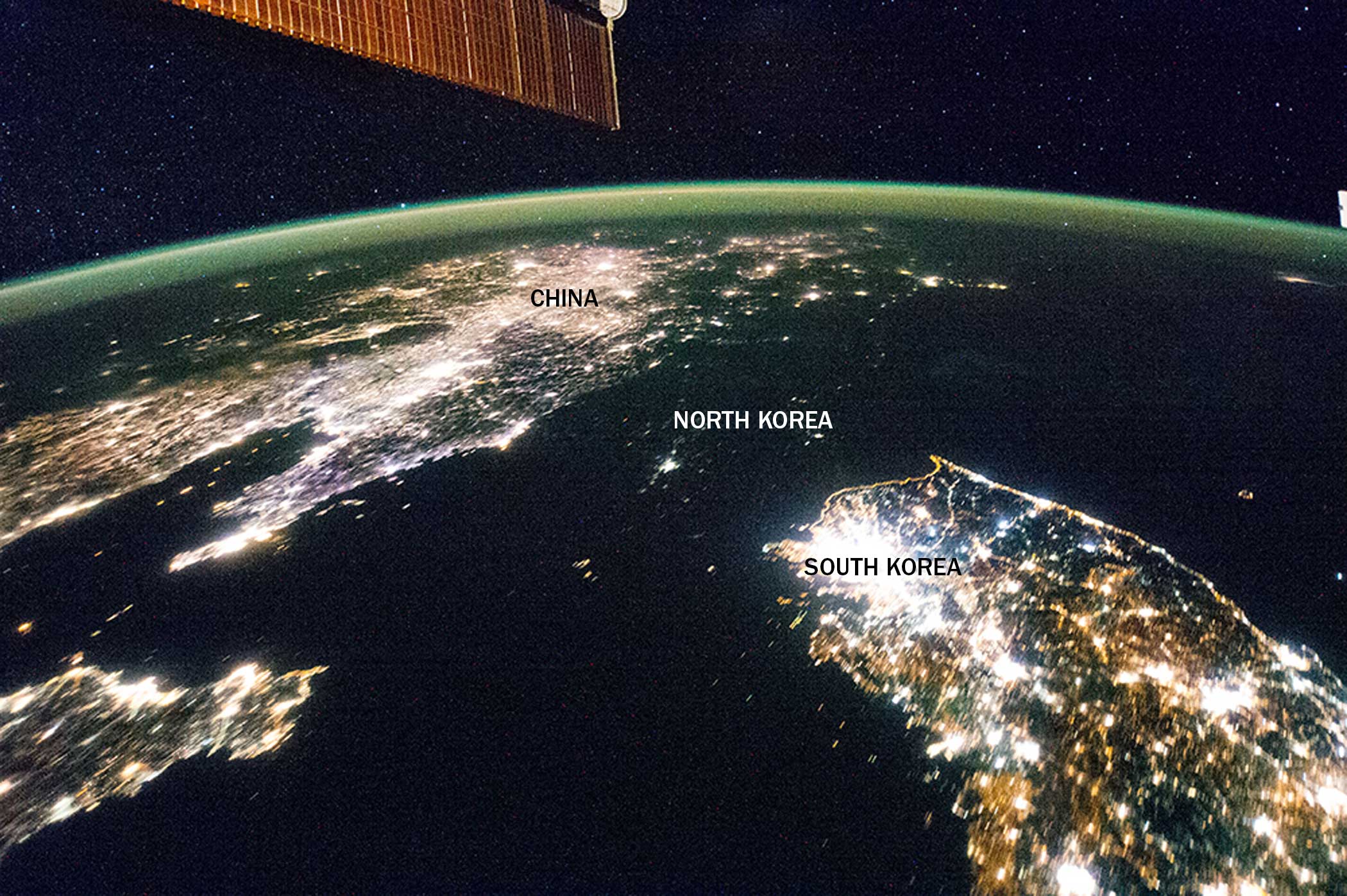
North Korea appears almost fully blacked out in this night image of the Korean Peninsula taken by the Expedition 38 crew aboard the ISS in Feb. 2014. The capital city, Pyongyang is visible in the center, but its borders are so dark they are virtually indistinguishable from the Yellow Sea and Sea of Japan on either side of the country.
Israel / Egypt
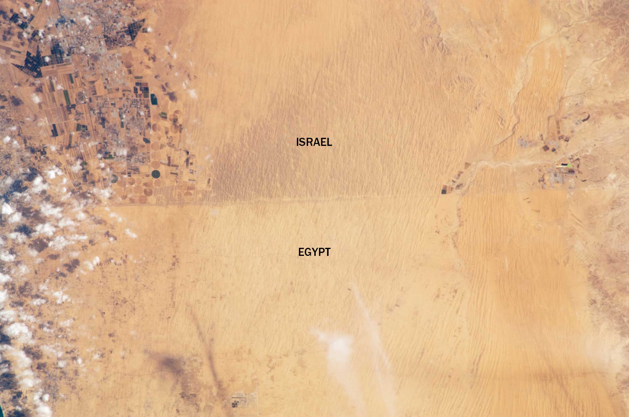
In this Nov. 2011 image taken from the ISS by the Expedition 29 crew, a clearly visible line marks about 30 miles of the border between Egypt and Israel. A road separates the two countries. To the north, Israel’s commercial agriculture is seen in angular fields. To the south, the lighter color of the Egyptian soil is a result of trampling by livestock, which disrupts the dark soil crusts.
East Germany / West Germany
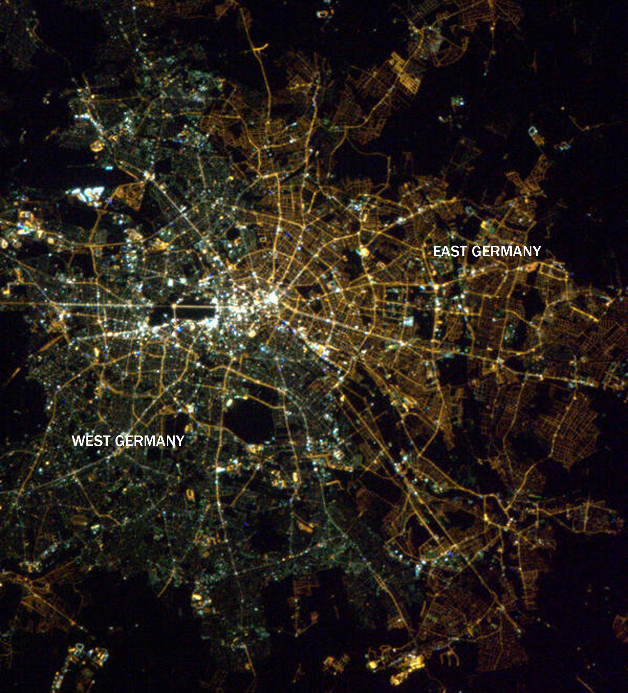
Over 25 years after the fall of the Berlin Wall, the separation between the eastern and western halves of Germany is still evident in Berlin at night. The yellow lights in the eastern part appear yellow, while the lights in the western part are a bit greener. This is a result of preferences for more environmentally friendly forms of lighting in the western part of the city. This phenomenon was documented by André Kuipers from the ISS in 2012.
Haiti / Dominican Republic
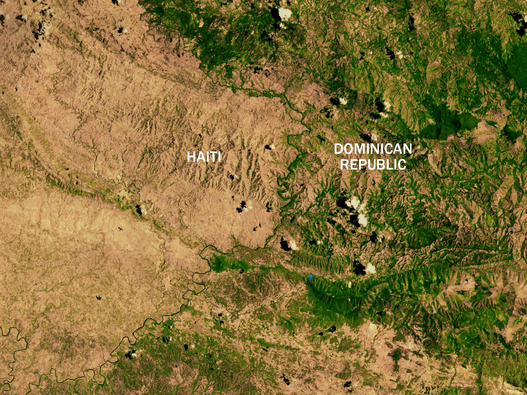
There is no mistaking the border between Haiti and the Dominican Republic. In this 2002 satellite image, the Dominican Republic on the right is far greener. This is the result of deforestation in Haiti.
India / Pakistan
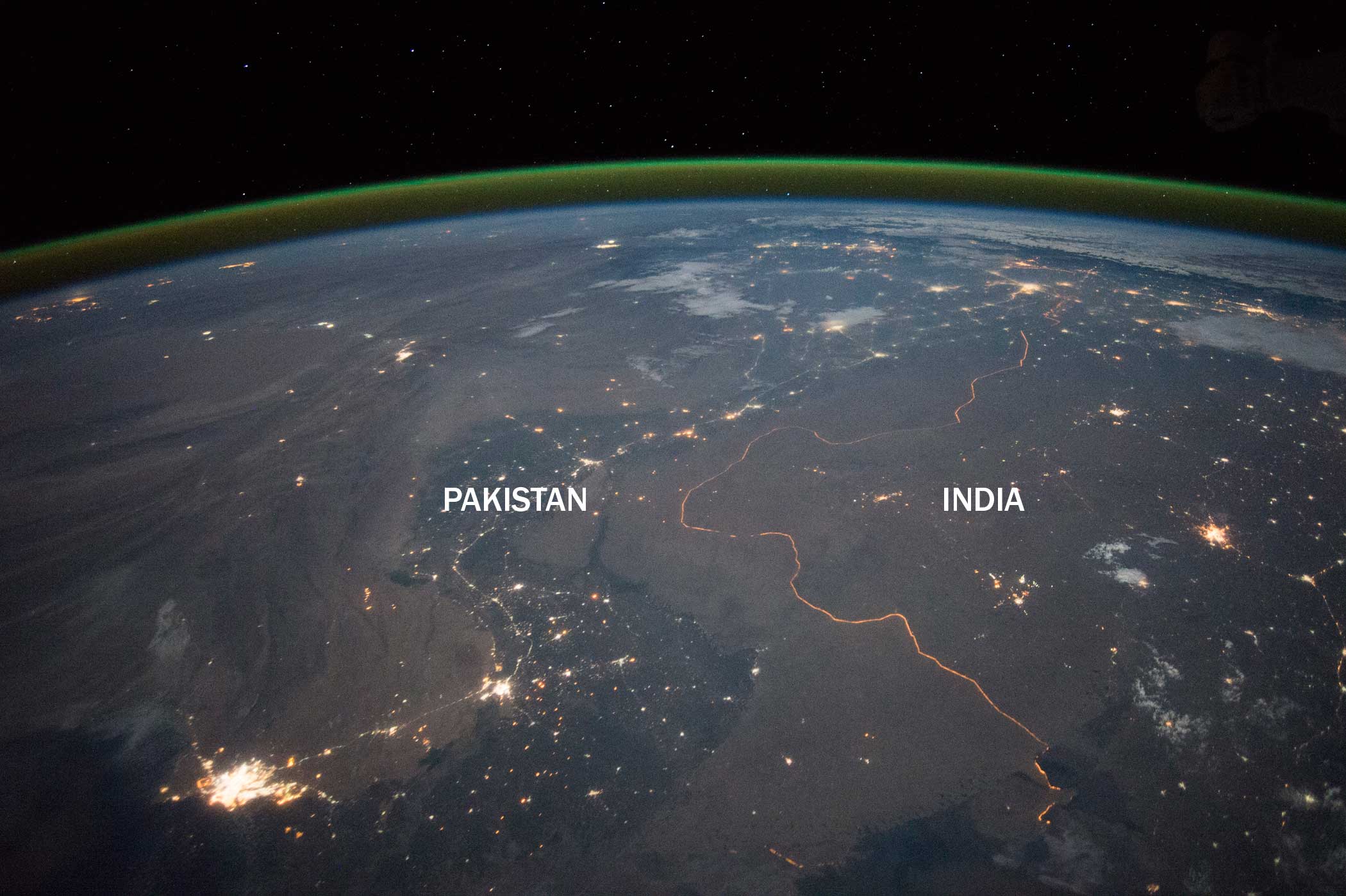
An expedition 45 crew member aboard the ISS took this nighttime panorama in Sept. 2015 while looking north across Pakistan’s Indus River valley. The India-Pakistan border is one of the few international boundaries evident at night because of illumination from bright security lights. According to NASA “More than two millennia ago, Alexander the Great entered the Indus plains in 327 BCE from the northwest. He then spent many months leading his army and navy down the length of the Indus valley shown in this view. From near Karachi, he then began the desert march back to Mesopotamia (modern Iraq). By contrast, it takes the space station just three minutes to travel this distance.”
US / Mexico
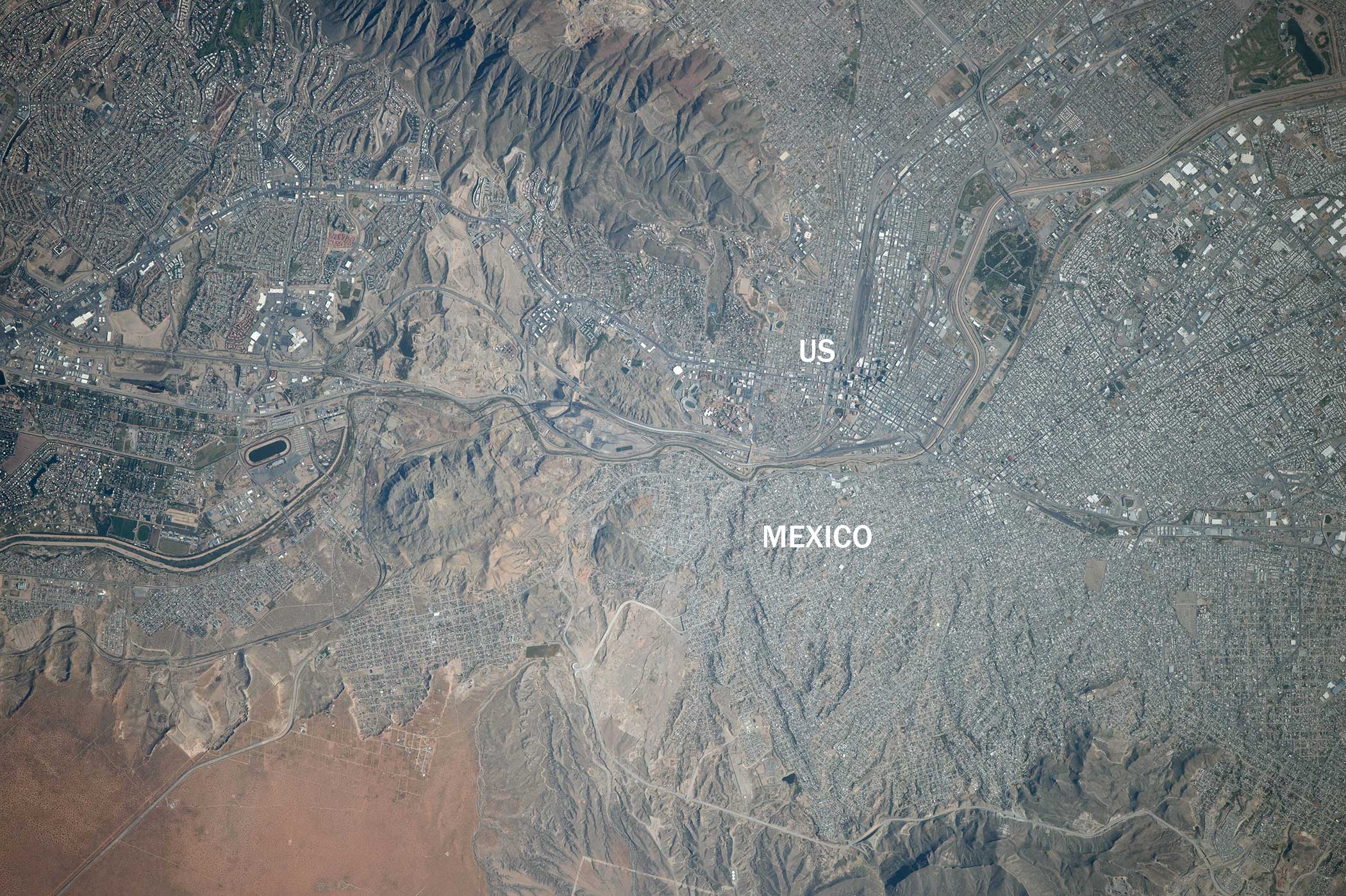
This Oct. 2014 image taken from the ISS shows US and Mexico separated by both the Rio Grande and a wall. El Paso on the U.S. side abuts Ciudad Juarez top right on the Mexico side. Both are heavily developed, with the respective exceptions of Franklin Mountain State Park on the top left and land near Puerto de Anapra bottom right.
Iraq / Iran
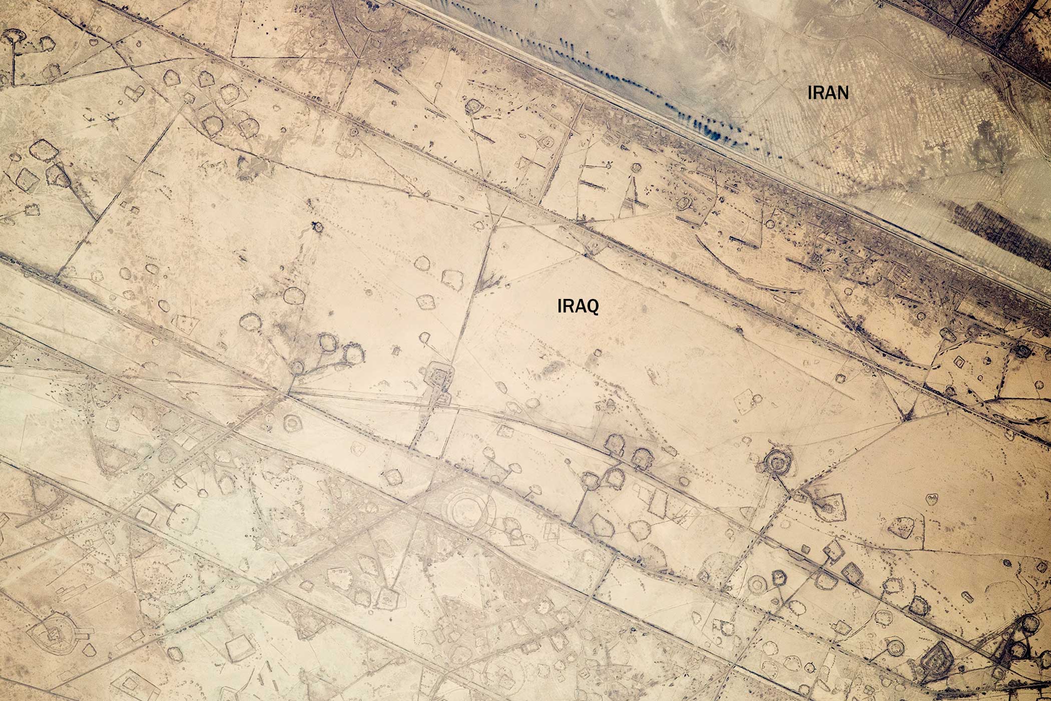
The series of lines along this 12-mile stretch of the Iraq-Iran border were first thought to be oil pads by the Expedition 41 crew aboard the ISS in Nov. 2014. They soon realized the lines were actually military fortifications. In the 1980s, this was a highly contested area between the two countries, especially during Iraq’s defense of the southern city of Basra.
More Must-Reads from TIME
- Inside Elon Musk’s War on Washington
- Why Do More Young Adults Have Cancer?
- Colman Domingo Leads With Radical Love
- 11 New Books to Read in February
- How to Get Better at Doing Things Alone
- Cecily Strong on Goober the Clown
- Column: The Rise of America’s Broligarchy
- Introducing the 2025 Closers
Contact us at letters@time.com