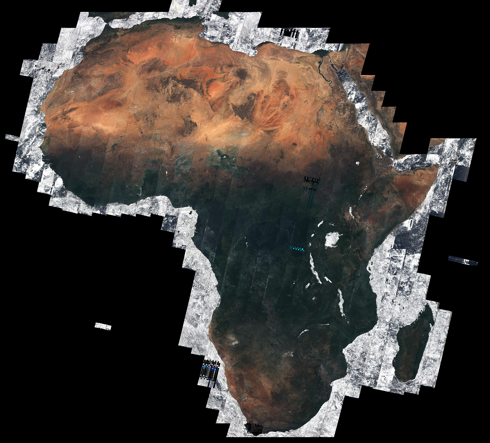
Satellite images offer some of the most incredible images of Earth, but clouds often obscure the land humans inhabit. A composite image created by the European Space Agency gives space lovers a sense of how Africa would appear without any cloud cover.
The ESA created an image of the African continent—around a fifth of the world’s land area—completely free of clouds using a composite of nearly 7,000 images taken by the Sentinel-2A satellite. The images were primarily taken between December 2015 and April 2016.
The imaging device on Sentinel is intended to help map changes in land cover that will improve agriculture and detect pollution in waterways, according to ESA.
More Must-Reads from TIME
- Inside Elon Musk’s War on Washington
- Meet the 2025 Women of the Year
- The Harsh Truth About Disability Inclusion
- Why Do More Young Adults Have Cancer?
- Colman Domingo Leads With Radical Love
- How to Get Better at Doing Things Alone
- Cecily Strong on Goober the Clown
- Column: The Rise of America’s Broligarchy
Write to Justin Worland at justin.worland@time.com