By Daniel White
The latest European space radar produced its first image Thursday, after only being online for two hours.
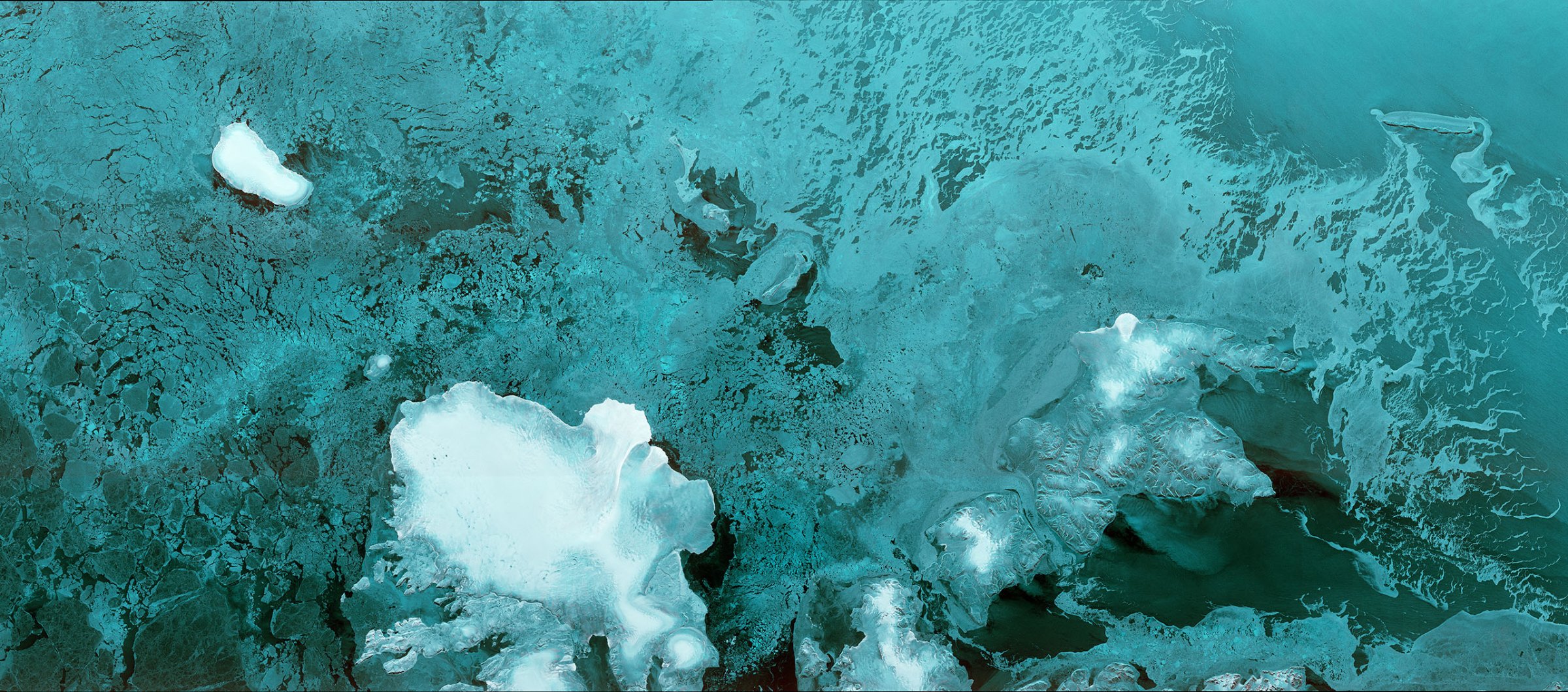
Sentinel-1B launched April 25 and produced the image after deploying its 12 meter-long radar (about 39 feet)—a record time for a space radar, according to the European Space Agency.
The first image is of the Norwegian archipelago Svalbard, with the Austfonna glacier visible.
The ESA, an intergovernmental body dedicated to European space exploration, operates the Copernicus program, which Sentinel-1B is a part of. Copernicus is the largest single earth observation mission, according to the ESA, and is comprised of multiple satellites that monitor the Earth below.
More Must-Reads from TIME
- Cybersecurity Experts Are Sounding the Alarm on DOGE
- Meet the 2025 Women of the Year
- The Harsh Truth About Disability Inclusion
- Why Do More Young Adults Have Cancer?
- Colman Domingo Leads With Radical Love
- How to Get Better at Doing Things Alone
- Michelle Zauner Stares Down the Darkness
Contact us at letters@time.com