See the Most Stunning Photos From the Mars Odyssey Spacecraft

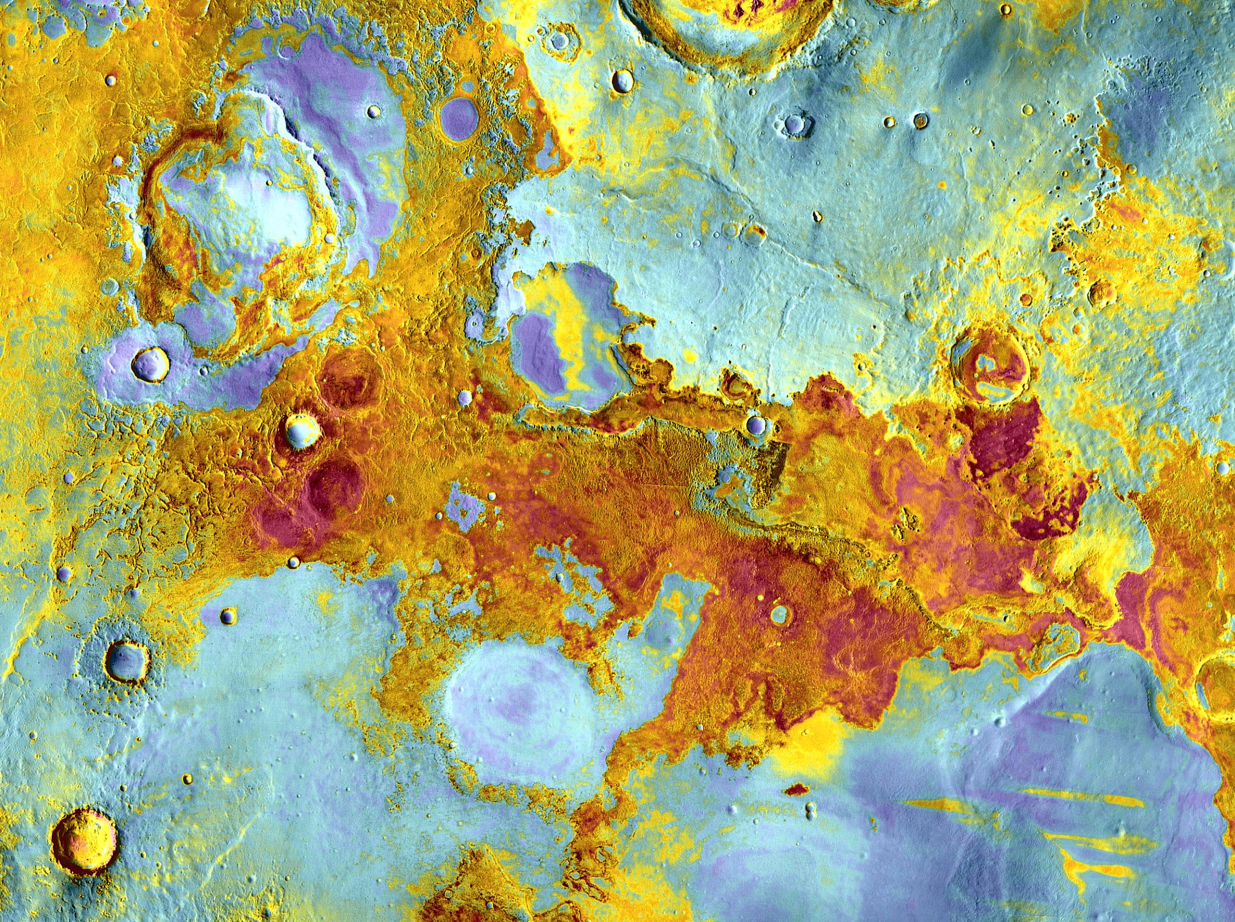
This image here shows a false-color view of part of Meridiani Planum, about 250 miles northeast of where Opportunity landed. The image was taken by the Thermal Emission Imaging System on NASA's Mars Odyssey orbiter and acquired Dec. 2004.
Meridiani Planum: This image shows a false-color view of part of Meridiani Planum, about 250 miles northeast of where Opportunity landed. The image was taken by the Thermal Emission Imaging System on NASA's Mars Odyssey orbiter and released April 1, 2012.NASA/JPL-Caltech/ASU
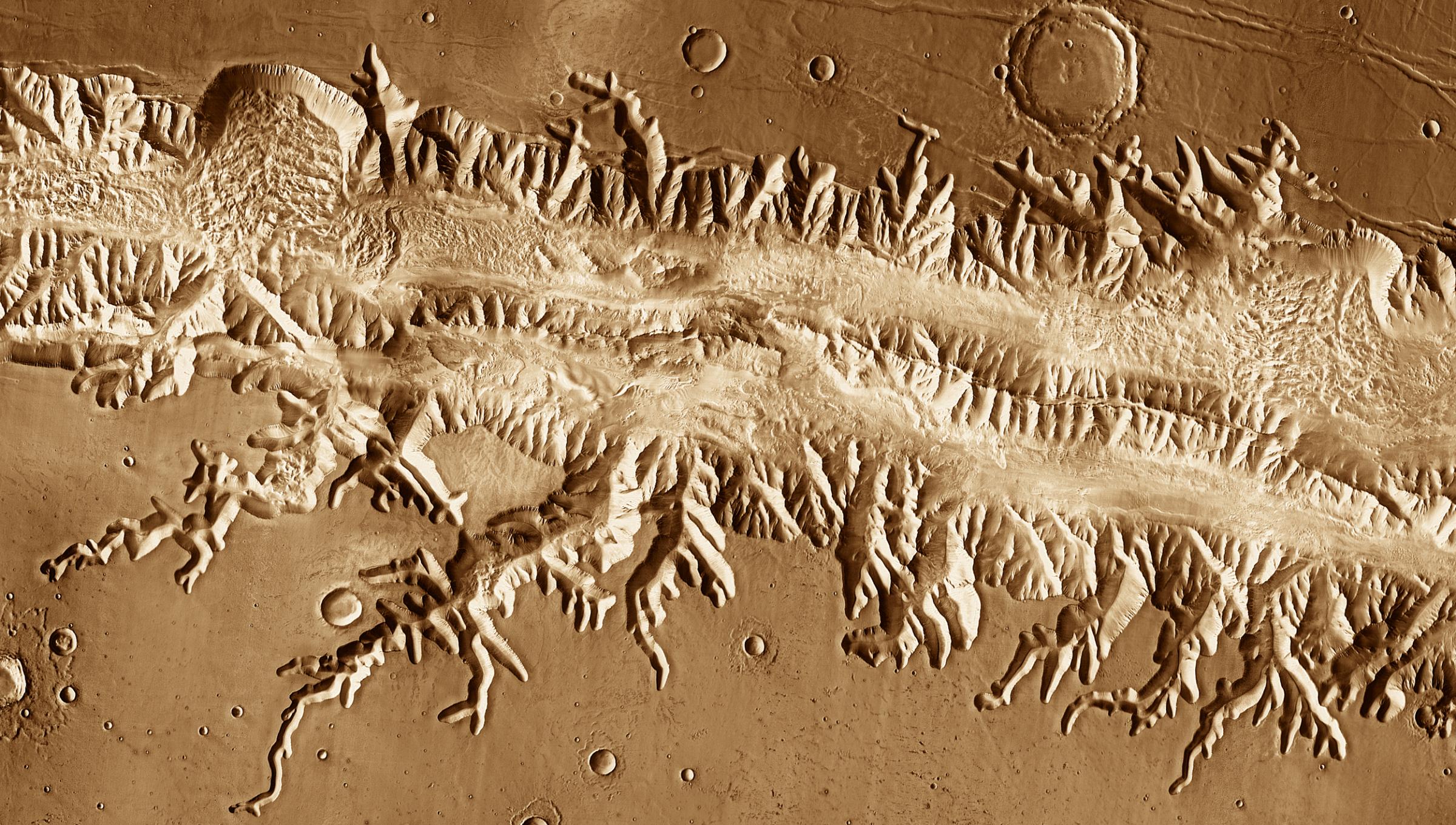
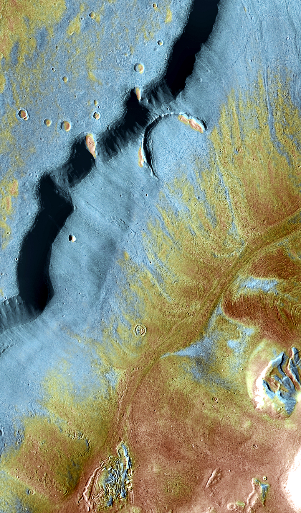
Valles Marineris: With a length great enough to stretch from New York to Los Angeles, Valles Marineris is the Grand Canyon of Mars. Scientists think the canyons cutting into the rim developed as subsurface water escaped and the ground collapsed, a process called "sapping." This image was acquired July 2005 by the Thermal Emission Imaging System instrument on NASA's Mars Odyssey orbiter.
Valles Marineris: With a length great enough to stretch from New York to Los Angeles, Valles Marineris is the Grand Canyon of Mars. Scientists think the canyons cutting into the rim developed as subsurface water escaped and the ground collapsed, a process called "sapping." This image was acquired in July 2005 by the Thermal Emission Imaging System instrument on NASA's Mars Odyssey orbiter. NASA/JPL-Caltech/ASU
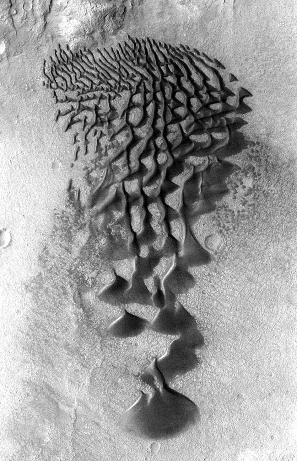
Fans and ribbons of dark sand dunes creep across the floor of Bunge Crater in response to winds blowing from the direction at the top of the picture. The frame is about 9 miles wide. This image was taken in January 2006 by the Thermal Emission Imaging System instrument on NASA's Mars Odyssey orbiter.
Bunge Crater Dunes: Fans and ribbons of dark sand dunes creep across the floor of Bunge Crater in response to winds blowing from the direction at the top of the picture. The frame is about 9 miles wide. This image was taken in January 2006 by the Thermal Emission Imaging System instrument on NASA's Mars Odyssey orbiter. NASA/JPL-Caltech/ASU
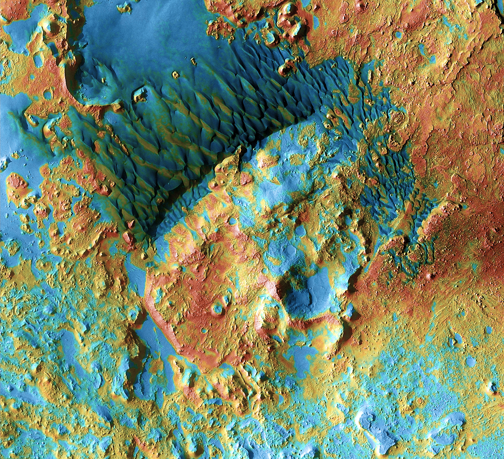
Sand dunes shaped like blue-black flames lie next to a central hill within an unnamed 75-mile-wide crater in eastern Arabia on Mars. Areas in bluish tints have more fine sand at the surface, while redder tints indicate harder sediments and outcrops of rock. This scene combines images taken during the period from Feb. 2003 to Aug. 2004 by the Thermal Emission Imaging System instrument on NASA's Mars Odyssey orbiter.
Arabia Dunes: Sand dunes shaped like blue-black flames lie next to a central hill within an unnamed 75-mile-wide crater in eastern Arabia on Mars. Areas in bluish tints have more fine sand at the surface, while redder tints indicate harder sediments and outcrops of rock. This scene combines images taken during the period from February 2003 to August 2004 by the Thermal Emission Imaging System instrument on NASA's Mars Odyssey orbiter. NASA/JPL-Caltech/ASU
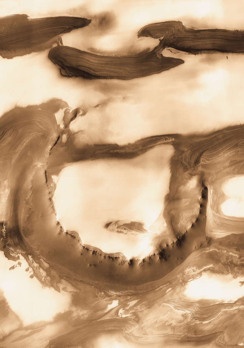
Udzha Crater: Although it is 28 miles wide, countless layers of ice and dust have all but buried Udzha Crater. Udzha lies near the edge of the northern polar cap, and only the topmost edges of its crater rim rise above the polar deposits to hint at its circular shape. The image was taken by the Thermal Emission Imaging System instrument on NASA's Mars Odyssey orbiter and posted in a special Dec. 2010 set marking the occasion of Odyssey becoming the longest-working Mars spacecraft in history.
Udzha Crater: Although it is 28 miles wide, countless layers of ice and dust have all but buried Udzha Crater. Udzha lies near the edge of the northern polar cap, and only the topmost edges of its crater rim rise above the polar deposits to hint at its circular shape. The image was taken by the Thermal Emission Imaging System instrument on NASA's Mars Odyssey orbiter and posted in a special December 2010 set marking the occasion of Odyssey becoming the longest-working Mars spacecraft in history.NASA/JPL-Caltech/ASU
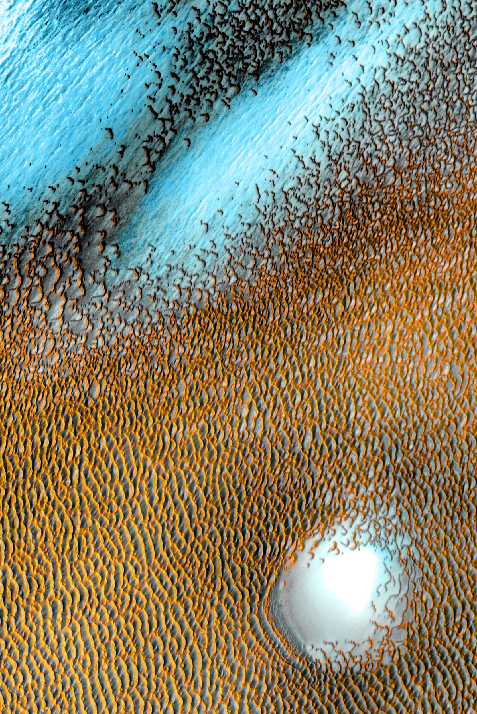
A sea of dark dunes, sculpted by the wind into long lines, surrounds the northern polar cap. This image covers an area 19 miles wide. This scene combines images taken during the period from Dec. 2002 to Nov. 2004 by the Thermal Emission Imaging System instrument on NASA's Mars Odyssey orbiter.
Polar Dunes: A sea of dark dunes, sculpted by the wind into long lines, surrounds the northern polar cap. This image covers an area 19 miles wide. This scene combines images taken during the period from December 2002 to November 2004 by the Thermal Emission Imaging System instrument on NASA's Mars Odyssey orbiter. NASA/JPL-Caltech/ASU
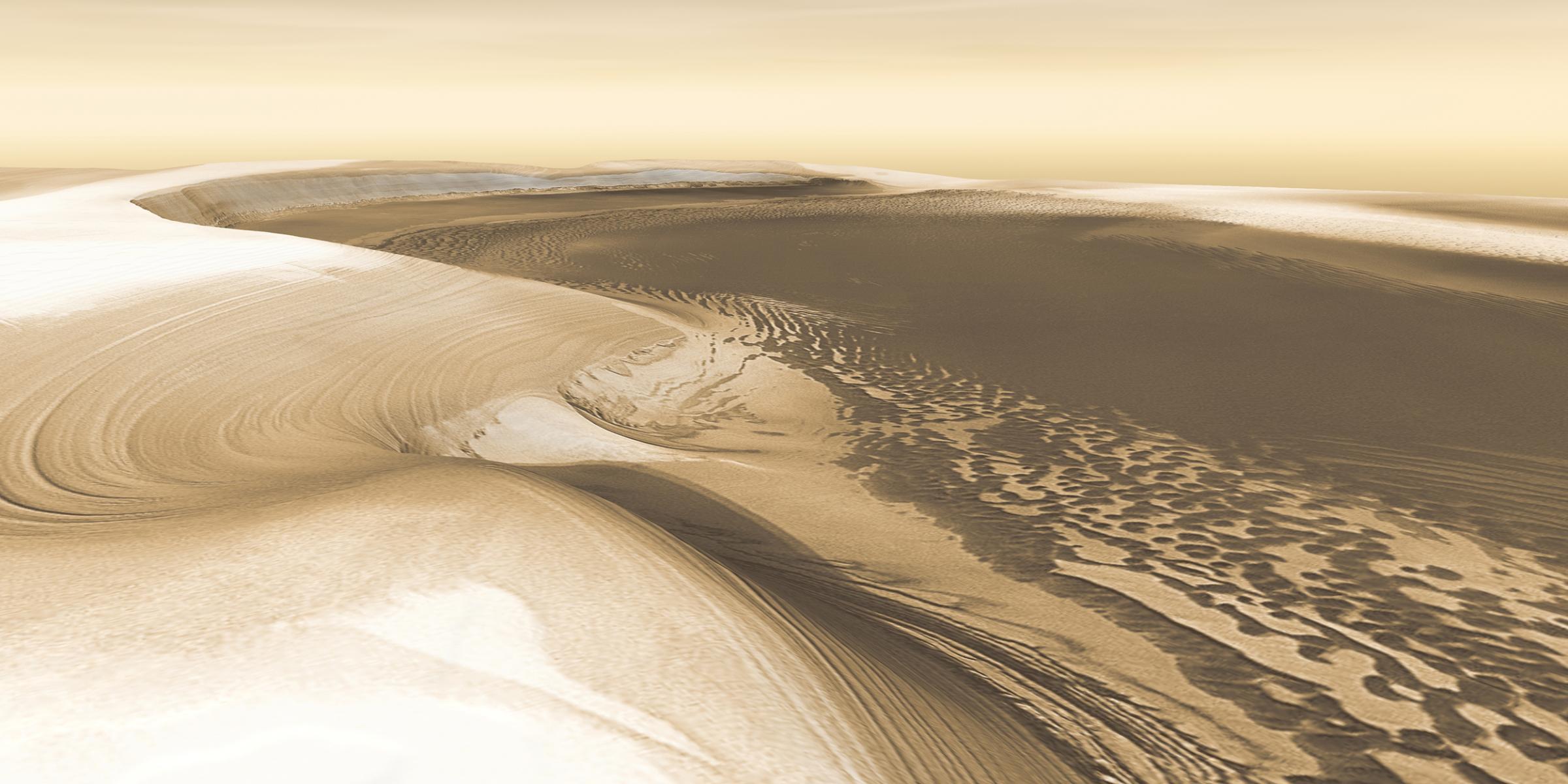
Chasma Boreale: A long, flat-floored valley that cuts deep into Mars' north polar icecap. Its walls rise about 4,600 feet above the floor. Where the edge of the ice cap has retreated, sheets of sand are emerging that accumulated during earlier ice-free climatic cycles. Winds blowing off the ice have pushed loose sand into dunes and driven them down-canyon in a westward direction, toward our viewpoint. This scene combines images taken during the period from Dec. 2002 to Feb. 2005 by the Thermal Emission Imaging System instrument on NASA's Mars Odyssey orbiter.
Chasma Boreale: A long, flat-floored valley that cuts deep into Mars' north polar icecap. Its walls rise about 4,600 feet above the floor. Where the edge of the ice cap has retreated, sheets of sand are emerging that accumulated during earlier ice-free climatic cycles. Winds blowing off the ice have pushed loose sand into dunes and driven them down-canyon in a westward direction, toward our viewpoint. This scene combines images taken during the period from December 2002 to February 2005 by the Thermal Emission Imaging System instrument on NASA's Mars Odyssey orbiter.NASA/JPL-Caltech/ASU
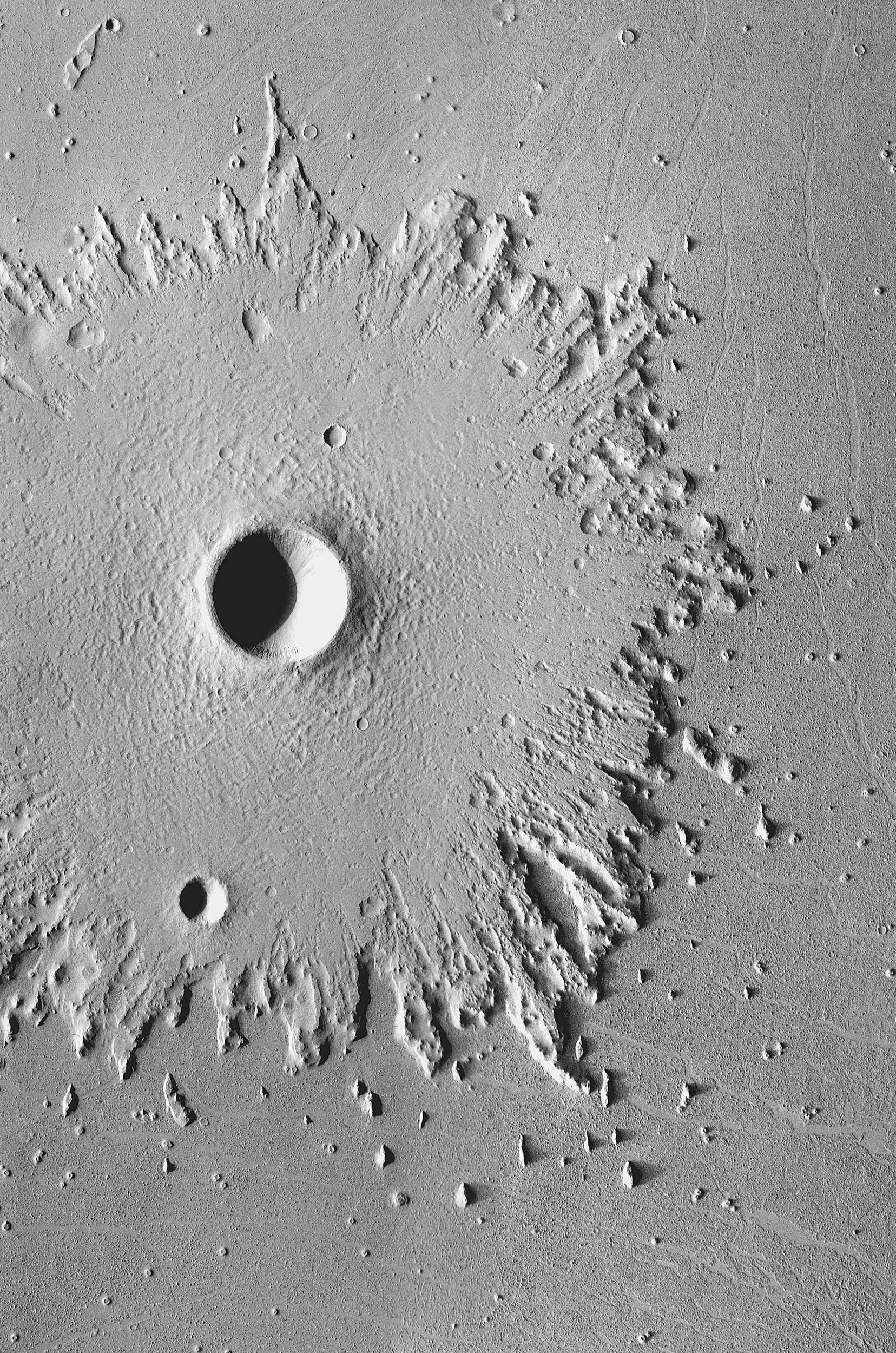
Radical Erosion: The wide, circular blanket of ejected debris surrounding this crater has become greatly eroded by the wind, which has stripped its surface features. This images was acquired between May 2003 and April 2006 by the Thermal Emission Imaging System instrument on NASA's Mars Odyssey orbiter.
Radical Erosion: The wide, circular blanket of ejected debris surrounding this crater has become greatly eroded by the wind, which has stripped its surface features. This images was acquired between May 2003 and April 2006 by the Thermal Emission Imaging System instrument on NASA's Mars Odyssey orbiter. NASA/JPL-Caltech/ASU
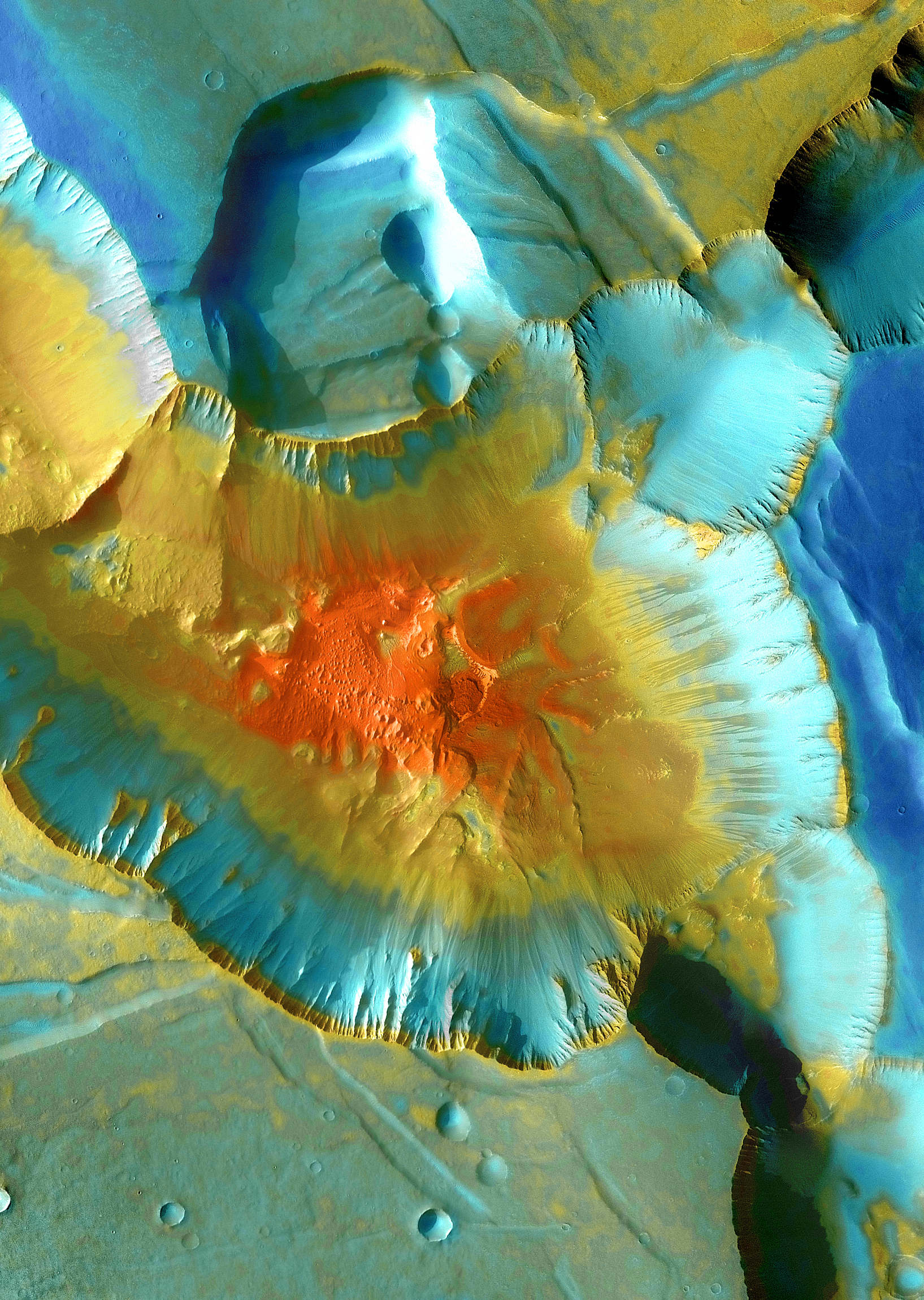
A false-color mosaic focuses on one junction in Noctis Labyrinthus where Mars canyons meet to form a depression 13,000 feet deep. Dust lies on the upper surfaces, while rockier material lies below. The pictures used to create this mosaic image were taken by the Thermal Emission Imaging System instrument on NASA's Mars Odyssey orbiter and acquired from April 2003-Sept. 2005.
Noctis Canyon: A false-color mosaic focuses on one junction in Noctis Labyrinthus where Mars canyons meet to form a depression 13,000 feet deep. Dust lies on the upper surfaces, while rockier material lies below. The pictures used to create this mosaic image were taken by the Thermal Emission Imaging System instrument on NASA's Mars Odyssey orbiter and acquired from April 2003 to September 2005.NASA/JPL-Caltech/ASU
Mamers Valles: This region winds for nearly 600 miles through the ragged highlands of Arabia Terra before it empties onto the vast northern lowlands in Deuteronilus. Scientists think the linear features on the valley bottom are telling a tale of flowing ice covered with a layer of rock. This images was acquired from April 2002 to May 2003 by the Thermal Emission Imaging System instrument on NASA's Mars Odyssey orbiter.
Mamers Valles: This region winds for nearly 600 miles through the ragged highlands of Arabia Terra before it empties onto the vast northern lowlands in Deuteronilus. Scientists think the linear features on the valley bottom are telling a tale of flowing ice covered with a layer of rock. This images was acquired from April 2002 to May 2003 by the Thermal Emission Imaging System instrument on NASA's Mars Odyssey orbiter.NASA/JPL-Caltech/ASU
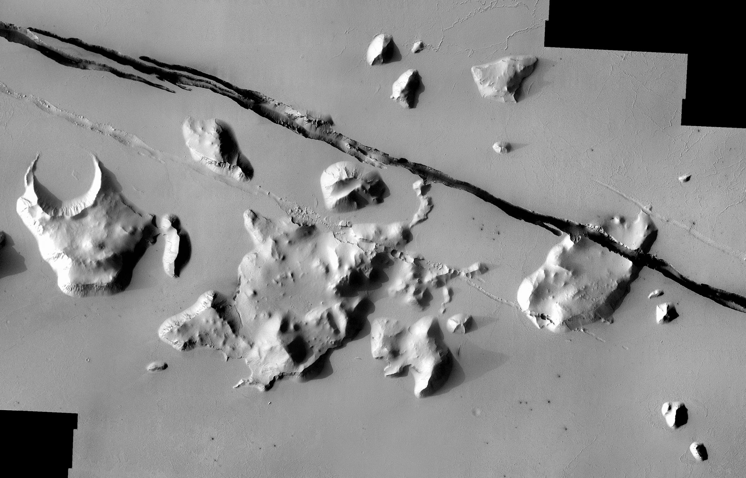
Geological faulting has opened cracks in the Cerberus region that slice through flat plains and mesas alike. This view covers an area 35 miles wide. It combines images taken during the period from May 2002 to July 2004 by the Thermal Emission Imaging System instrument on NASA's Mars Odyssey orbiter.
Cerberus Crack: Geological faulting has opened cracks in the Cerberus region that slice through flat plains and mesas alike. This view covers an area 35 miles wide. It combines images taken during the period from May 2002 to July 2004 by the Thermal Emission Imaging System instrument on NASA's Mars Odyssey orbiter. NASA/JPL-Caltech/ASU
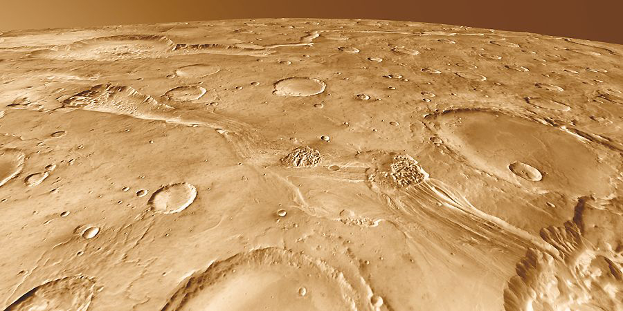
Ravi Vallis: Around 200 kilometers long, Ravi Vallis was born in a flood of water from Aromatum Chaos (left). The racing waters sliced a pathway across Xanthe Terra, spawned at least two small chaos regions in the channel (center), and then hurtled over the plateau edge to disappear into another chaos region (right foreground). In the distance at left lies Orson Welles Crater and the meandering path of Shalbatana Vallis, a much longer outflow channel perhaps related hydrologically to Ravi.
Ravi Vallis: Around 200 kilometers long, Ravi Vallis was born in a flood of water from Aromatum Chaos (left). The racing waters sliced a pathway across Xanthe Terra, spawned at least two small chaos regions in the channel (center), and then hurtled over the plateau edge to disappear into another chaos region (right foreground). This image was taken by the Thermal Emission Imaging System instrument on NASA's Mars Odyssey orbiter. NASA/JPL-Caltech/ASU

More Must-Reads from TIME

Contact us at letters@time.com