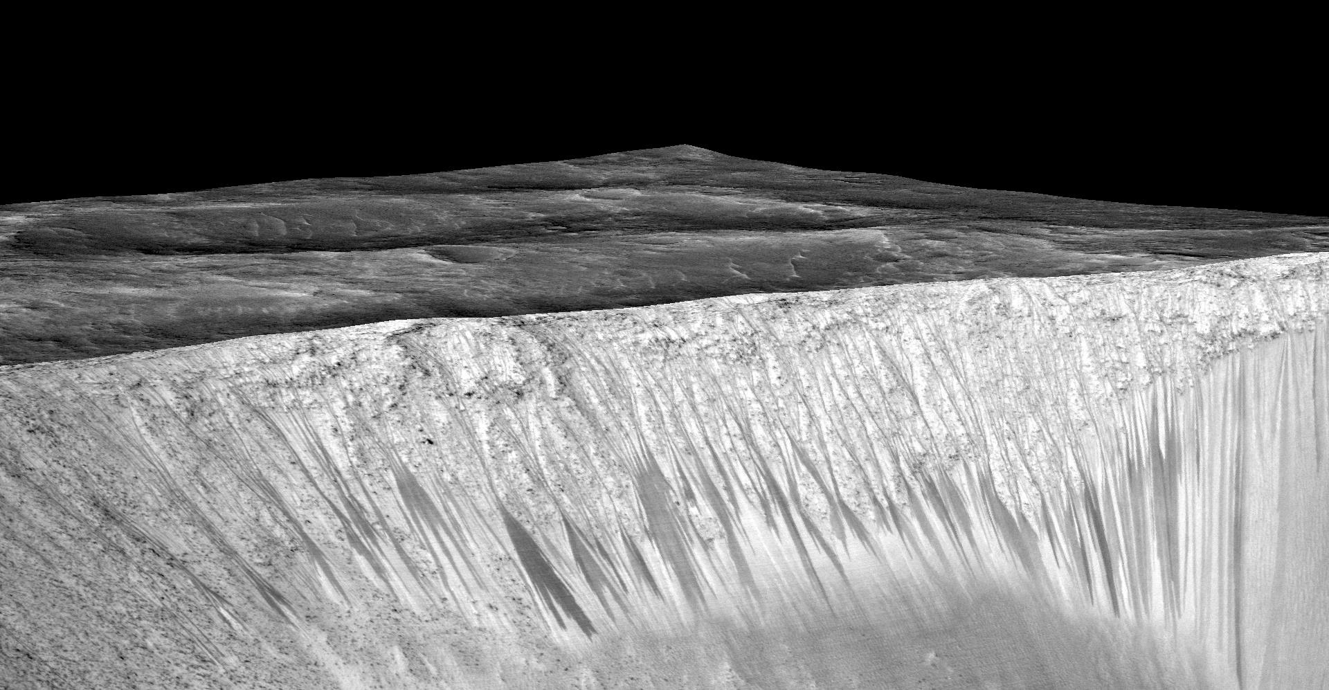
A 3-D computer model (a digital terrain map) of the walls of Garni Crater on Mars based on stereo information from two HiRISE observations showing dark, narrow streaks on the Martian slopes that are inferred to be formed by seasonal flow of water on contemporary Mars.NASA/JPL-Caltech/Univ. of Arizona
The news on Monday that signs of water had been found on Mars is, NASA declared, “the strongest evidence yet that liquid water flows intermittently on present-day Mars.” It’s also the latest step forward in the long history of humankind’s search for the life-sustaining liquid on the Red Planet—and of our interest in the ever-intriguing possibility of sustained life on Mars.
The excitement over possible Martian inhabitants, and what they might drink, was started in the 19th century by the Italian astronomer Giovanni Schiaparelli, who described hazy streaks on the surface of the planet, calling them canali. This Italian word means “channels,” TIME explained decades later, but was erroneously translated as “canals,” which suggested that someone had chosen to build them.
The idea of those channels—whether they were an act of nature or an act of intelligent construction—continued to fascinate scientists as observation technology improved. In 1923, for example, scientists argued that powerful telescope imagery suggested that the topography of Mars contains contains canals and polar snow caps. “These and other observations have led to the irresistible conclusion that Mars has air, water, warmth, and vegetable life,” TIME reported. A British astronomer, P.M. Ryves is quoted in the story saying Mars “appears to be far from a dead world,” adding, “whether it is inhabited by intelligent beings like ourselves is perhaps the most absorbent question that confronts the human race.”
Without a solid photo of the planet, exactly what type of water structures were possible was up for debate. A TIME story from 1940 summed up the most current thinking thus: “Mars has a little water, as the white polar caps show. These caps melt in the Martian summer, accumulate again in winter.” Hazy images of the canali and of areas that appeared green or brown suggested to many scientists that there might be vegetation out there.
By the end of the 1960s, the far-off telescope images had given way to close-up photographs. Water no longer seemed like a certainty. An April 4, 1969, story in TIME debated the question: “Contemporary scientists have been far less convinced that Mars has water,” the article noted. “They believe that the caps consist not of snow or ice but largely of frozen carbon dioxide, the principal constituent of the atmosphere of Mars.” On the other hand, a team of astronomers at the McDonald Observatory in Texas had recently announced that they obtained “absolutely conclusive proof” of water vapor on the planet. Using a telescope and the spectrograph the researchers claimed to discover water vapor in the planet’s atmosphere.
By 1976, scientists had changed their minds again. Data sent by the Viking 2 orbiter revealed “the summer ice cap of Mars’ North Pole is composed of frozen water,” TIME explained, adding that “the discovery confirms that Mars has far more water than had previously been believed, and suggests that even more lies in a shell of permafrost below the planet’s rocky surface. In fact, scientists said, the polar caps might be merely the visible tips of an iceberg-like Mars.”
In more recent years, the evidence has continued to flood in. By 2000, the Mars Global Surveyor, which at the time had been orbiting Mars since 1997, sent images that appeared to be the remains of lake beds dating back billions of years. In 2004, NASA announced that its rover Opportunity had determined that Mars was “drenched” with liquid water in the past, TIME noted. Through a variety of rock studies, experts were able to determine the prior existence of water on the planet. And as recently as 2012, TIME devoted a cover story to the landing of the Curiosity rover on Mars, and the plan to sample the Martian soil in search of materials that “interacted with water.”
And now it appears that the long search for water on Mars may have finally yielded the hoped-for result—not ice, and not in some past era. In the new study, researchers identified signs of hydrated salts at multiple locations on Mars, which suggests the possible presence of liquid water. “Mars is not the dry arid planet that we through of in the past,” Jim Green, director of planetary science at NASA Headquarters said in a press conference on Monday. “Under certain circumstances, liquid water has been found on Mars.”
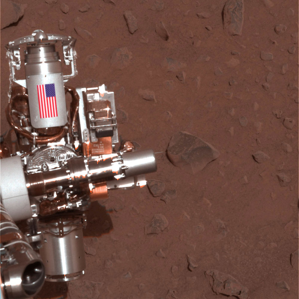
Photos from the Curiosity Rover’s First 2 Incredible Years on Mars
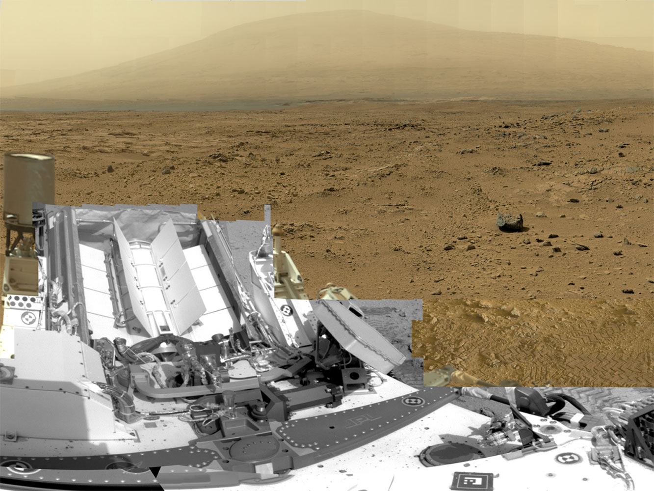
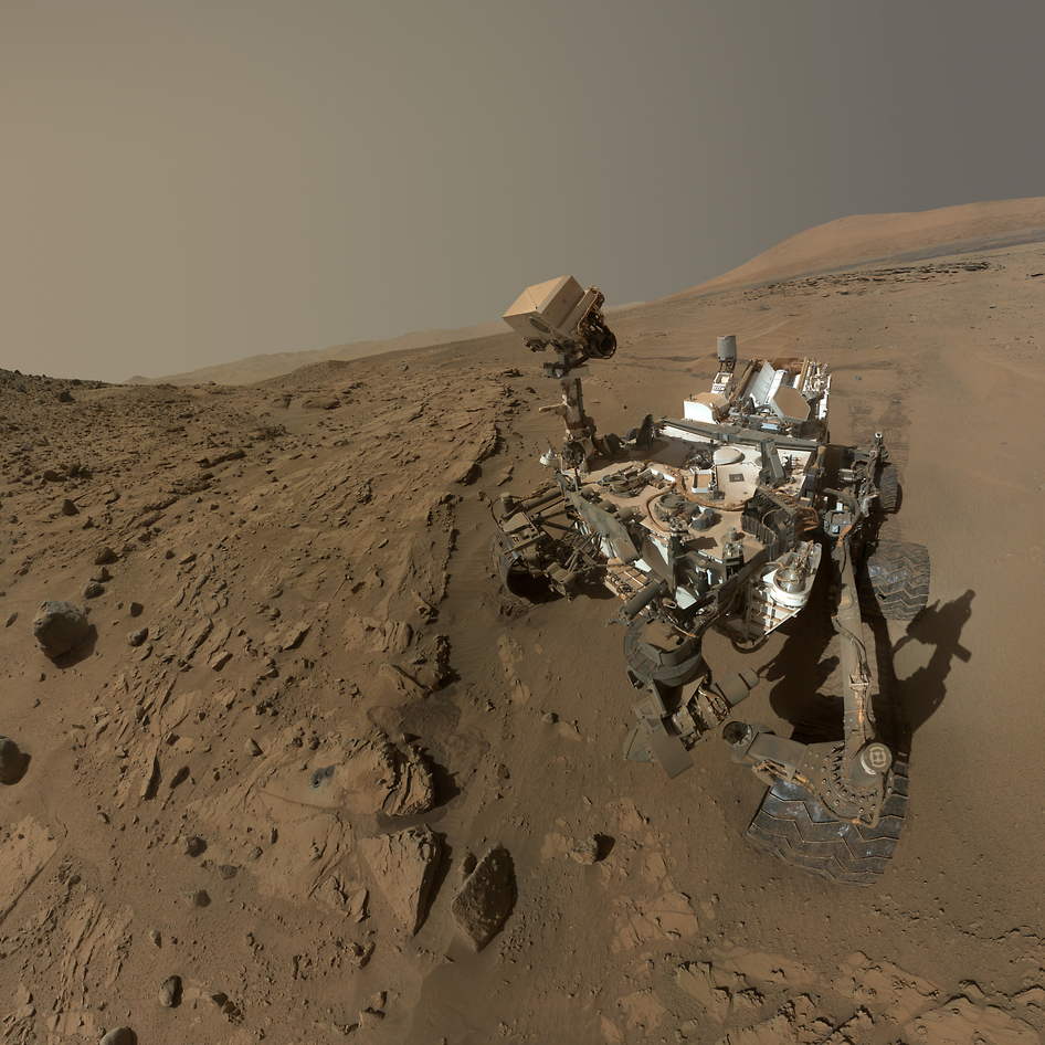
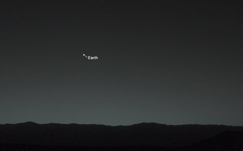
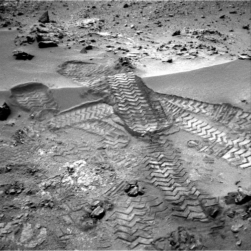
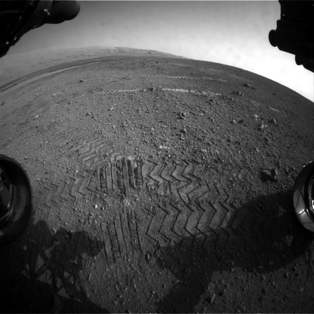
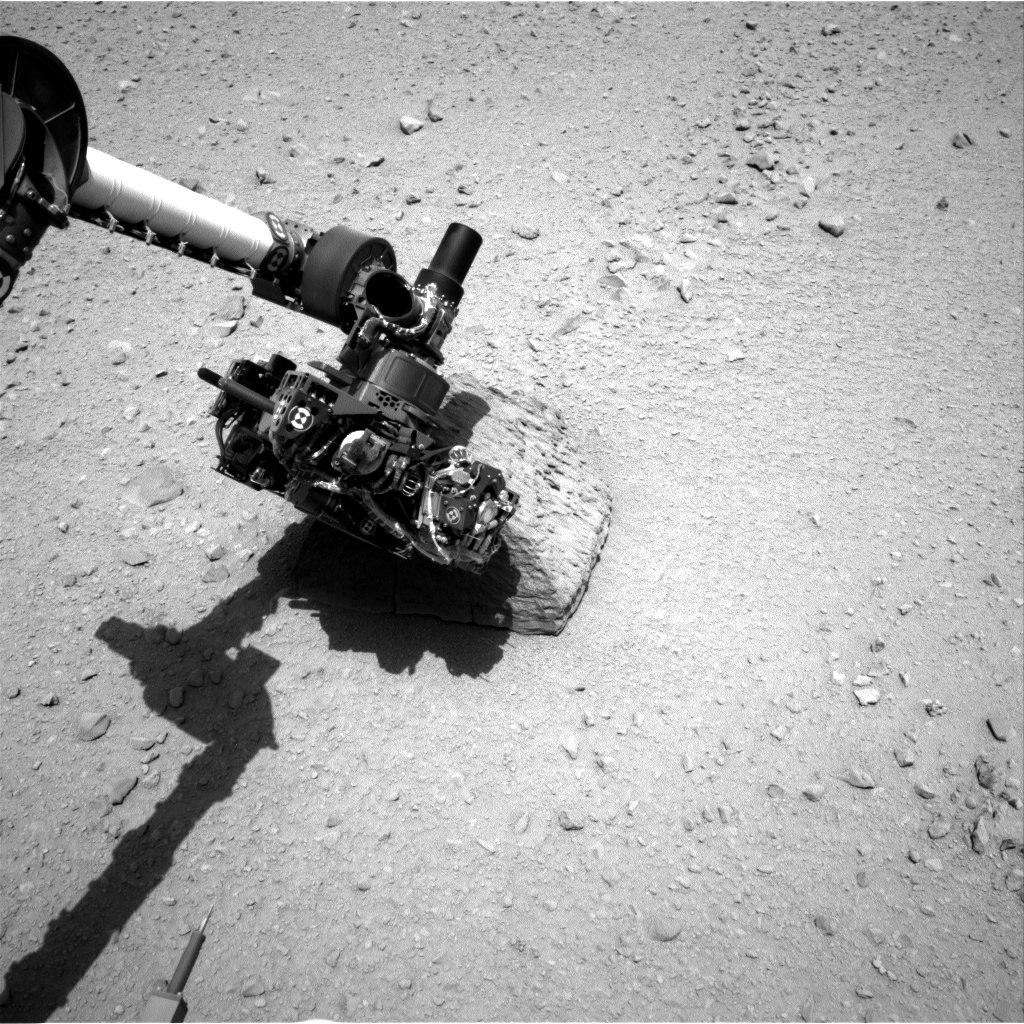
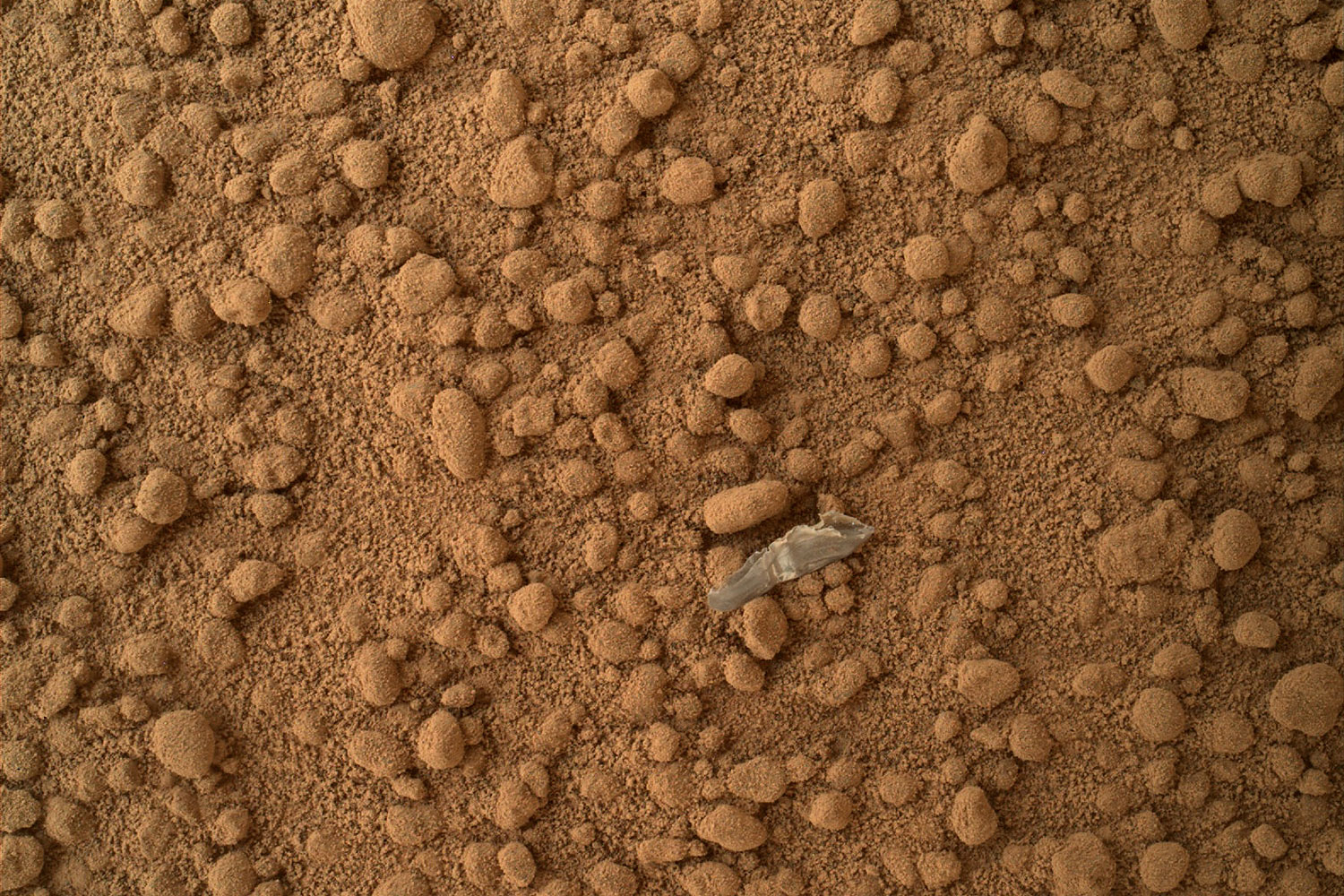
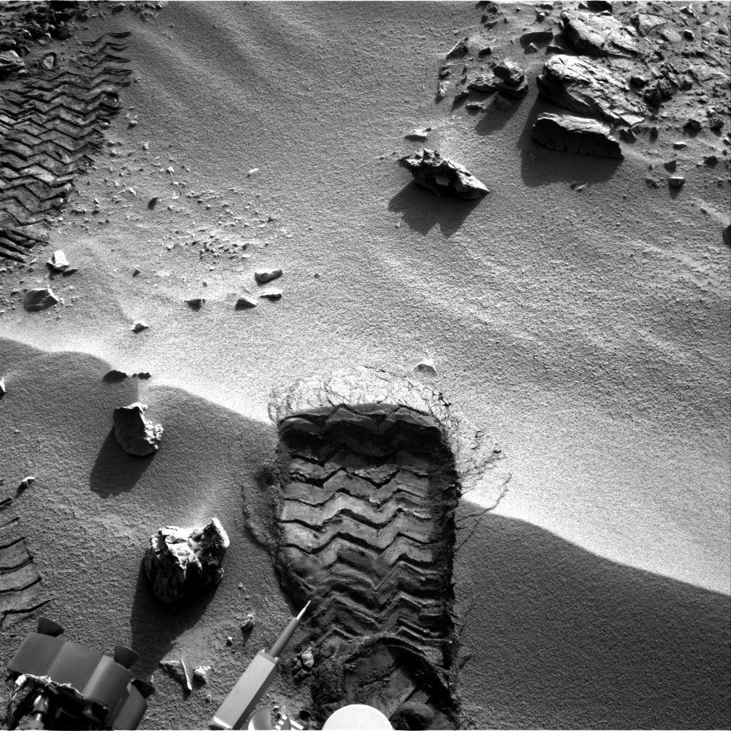
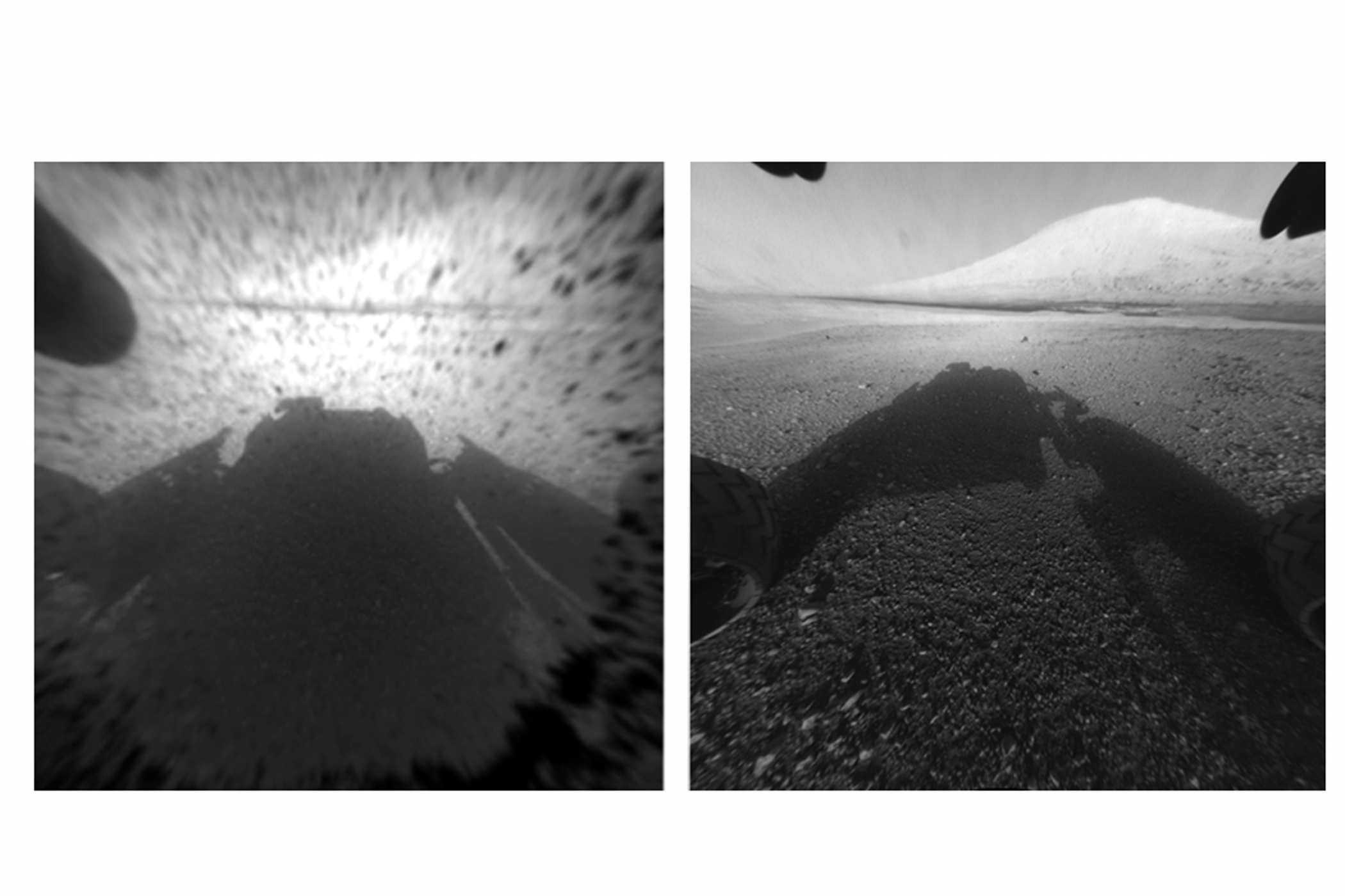
A full-circle view released by NASA on June 20, 2013, combined nearly 900 images taken by NASA's Curiosity Mars rover, generating a panorama with 1.3 billion pixels in the full-resolution version. The view is centered toward the south, with north at both ends. It shows NASA's Mars rover Curiosity at the 'Rocknest' site where the rover scooped up samples of windblown dust and sand.NASA/JPL-Caltech/MSSS/EPANASA's Mars Curiosity Rover captures a selfie to mark a full Martian year -- 687 Earth days -- spent exploring the Red Planet.NASA/JPLA detailed telephoto view from Curiosity shows Mount Sharp. The rover was expected to reach the 3.4-mile-high peak in February 2013, and the layered surface of the mountain should yield information to scientists on the planet's geological history. University of Arizona/JPL-Caltech/NASAThe Mar's Curiosity Rover's first photo of earth from the surface of Mars via TwitterNASACuriosity's tracks was taken by Navcam onboard NASA's Mars rover Curiosity, on Nov. 18 2012.University of Arizona/JPL-Caltech/NASATracks from NASA's Curiosity Mars rover on Aug. 22, 2012 on Mars. NASA said the rover moved forward 15 feet, then rotated 120 degrees before reversing 8.2 feet during its first planned movement.NASA/JPL-Caltech/MSSS/EPAThe highest point on Mount Sharp is visible from the Curiosity rover on Aug. 18, 2012. The Martian mountain rises 3.4 miles above the floor of Gale Crater. Geological deposits near the base of Mount Sharp are the destination of Curiosity's Mars mission.NASA/JPL-Caltech/MSSS/EPAThis image shows the robotic arm of NASA's Mars rover Curiosity with the first rock touched by an instrument on the arm. JPL-Caltech/NASAThis patch of windblown sand and dust downhill from a cluster of dark rocks is the "Rocknest" site, which was the location for the first use of the scoop on the arm of Curiosity.JPL-Caltech/MSSS/NASAA small bright object on the ground beside the rover at the "Rocknest" site. The rover team has assessed this object as debris from the spacecraft, possibly from the events of landing on Mars. NASANASA's Mars rover Curiosity cut a wheel scuff mark into a wind-formed ripple at the "Rocknest" site to examine the particle-size of the ripple. For scale, the width of the wheel track is about 16 inches (40 centimeters).JPL-Caltech/NASAA Martian rock illuminated by white-light LEDs is part of the first set of nighttime images taken by the Mars Hand Lens Imager camera. NASAWhen the rover landed, it sent images from one of the hazard-avoidance cameras. The image at left was taken before the camera's dust cover was removed, the image on the right was taken after. These engineering cameras are located at the rover's base, and are lower-resolution than the color images produced by the rover's mast.
University of Arizona/JPL-Caltech/NASANASA's Curiosity rover and its parachute are seen by NASA's Mars Reconnaissance Orbiter as Curiosity descends to the surface around 10:32 p.m. PDT, Aug. 5, or 1:32 a.m. EDT, Aug. 6, 2012. The rover is equipped with a nuclear-powered lab capable of vaporizing rocks and ingesting soil, measuring habitability, and whether Mars ever had an environment able to support life.University of Arizona/JPL-Caltech/NASA
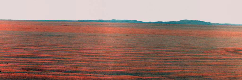
PHOTOS: The Most Beautiful Panoramas and Mosaics From Opportunity’s Decade on Mars
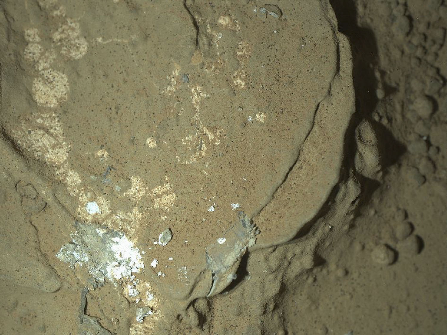
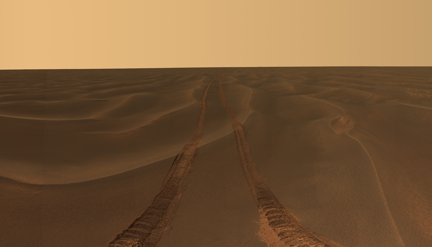
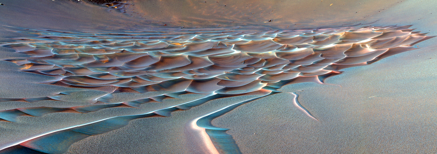
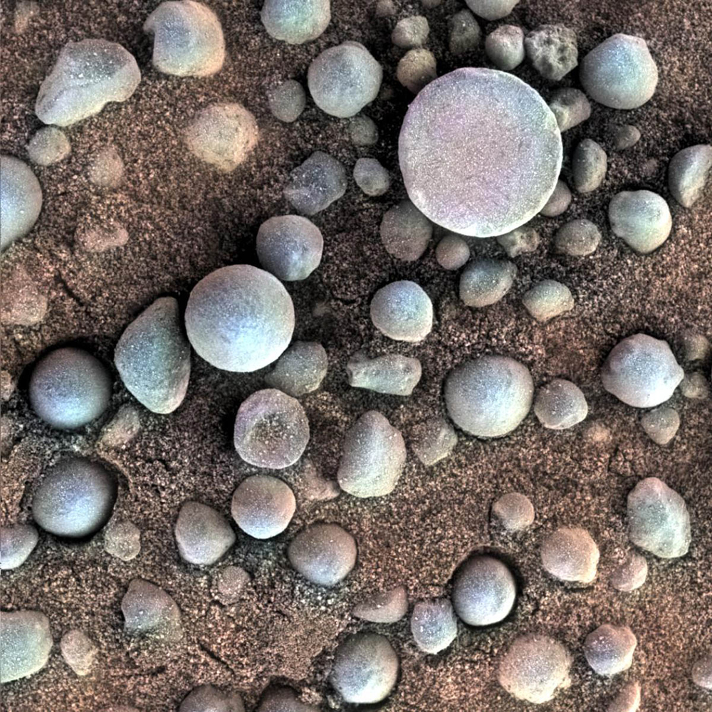
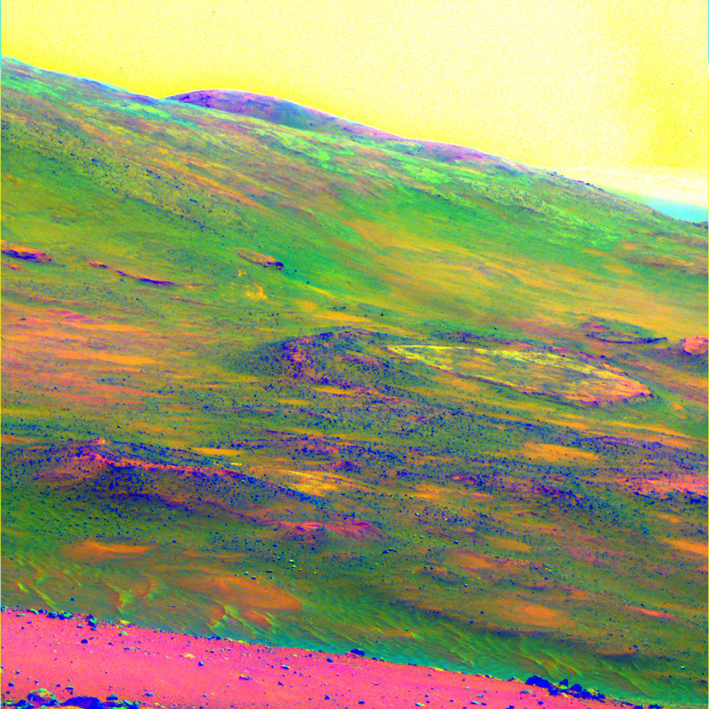
Rover tracks disappear toward the horizon like the wake of a ship across the desolate sea of sand between the craters Endurance and Victoria on the Meridiani Plains. NASA— JPL-Caltech / Cornell UniversityThe Mars Rover Spirit took this sublime view of a sunset over the rim of Gusev Crater, about 80 kilometers (50 miles) away. NASA—JPL-Caltech / Texas A&M / CornellA false-color image of Endurance Crater. In this image, tendrils of sand less than 3.3 ft (1 m) high extend from the main dune field toward the rover. Dunes are a common feature across the surface of Mars. Before the rover headed down to the dunes, mission managers first established whether the slippery slope that led to them was firm enough to ensure a successful drive back out of the crater. Otherwise, the dune field would become a sand trap. NASA—JPL-Caltech / Cornell UniversityTiny spherules, photographed by Opportunity, pepper a sandy surface in this 1.2-in (3 cm) square view of the Martian soil. Nicknamed "blueberries" by mission scientists, the little pellets are actually hematites, an iron oxide typically formed in standing water—of which Mars once had plenty.NASA—JPL-Caltech / Cornell / USGS / Cathy WeitzSpirit obtained this view of the area called Home Plate while parked atop a formation called Husband Hill. The colors emphasize differences in rock weathering. A large dust devil appears as the V-shaped discoloration in the sky at the top right.NASA—JPL-Caltech / Cornell UniversityThe Opportunity rover used its panoramic camera to record the East Rim of Endeavor Crater, on October 31, 2010. The view is presented in false color to make differences in surface materials more visible. A portion of Endeavour Crater's eastern rim, nearly 19 miles (30 km) distant, is visible.NASA—JPL-Caltech / CornellNASA's Spirit rover acquired this false-color image after using its abrasion tool to brush the surfaces of rock targets informally named "Stars" (left) and "Crawfords" (right). Small streaks of dust extend for several centimeters behind the chips and pebbles in the dusty soil. NASA—JPL-Caltech / USGS / Cornell UniversityRover tracks disappear toward the horizon like the wake of a ship between the craters Endurance and Victoria on the Meridiani Plains. Opportunity took the image while stuck in the sand ripple dubbed Purgatory for over a month. This panorama (only partly shown here) was named Rub Al Khali after the “Empty Quarter” in the Arabian Desert.NASA—JPL-Caltech / Cornell University