
By Sarah Begley and TIME Photo
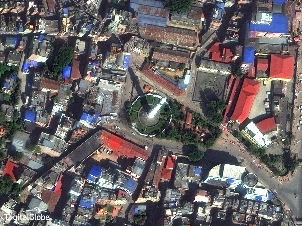
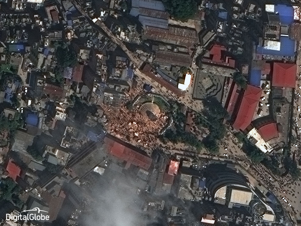
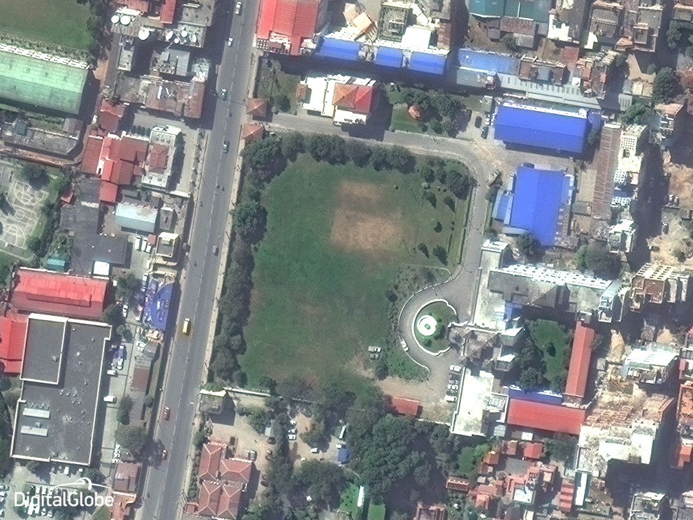
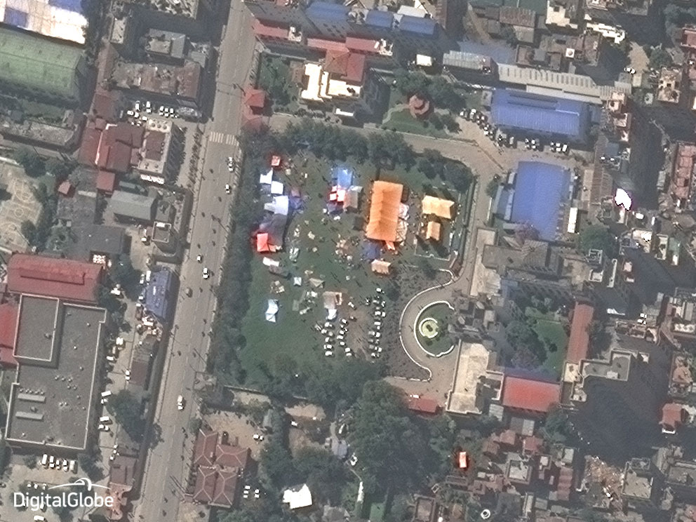
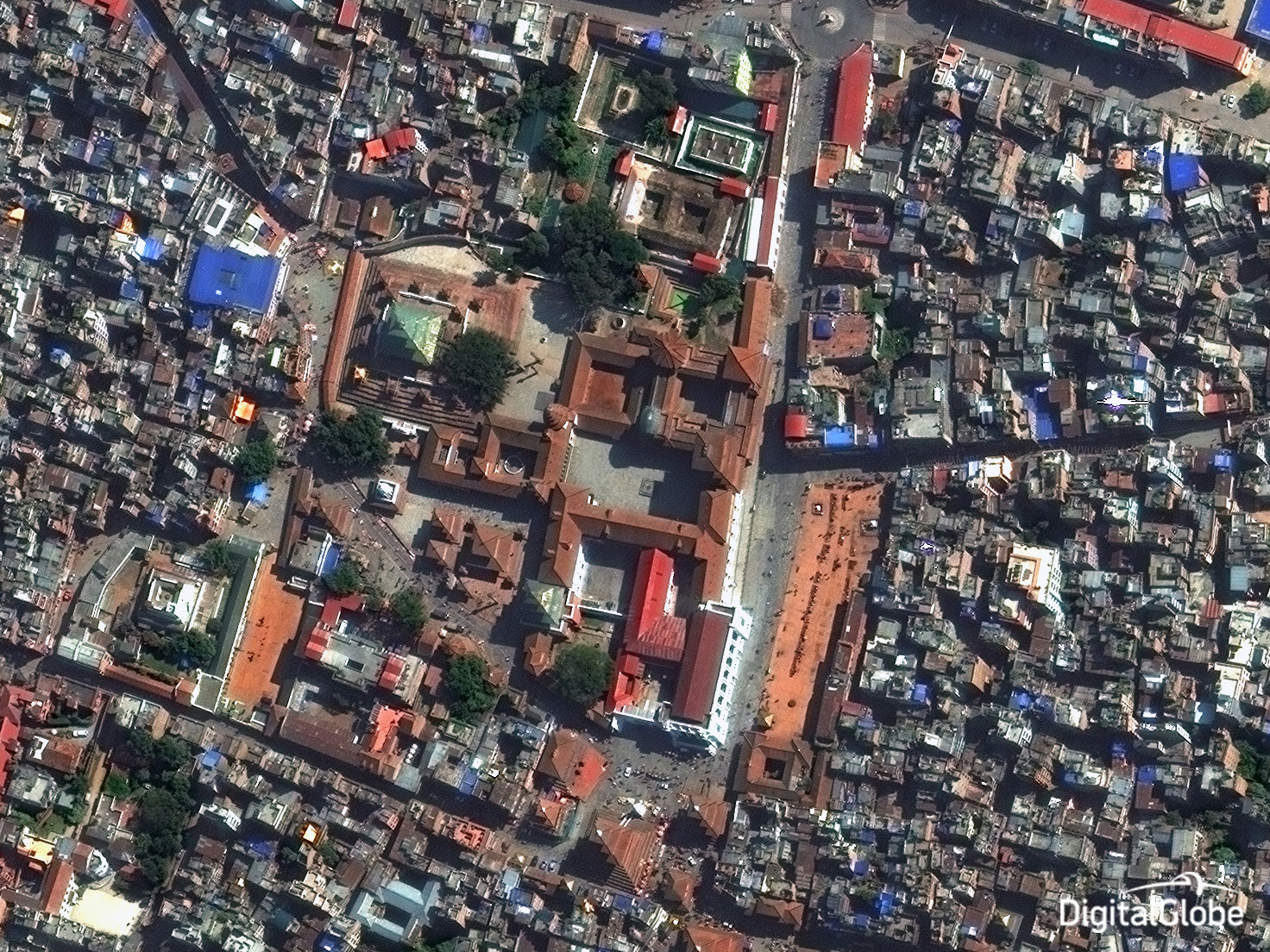
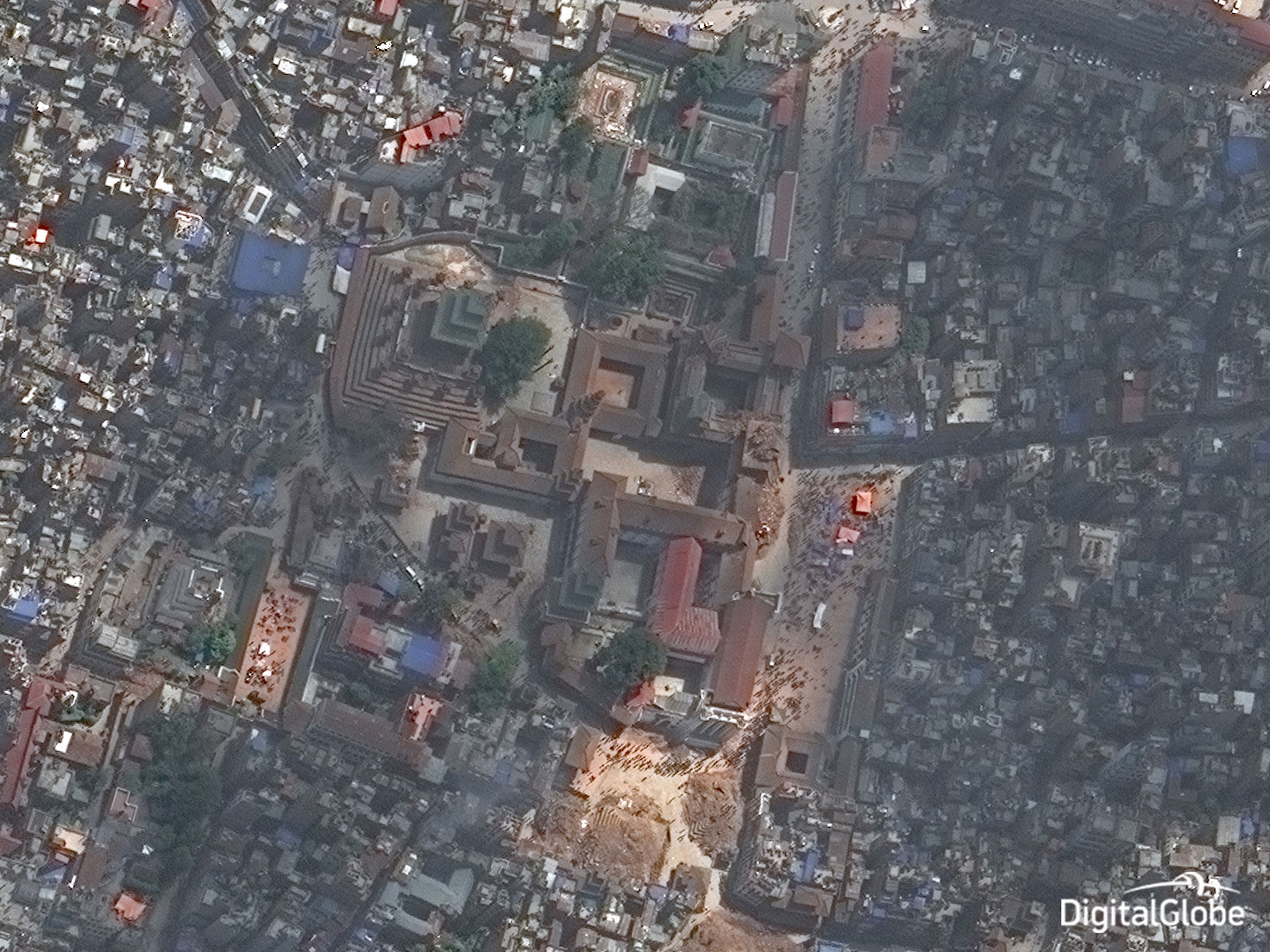
The 7.8-magnitude earthquake that devastated Nepal on Sunday has altered the face of the country, as new satellite images show. The disaster has killed more than 4,600 people and leveled buildings—many of them historic—to rubble.
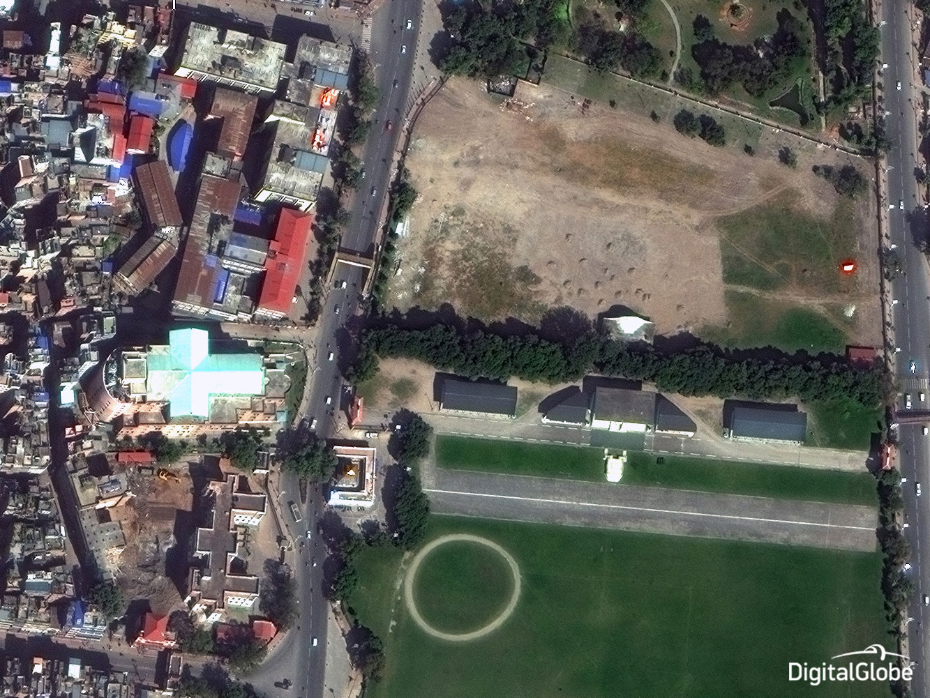
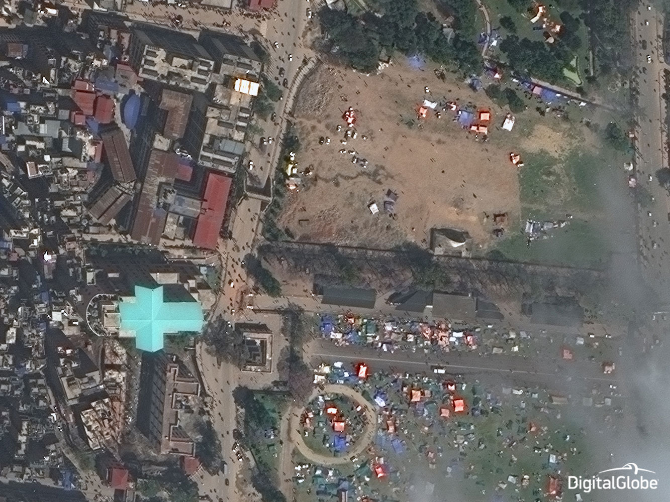
The Dharhara Tower, a UNESCO World Heritage site, was toppled, leaving about 180 bodies in its ruins. Survivors have set up tents and other temporary structures in open areas of their towns and cities, away from the danger of more buildings falling in an aftershock, as they await aid. Meanwhile, villagers in remote areas of Nepal are cut off by landslides that prevent rescue crews from providing relief.
More Must-Reads from TIME
- How the Economy is Doing in the Swing States
- Democrats Believe This Might Be An Abortion Election
- Our Guide to Voting in the 2024 Election
- Mel Robbins Will Make You Do It
- Why Vinegar Is So Good for You
- You Don’t Have to Dread the End of Daylight Saving
- The 20 Best Halloween TV Episodes of All Time
- Meet TIME's Newest Class of Next Generation Leaders
Contact us at letters@time.com