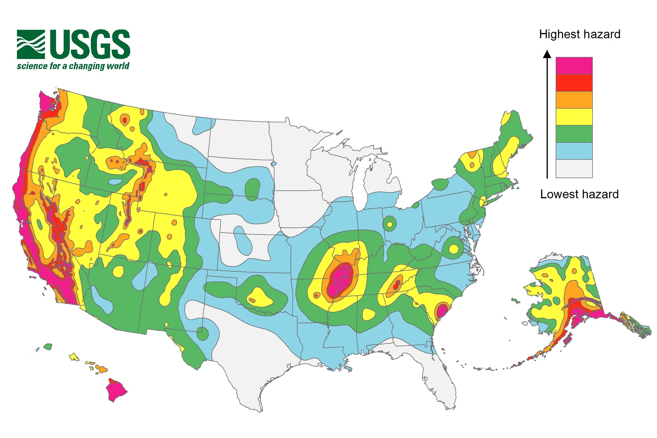
This colorful new map from the U.S. Geological Survey shows the areas across the United States that are most likely to experience a significant earthquake in the next 50 years.
In its update to the U.S. National Seismic Hazard Maps using the latest earthquake data, the USGS found that 16 states are at high risk for experiencing a damaging earthquake in the next half century. They are: Alaska, Arkansas, California, Hawaii, Idaho, Illinois, Kentucky, Missouri, Montana, Nevada, Oregon, South Carolina, Tennessee, Utah, Washington and Wyoming.
The USGS notes in its report that fracking may be to blame for a sizeable uptick in earthquakes in places like Oklahoma. “Some states have experienced increased seismicity in the past few years that may be associated with human activities such as the disposal of wastewater in deep wells,” the report says. USGS hopes to use that data in future maps but it isn’t included in this one. “Injection-induced earthquakes are challenging to incorporate into hazard models because they may not behave like natural earthquakes and their rates change based on man-made activities,” the report says.
More Must-Reads from TIME
- Why Biden Dropped Out
- Ukraine’s Plan to Survive Trump
- The Rise of a New Kind of Parenting Guru
- The Chaos and Commotion of the RNC in Photos
- Why We All Have a Stake in Twisters’ Success
- 8 Eating Habits That Actually Improve Your Sleep
- Welcome to the Noah Lyles Olympics
- Get Our Paris Olympics Newsletter in Your Inbox
Contact us at letters@time.com