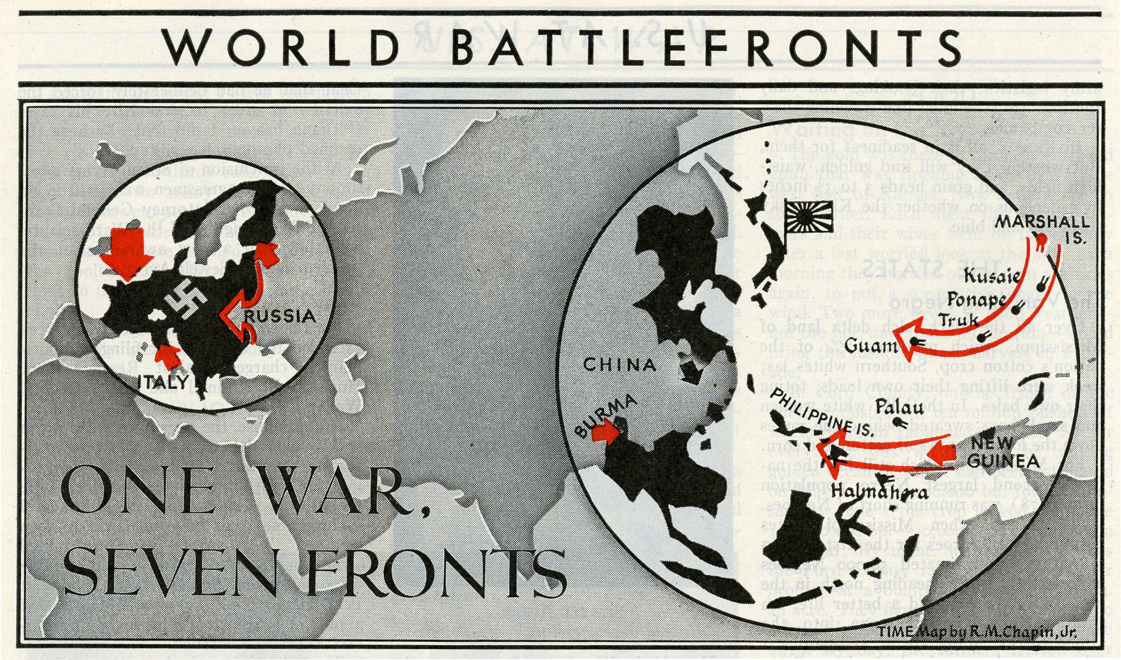
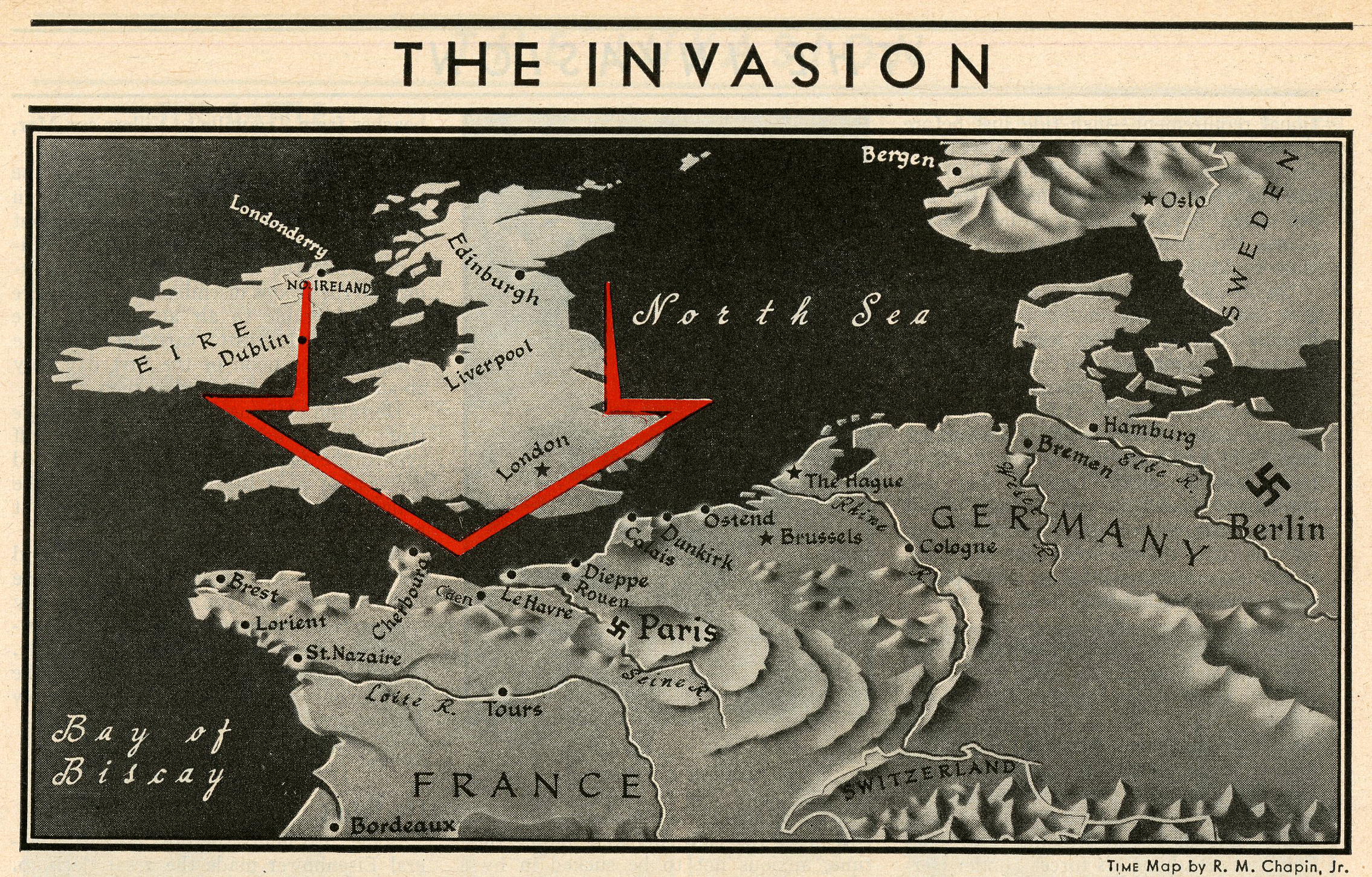
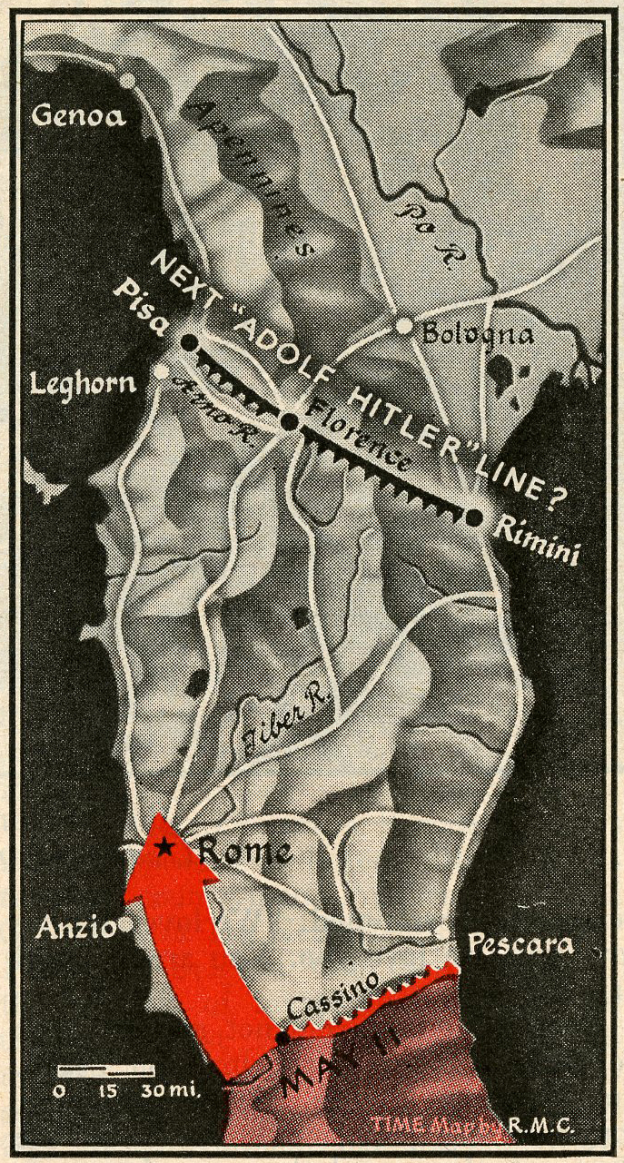
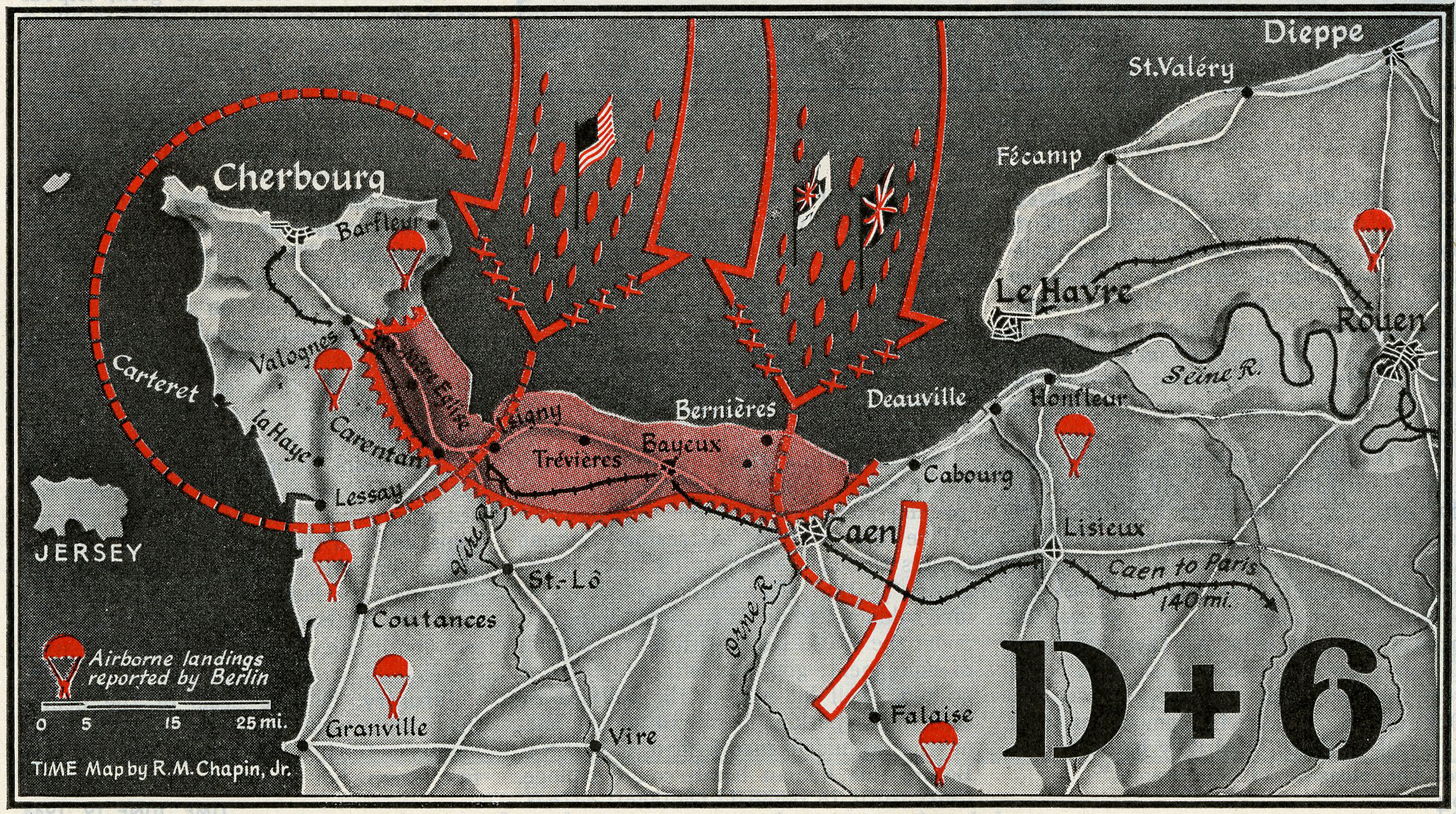
One of the most striking features of World War II-era TIME magazines — aside from their marvelous ads — is the prevalence of elaborate illustrations, often bordering on the beautiful. Visually compelling, rich in detail, these graphics — and especially the maps, like those shown here — don’t merely convey data; all these years later, they immediately conjure a singular period in history, when enormous forces were on the move, or were stuck in brutal stalemate, all over the globe.
For film buffs, these maps might conjure the opening sequence from the greatest American wartime movie of them all, Casablanca, with its black-and-white globe spinning away beneath a harsh, nasal, newsreel-toned voiceover. For others, the maps might bring to mind old textbooks from a long-forgotten history class. But whatever associations they spark today, it’s worth recalling that when they were first published, 70 years ago, they were vital, immediate records of an epic military operation that not only was fresh in every TIME reader’s mind, but was still underway, and still costing lives, on the roads and in the fields and villages of Normandy and beyond.
[WATCH: ‘Behind the Picture: Robert Capa’s D-Day’]

More Must-Reads From TIME
- The 100 Most Influential People of 2024
- Coco Gauff Is Playing for Herself Now
- Scenes From Pro-Palestinian Encampments Across U.S. Universities
- 6 Compliments That Land Every Time
- If You're Dating Right Now , You're Brave: Column
- The AI That Could Heal a Divided Internet
- Fallout Is a Brilliant Model for the Future of Video Game Adaptations
- Want Weekly Recs on What to Watch, Read, and More? Sign Up for Worth Your Time
Contact us at letters@time.com