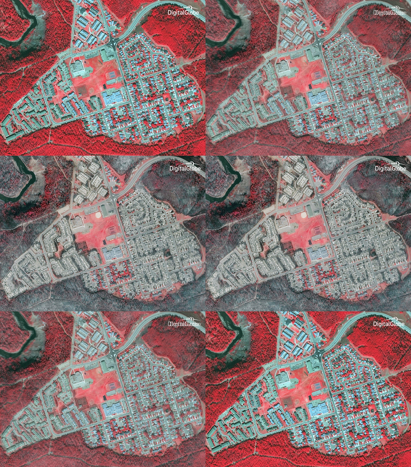
A series of satellite images captured by DigitalGlobe show the extent of the damage done by a massive wildfire in the Canadian city of Fort McMurray, where more than 88,000 people were forced to evacuate last week.
About 2,400 homes and buildings were destroyed or damaged in the wildfire, Alberta Premier Rachel Notley said Monday, according to the Associated Press. But she said about 25,000 buildings had been saved.
Notley said fire suppression efforts are still ongoing, but the fire is growing at a slower pace.

DigitalGlobe used its WorldView-2 satellite and infrared imagery to depict the extent of the damage. Healthy vegetation appears in bright red, and dead or burnt vegetation appears in darker colors. The different images were captured on May 29, 2015, and May 5, 2016.
See more images captured by DigitalGlobe here.
More Must-Reads from TIME
- Donald Trump Is TIME's 2024 Person of the Year
- Why We Chose Trump as Person of the Year
- Is Intermittent Fasting Good or Bad for You?
- The 100 Must-Read Books of 2024
- The 20 Best Christmas TV Episodes
- Column: If Optimism Feels Ridiculous Now, Try Hope
- The Future of Climate Action Is Trade Policy
- Merle Bombardieri Is Helping People Make the Baby Decision
Write to Katie Reilly at Katie.Reilly@time.com