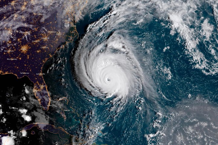
Lockheed Martin might be best known for its its massive defense contracts, like the F-35 fighter jet. But in recent months, the aerospace giant has been revolutionizing the way we see—and potentially respond to—weather patterns with next-generation weather satellites, built for NASA and NOAA. The first in this new series, known as GOES-16, was launched in late 2016 and went into official service last December. The spacecraft, part of a $10.8 billion program, beams down images with four times the resolution of the satellite it replaced. It can spot wildfires to help direct first responders and includes a device called the Geostationary Lightning Mapper (GLM), which can detect lightning flashes even during daylight—data that promises to improve tornado warning times. In an age when startup culture preaches “fail fast,” sophisticated satellites, which can take years to design and build, are a much different challenge. “We have to imagine future needs and meet them,” says Tim Gasparrini, the Lockheed vice president who oversees the program. A sister satellite, GOES-17, blasted off in March and is in a testing period; its imager has been partly hampered by a cooling-system problem and engineers are trying out workarounds. But both spacecraft transmit remarkable images around the clock—providing information from space to help better decisions here on Earth. —Thomas E. Weber
TIME may receive compensation for some links to products and services on this website. Offers may be subject to change without notice.
