Wildfires raging across Northern California have left at least 17 people dead and destroyed more than 3,500 homes and businesses throughout California’s wine country since Sunday.
Spurred by powerful winds, more than a dozen wildfires have forced thousands of people out of their homes and destroyed California wineries in the Northern California region.
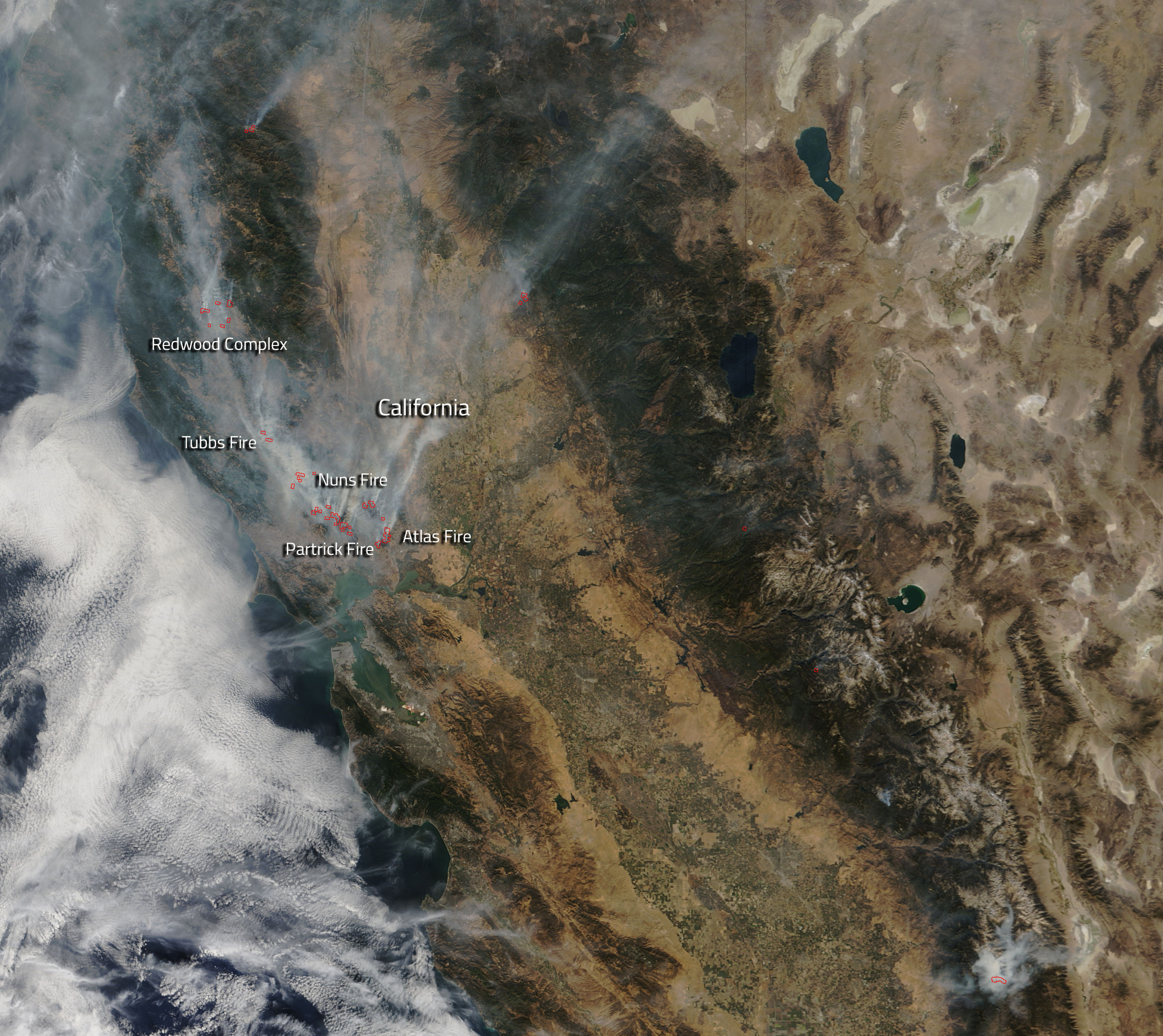
A photo from NASA showing the California wildfires from space reveals actively burning “hot spots,” which are outlined in red. The hot spots on the map are peppered throughout Northern California, including areas surrounding Napa, Calistoga and Mendocino County.
NASA’s Terra satellite took the photo of the California wildfires from space, and highlighted the hot spots using an instrument that detected higher temperatures in those areas.
See how the California wildfires look from space above.
More Must-Reads From TIME
- The 100 Most Influential People of 2024
- Coco Gauff Is Playing for Herself Now
- Scenes From Pro-Palestinian Encampments Across U.S. Universities
- 6 Compliments That Land Every Time
- If You're Dating Right Now , You're Brave: Column
- The AI That Could Heal a Divided Internet
- Fallout Is a Brilliant Model for the Future of Video Game Adaptations
- Want Weekly Recs on What to Watch, Read, and More? Sign Up for Worth Your Time
Write to Mahita Gajanan at mahita.gajanan@time.com