#LightBoxFF: Matt Black Charts the Geography of Poverty

5 minute read

Welcome to this week’s edition of TIME’s LightBox Follow Friday, a series where we feature the work of photographers who are using Instagram in new and engaging ways. Each week we will introduce you to the person behind the feed through his or her pictures and an interview with the photographer.

This week, TIME speaks with Matt Black (@mattblack_blackmatt), who charts the physical terrain of economic inequality in his Geography of Poverty project. He says Instagram has allowed him to explore the connection between cartography and photography as he builds a map of modern poverty in pictures.


LightBox: How are you using Instagram now, and how has it become a part of your professional practice?

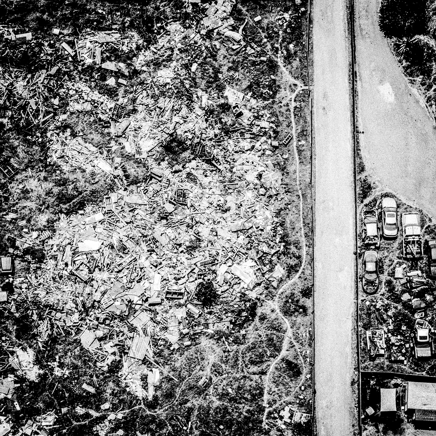
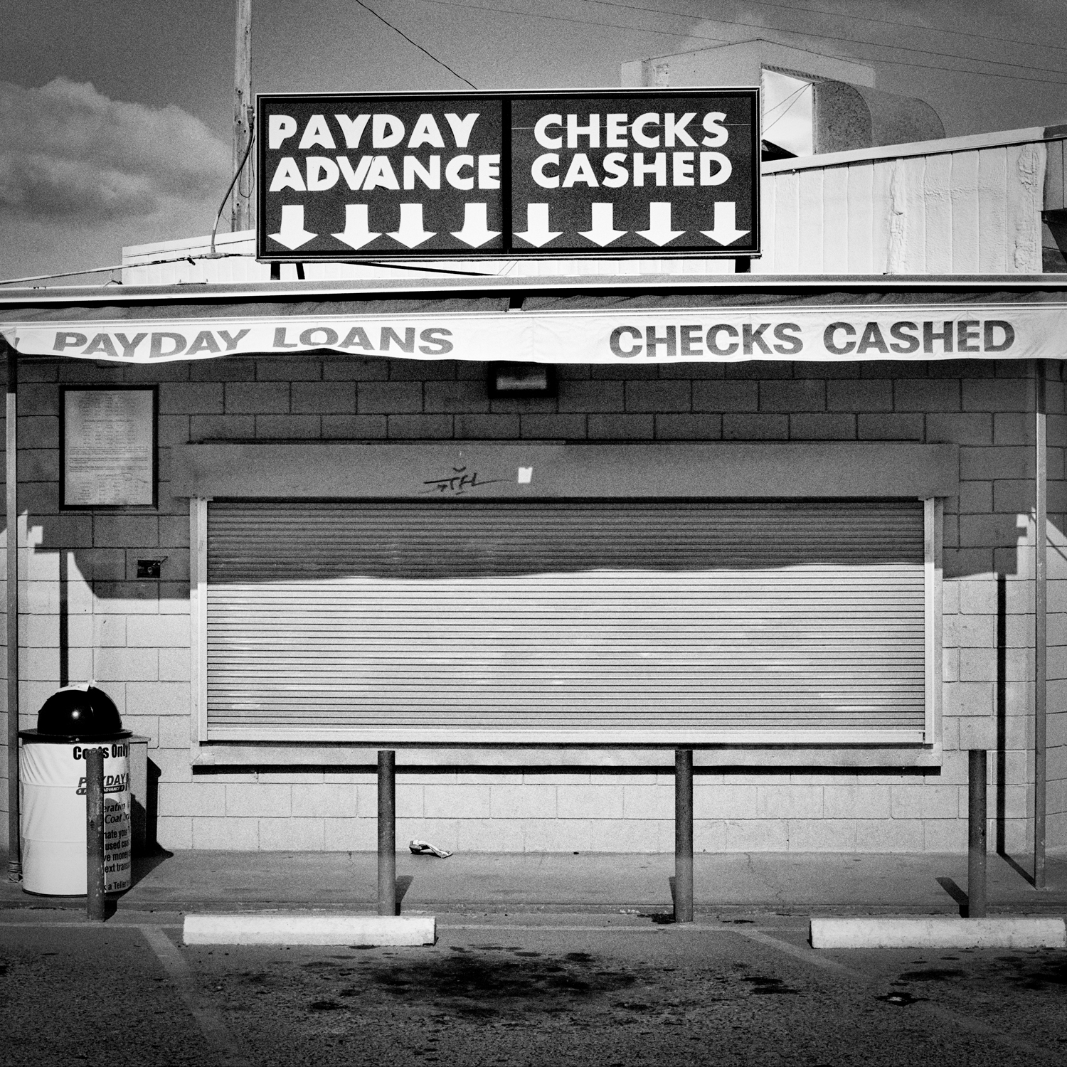
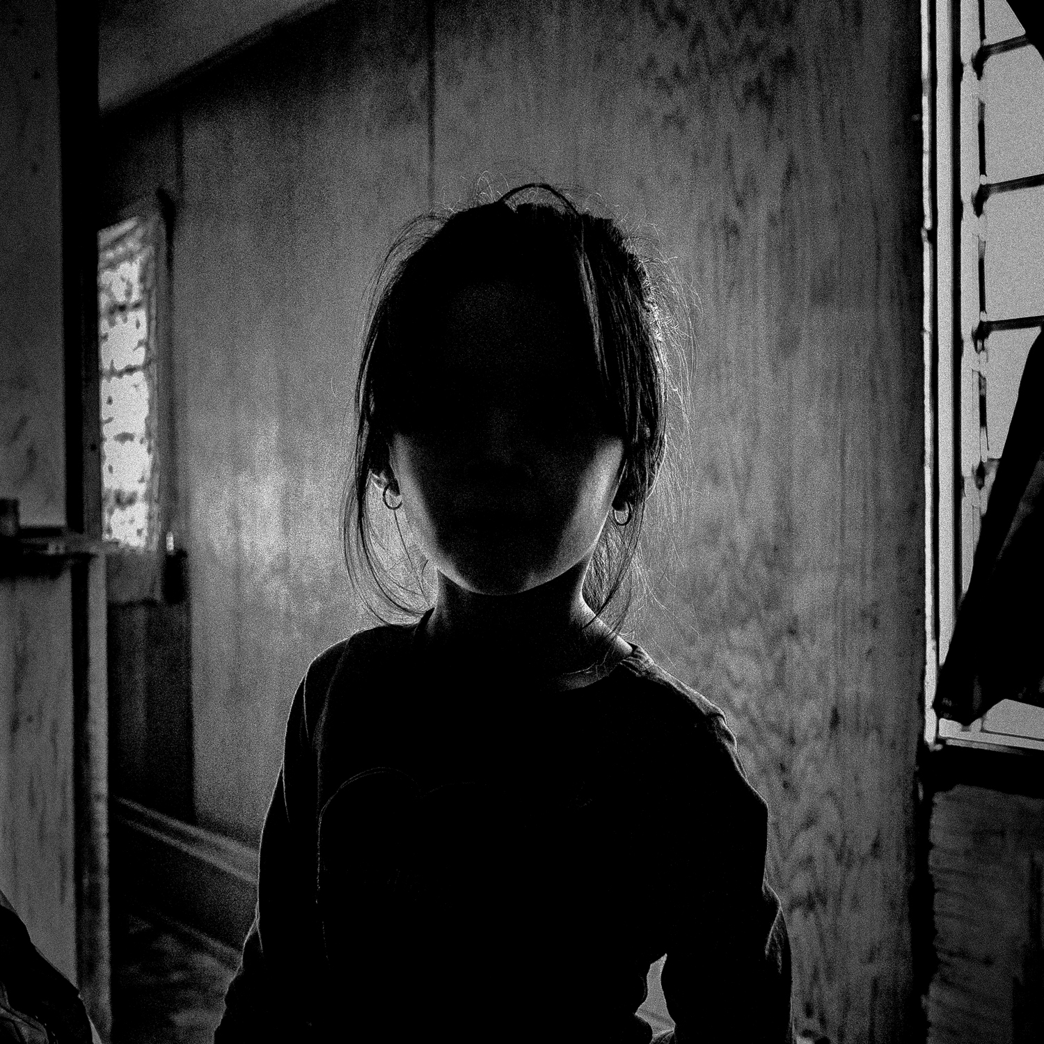
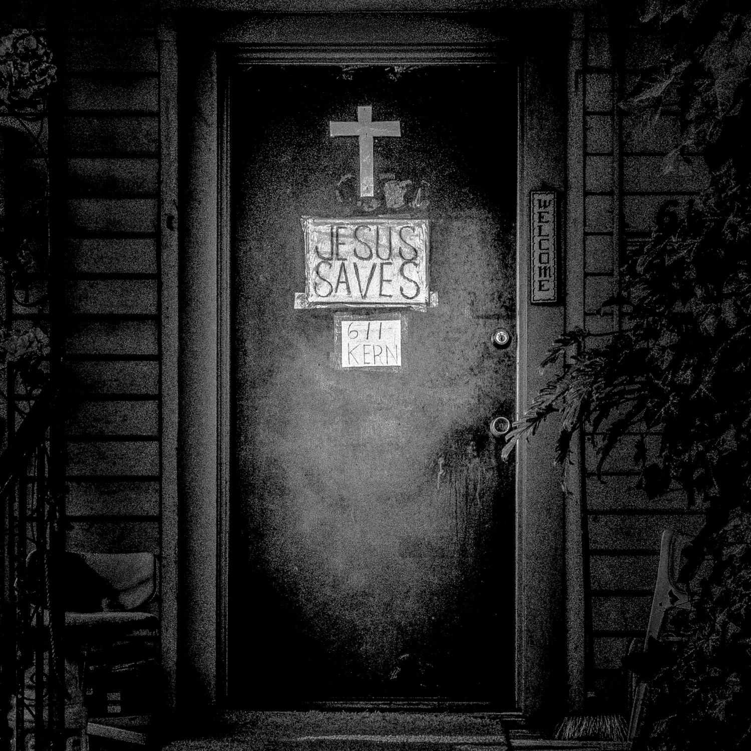
MB: I’m working on a project where I’m going to poor communities, taking a photo, posting it, and putting it on a map. The photography itself is not that different from my other work, but the idea is very documentary, in the older sense of the word: single photos that record certain conditions. The project also ties in with the idea of building maps from the bottom up — critical cartography, it’s called. All of my work is about similar themes, but this time I’m being more explicit about injustice and inequity. Poverty and place are so closely related that it’s taken for granted, and it’s a mindset that enables the kind of shoddy treatment that poor communities receive: bad roads, dirty water, crummy schools, polluted air. All these things are a reflection of power and acquiescence. Both photography and maps can play a role in highlighting that, and I think social media can, too. There does seem to be room on sites like Instagram to deal with serious issues, and so far the reaction to this project has been good. I started posting last December. Right now, I’m concentrating on rural California, but I plan to expand to other areas, and eventually I’d like to have other photographers contribute, too

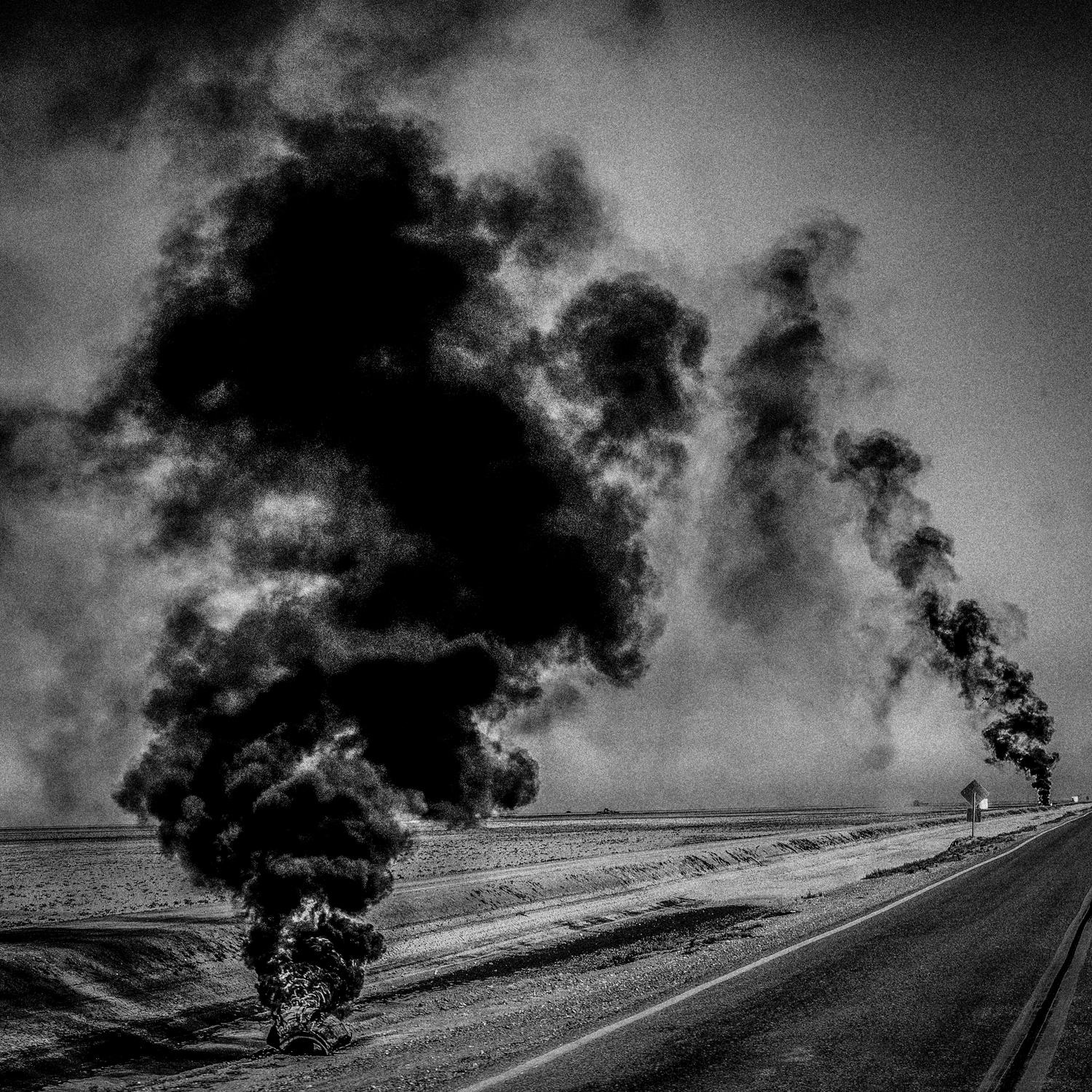
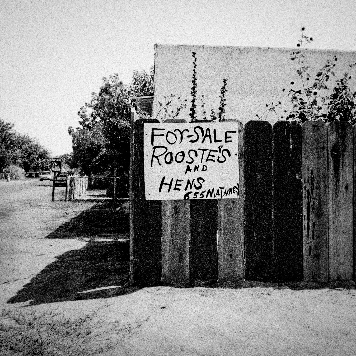
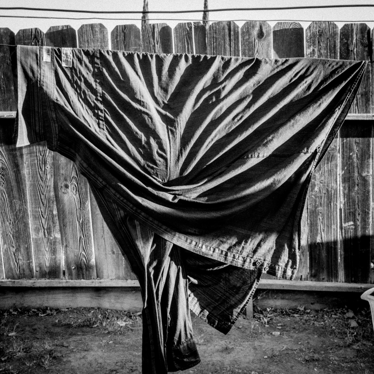
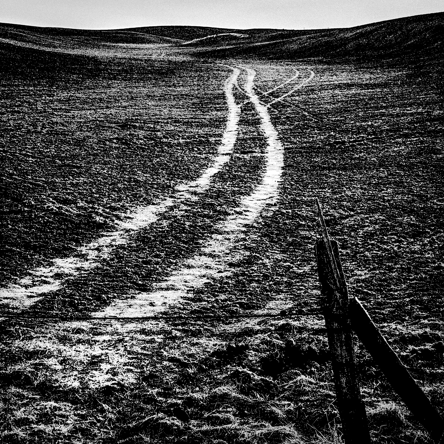
Orange Grove. Easton, California. Apr. 8, 2014

LightBox: What is the purpose of your feed? What does Instagram provide for you that other platforms don’t.

MB: I’d been developing the idea of the project for about a year and when I went looking at platforms and how best to execute it, Instagram already had everything that I needed — namely, the ability to put photos on a map and then distribute them. I experimented a bit with custom maps, but why reinvent the wheel? I’ve also linked the feed back to a Tumblr blog, where I can give things a bit more context, put the photos on a bigger map, etc., but Instagram is the baseline for the project. That’s where it’s being made. As far as the photos themselves, now I’m using a little Sony, an RX 100 II, which is a great camera, but earlier I used an iphone and a dslr, and there are even some film shots in there, too – whatever I was working with at the time. All the photos are downloaded to the phone through Dropbox, but the Sony I’m using now can connect directly, I’m told.

LightBox: Why did you start using Instagram, and how has your use of it changed since your first post?

It has a real sense of intimacy that’s hard to gauge at first, but you begin to feel a strong connection to the person behind the feed. I suppose it’s because there’s a progression, and you are building some trust and a certain dialogue along the way.

LightBox: When did you hit your stride with Instagram? Was there a moment where you crossed a threshold and your perspective on the platform changed?

MB: At first, it’s hard to adjust to the small size. I’m used to using negative space and taking photos with lots of elements, but that doesn’t work so well on a tiny screen. You can’t do an epic poem in a couple of square inches, but it’s perfectly suited to polished little haikus. I’ve enjoyed the challenge of that.

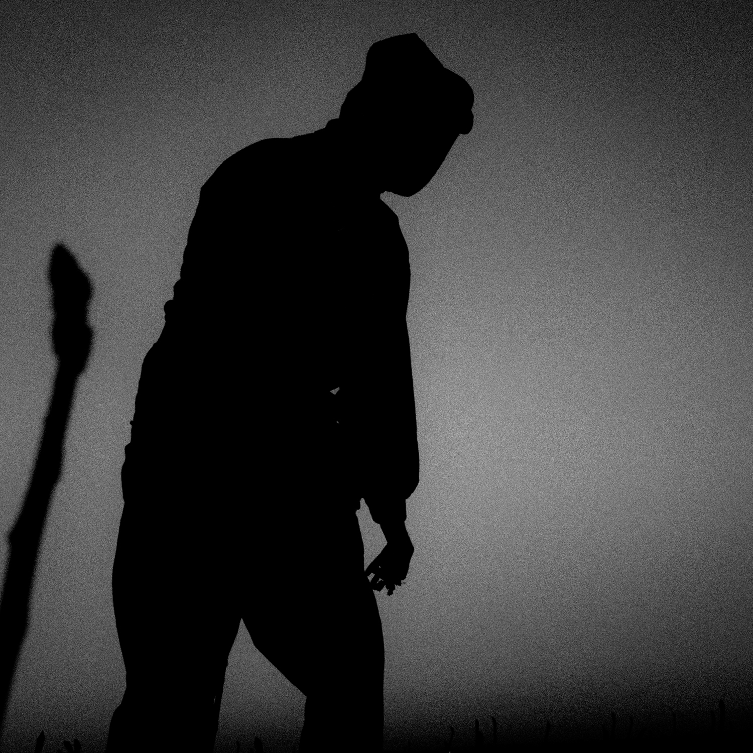
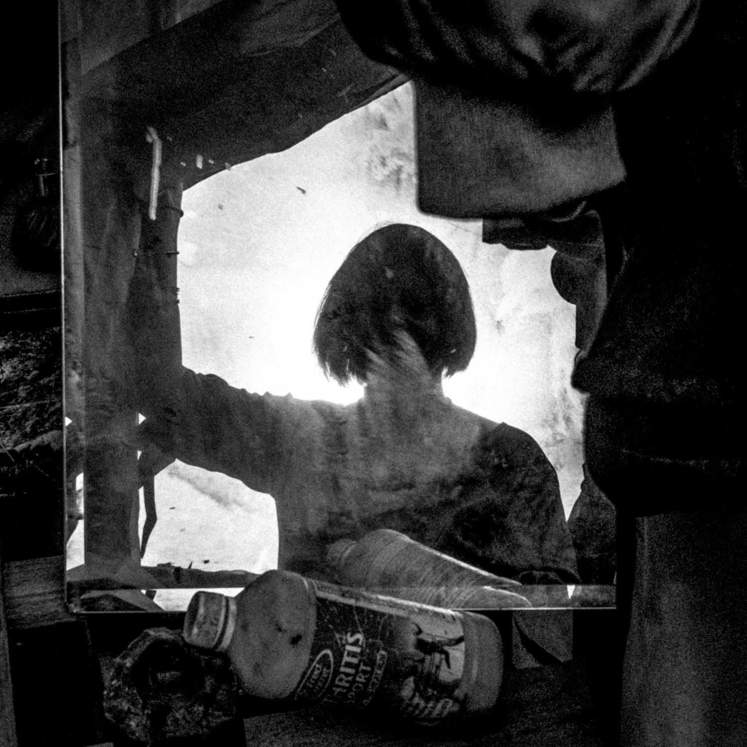
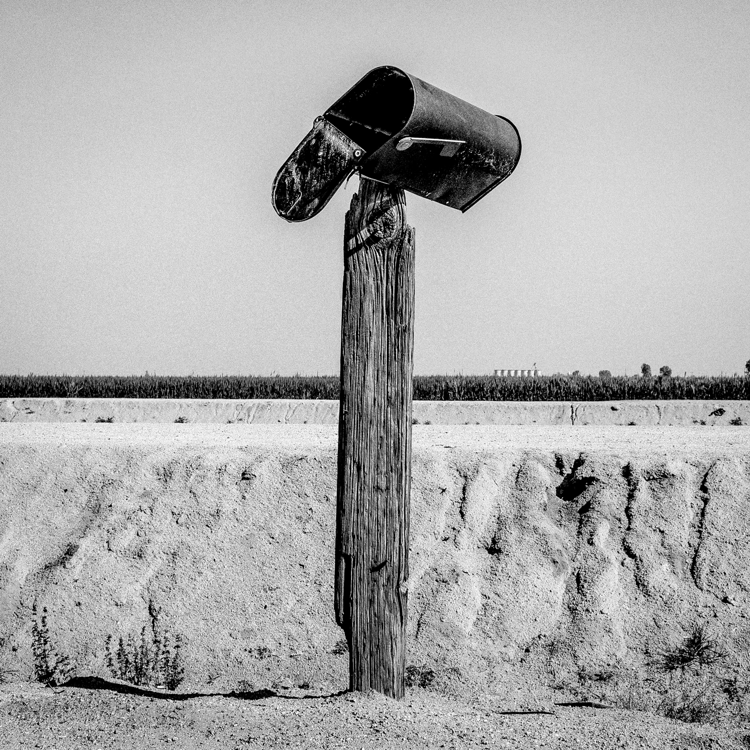
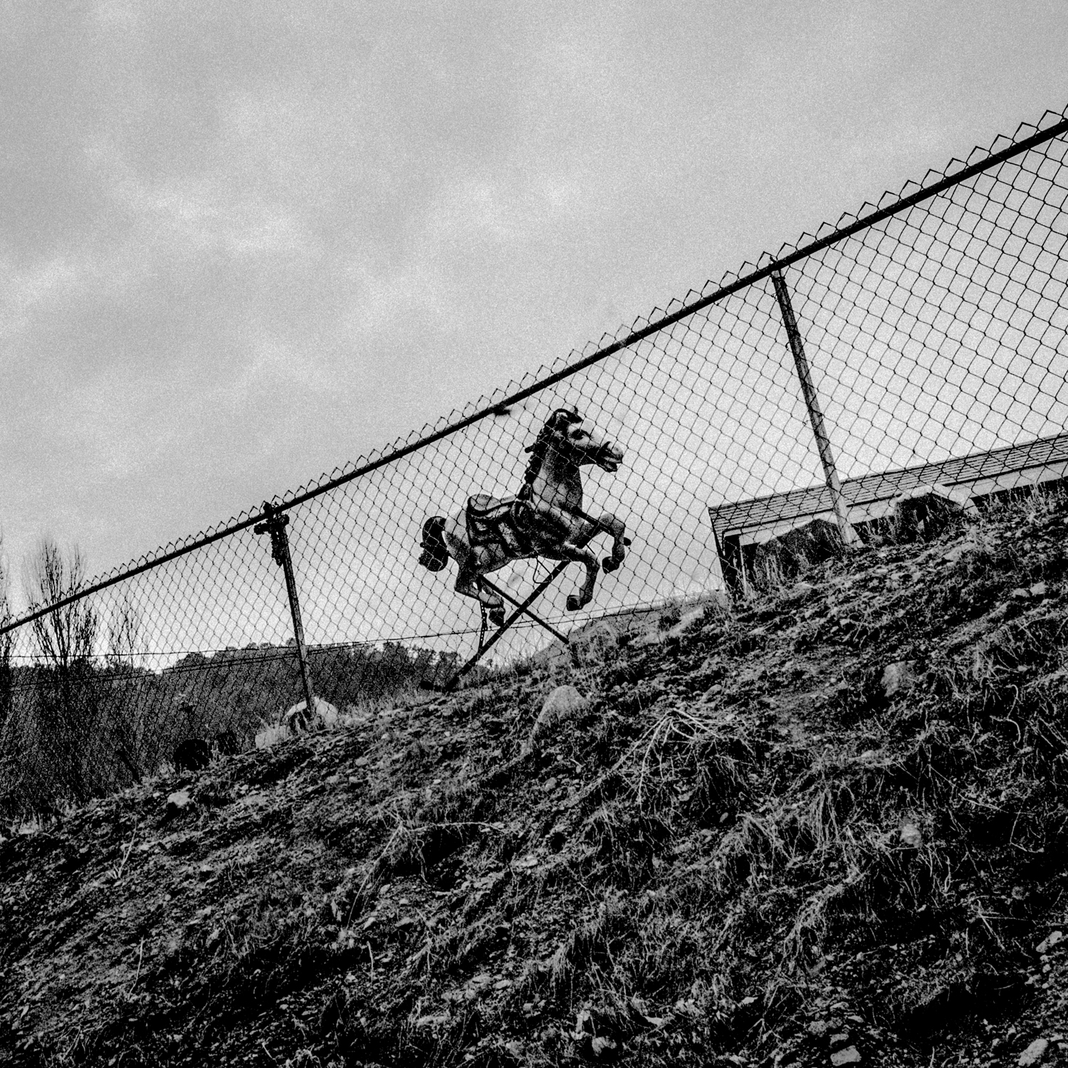
Memorial. Lost Hills, California. Feb. 4, 2014

LightBox: Which post inspired the most audience feedback and engagement? Why do you think that photo got people’s attention?

MB: The most recent posts have gotten more reaction, but that’s just because the audience has been growing. I’m trying not to pay too much attention to all that, and I’d still be doing the project regardless, because I’m doing something I want to do. You know before you post which pictures are likely to touch a nerve, but some of my favorites are actually the more quiet ones. You shouldn’t play to the choir; that’s the big danger with this.

LightBox: Do you envision Instagram ever loosing its appeal, and if so, how would you replace it?

MB: I’m sure things will change, but I like that it is not all walled off or too sanitized and I hope it stays that way for a while. There’s fair amount of shouting and general noise that you have to put up with, but if you are trying to reach people directly, I think that’s an okay price to pay.


Matt Black is a photographer whose work has been honored by the Robert F. Kennedy Memorial, World Press Photo, Pictures of the Year International and the Alexia Foundation.

Krystal Grow is a writer for TIME LightBox


See more photographers chosen by TIME for #LightBoxFF here

Matt Black, Geography of Poverty
Vegetable picker. Firebaugh, CA. 36°51’22”N 120°27’18”W #geographyofpoverty Firebaugh is a city in Fresno County, California, United States. The population was 7,549 at the 2010 census. Residents have a $12,142 per capita income and 34.9% live below the poverty level.Matt Black
Matt Black, Geography of Poverty
Trees. Alpaugh, CA. 35°53’15”N 119°29’12”W #geographyofpoverty Alpaugh is an unincorporated community in Tulare County, California, United States. The population was 1,026 at the 2010 census. Residents have a per capita income of $8,427 and 55.4% live below the poverty level. Alpaugh suffers from severe ground water contamination. Residents’ drinking water was found to contain high levels of arsenic and other chemicals.Matt Black
Matt Black, Geography of Poverty
Country road. Lindsay, CA. 36°12’8”N 119°5’17”W #geographyofpoverty Lindsay is a city in Tulare County, California, United States. Residents have a $11,117 per capita income and 40.9% live below the poverty level. Once the world’s largest olive producer, Lindsay’s last olive cannery closed in 1992.Matt Black
Matt Black, Geography of Poverty
Junk yard. Fresno. CA. 36°44’45”N 119°46’19”W #geographyofpoverty Fresno is a city in Fresno County, California, United States. The population was 494,665 at the 2010 census. Residents have a per capita income of $19,752 and 24.8% of its population lives below the poverty level. In 2006, Fresno was found to have the highest rates of concentrated poverty in the nation. Fresno County is the richest agricultural county in the United States, producing over $6 billion in crops annually.Matt Black
Matt Black, Geography of Poverty
Sale sign. Tulare, CA. 36°12’27”N 119°20’50”W #geographyofpoverty Tulare is a city in Tulare County, California, United States. The population was 59,278 at the 2010 census. Residents have a $18,203 per capita income and 20.2% live below the poverty level.Matt Black
Matt Black, Geography of Poverty
Guard dog. Mendota, CA. 36°45’13”N 120°22’53”W #geographyofpoverty Mendota is a city in Fresno County, California, United States. The population was 11,014 at the 2010 census. Residents have a per capita income of $8,947 and 45.6% live below the poverty level.Matt Black
Matt Black, Geography of Poverty
Homeless camp. Fresno, CA. 36°44’45”N 119°46’19”W #geographyofpoverty Fresno is a city in Fresno County, California, United States. The population was 494,665 at the 2010 census. Residents have a per capita income of $19,752 and 24.8% of its population lives below the poverty level. In 2006, Fresno was found to have the highest rates of concentrated poverty in the nation. Fresno County is the richest agricultural county in the United States, producing over $6 billion in crops annually.Matt Black
Matt Black, Geography of Poverty
Work shirt. Mendota, CA. 36°45’13”N 120°22’53”W #geographyofpoverty Mendota is a city in Fresno County, California, United States. The population was 11,014 at the 2010 census. Residents have a per capita income of $8,947 and 45.6% live below the poverty level.Matt Black
Matt Black, Geography of Poverty
Payday lender. Fresno, CA. 36°44’45”N 119°46’19”W #geographyofpoverty Fresno is a city in Fresno County, California, United States. The population was 494,665 at the 2010 census. Residents have a per capita income of $19,752 and 24.8% live below the poverty level. In 2006, Fresno was found to have the highest rates of concentrated poverty in the nation. Fresno County is the richest agricultural county in the United States, producing over $6 billion in crops annually.Matt Black
Matt Black, Geography of Poverty
Mailbox. Teviston, CA. 35°55’13”N 119°16’51”W #geographyofpoverty Teviston is an unincorporated community in Tulare County, California, United States. The population was 1,214 at the 2010 census. Residents have a per capita income of $8,891 and 65.6% live below the poverty level. Teviston is also known as “Freemanville,” a name given to it in the 1930s by Rev. J.F. Freeman, an Oklahoma labor contractor. www.geographyofpoverty.comMatt Black
Matt Black, Geography of Poverty
Spilled grapes. Caruthers, CA. 36°32’13”N 119°50’3”W #geographyofpoverty Caruthers is an unincorporated community in Fresno County, California, United States. The population was 2,497 at the 2010 census. Residents have a per capita income of $13,507 and 19% live below the poverty level.Matt Black
Matt Black, Geography of Poverty
Crop duster markers. Corcoran, CA. 36°5’53”N 119°33’37”W #geographyofpoverty Corcoran is a city in Kings County, California, United States. The population was 24,813 at the 2010 census. Residents have a $8,635 per capita income and 28% of its population lives below the poverty level. In 2013, Corcoran was ranked fifth on a list of the top ten most polluted cities in the US.Matt Black
Matt Black, Geography of Poverty
Rangeland. Madera, CA. 36°57’41”N 120°3’38”W #geographyofpoverty Madera is a city in Madera County, California, United States. The population was 61,416 at the 2010 census. Residents have a $14,637 per capita income and 27.4% live below the poverty level. Matt Black
Matt Black, Geography of Poverty
Farmworker camp. Alpaugh, CA. 35°53’16”N 119°29’14”W #geographyofpoverty Alpaugh is an unincorporated community in Tulare County, California, United States. The population was 1,026 at the 2010 census. Residents have a per capita income of $8,427 and 55.4% live below the poverty level. Alpaugh suffers from severe ground water contamination. Residents’ drinking water was found to contain high levels of arsenic and other chemicals.Matt Black
Matt Black, Geography of Poverty
Toy horse. Frazier Park, CA. 34°49’21”N 118°56’41”W #geographyofpoverty Frazier Park is a city in Kern County, California, United States. The population was 2,691 at the 2010 census. Residents have $23,785 per capita income and 4.5% live below the poverty level.Matt Black
Matt Black, Geography of Poverty
Front door. Taft, CA. 35°8’33”N 119°27’23”W #geographyofpoverty Taft is a city in Kern County, California, United States. The population was 9,327 at the 2010 census. Residents have a per capita income of $17,558 and 15.4% live below the poverty level.Matt Black

More Must-Reads From TIME

Contact us at letters@time.com