Mars likely had a body of water larger than the Arctic Ocean, according to a new study by NASA scientists.
The size of the Martian ocean is significantly larger than previously thought and provides further evidence that the planet may have once had the ability to support life. The body of water would have been large enough to cover the planet’s entire surface in 450-feet deep water, according to the study published in the journal Science, though it was likely concentrated in smaller areas.
“Our study provides a solid estimate of how much water Mars once had, by determining how much water was lost to space,” said Geronimo Villanueva, a NASA scientist and study author. “With this work, we can better understand the history of water on Mars.”
The scientists analyzed water on Mars today and compared it to water from a 4.5-billion-year-old Mars meteorite to determine how much water was likely lost in the past four billion years.
Still, questions remain about what happened to the large body of water. “With Mars losing that much water, the planet was very likely wet for a longer period of time than was previously thought, suggesting it might have been habitable for longer,” said Michael Mumma, a NASA scientist and study co-author.
PHOTOS: The Most Beautiful Panoramas and Mosaics From Opportunity’s Decade on Mars
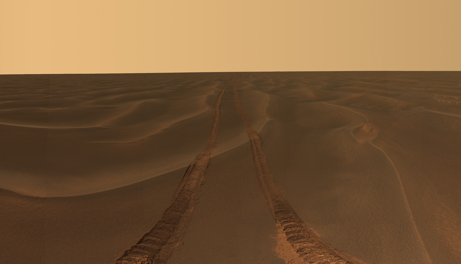
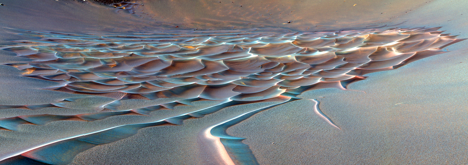
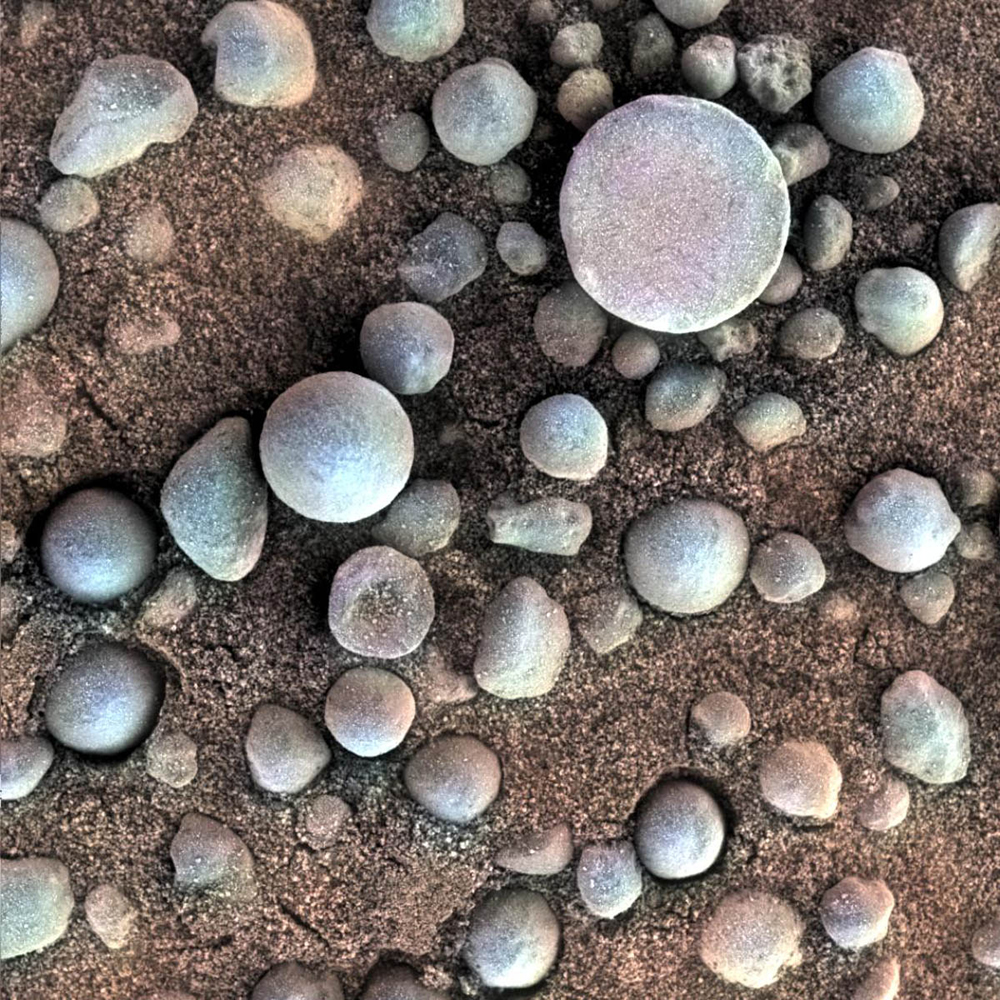
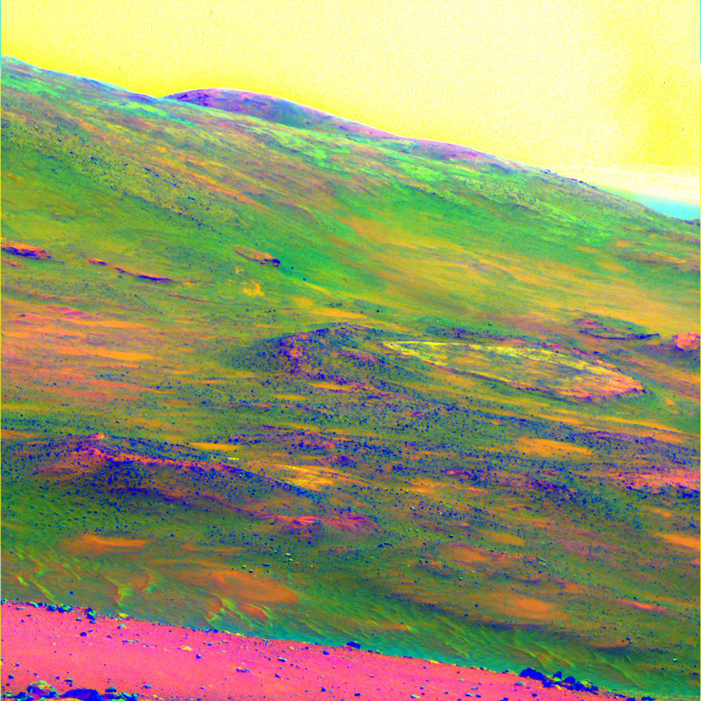
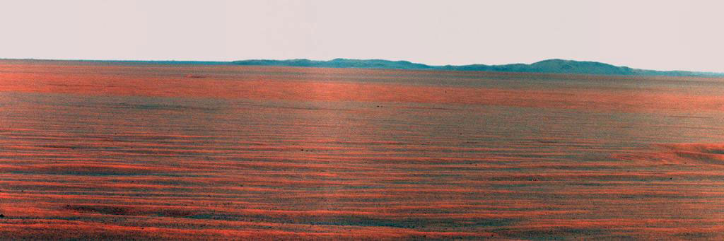
Rover tracks disappear toward the horizon like the wake of a ship across the desolate sea of sand between the craters Endurance and Victoria on the Meridiani Plains. NASA— JPL-Caltech / Cornell UniversityThe Mars Rover Spirit took this sublime view of a sunset over the rim of Gusev Crater, about 80 kilometers (50 miles) away. NASA—JPL-Caltech / Texas A&M / CornellA false-color image of Endurance Crater. In this image, tendrils of sand less than 3.3 ft (1 m) high extend from the main dune field toward the rover. Dunes are a common feature across the surface of Mars. Before the rover headed down to the dunes, mission managers first established whether the slippery slope that led to them was firm enough to ensure a successful drive back out of the crater. Otherwise, the dune field would become a sand trap. NASA—JPL-Caltech / Cornell UniversityTiny spherules, photographed by Opportunity, pepper a sandy surface in this 1.2-in (3 cm) square view of the Martian soil. Nicknamed "blueberries" by mission scientists, the little pellets are actually hematites, an iron oxide typically formed in standing water—of which Mars once had plenty.NASA—JPL-Caltech / Cornell / USGS / Cathy WeitzSpirit obtained this view of the area called Home Plate while parked atop a formation called Husband Hill. The colors emphasize differences in rock weathering. A large dust devil appears as the V-shaped discoloration in the sky at the top right.NASA—JPL-Caltech / Cornell UniversityThe Opportunity rover used its panoramic camera to record the East Rim of Endeavor Crater, on October 31, 2010. The view is presented in false color to make differences in surface materials more visible. A portion of Endeavour Crater's eastern rim, nearly 19 miles (30 km) distant, is visible.NASA—JPL-Caltech / CornellNASA's Spirit rover acquired this false-color image after using its abrasion tool to brush the surfaces of rock targets informally named "Stars" (left) and "Crawfords" (right). Small streaks of dust extend for several centimeters behind the chips and pebbles in the dusty soil. NASA—JPL-Caltech / USGS / Cornell UniversityRover tracks disappear toward the horizon like the wake of a ship between the craters Endurance and Victoria on the Meridiani Plains. Opportunity took the image while stuck in the sand ripple dubbed Purgatory for over a month. This panorama (only partly shown here) was named Rub Al Khali after the “Empty Quarter” in the Arabian Desert.NASA—JPL-Caltech / Cornell University