Hurricane Michael, currently a Category 4 storm with winds at 155 mph, is making landfall in Florida — and photos from the National Oceanic and Atmospheric Administration (NOAA) show just how massive the storm is as it hits the Panhandle region.
The NOAA is warning residents of the Florida Panhandle as well as those in Mid-Atlantic States like North Carolina, South Carolina and Georgia that Hurricane Michael will bring dangerous winds and flooding throughout the upcoming days. The eye of the storm, The National Hurricane Center says, “will bring hurricane-force winds well inland over the Florida Panhandle, southeastern Alabama, and southwest Georgia.”
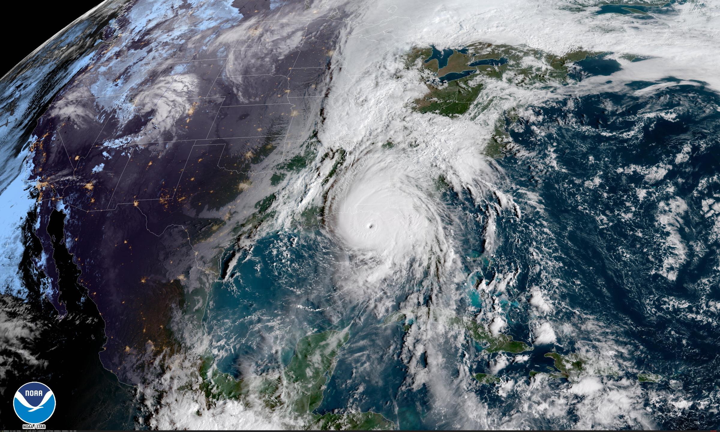
Although Hurricane Michael is expected to create immense storm surges, the NOAA says that the winds will cause catastrophic damage and the eye of the storm will likely make landfall in Panama City, Fla. There are also expected flash flood warnings from Florida to North Carolina, a state that is still recovering from Hurricane Florence.
More Must-Reads From TIME
- The 100 Most Influential People of 2024
- The Revolution of Yulia Navalnaya
- 6 Compliments That Land Every Time
- What's the Deal With the Bitcoin Halving?
- If You're Dating Right Now , You're Brave: Column
- The AI That Could Heal a Divided Internet
- Fallout Is a Brilliant Model for the Future of Video Game Adaptations
- Want Weekly Recs on What to Watch, Read, and More? Sign Up for Worth Your Time
Write to Elaine Selna at elaine.selna@time.com