World Space Week, designated in 1999 by the United Nations “to celebrate each year at the international level the contributions of space science and technology to the betterment of the human condition,” starts Oct. 4, with events continuing until Oct. 10. This year’s theme, “Remote Sensing: Enabling Our Future,” highlights Earth observation from space.
The U.S. Landsat mission, which celebrated it’s 50th anniversary this September, has collected millions of images of Earth from space, from the satellite Landsat 1, launched in 1972, to Landsat 8, launched in 2013. Both Landsat 7 and Landsat 8 continue to orbit the Earth today, capturing images of the entire planet every 16 days.
The original mission was to gather information about the natural resources of the Earth, according to its founder, Secretary of the Interior Stewart Udall. Today, “Landsat satellites monitor forest health, mobilize food resources to drought-stricken areas, observe climate change impact on polar ice caps, monitor crop health and stress, measure the impacts of carbon escaping into the atmosphere, and map rates, causes, and consequences of land cover change,” the United States Geological Survey (USGS) writes.
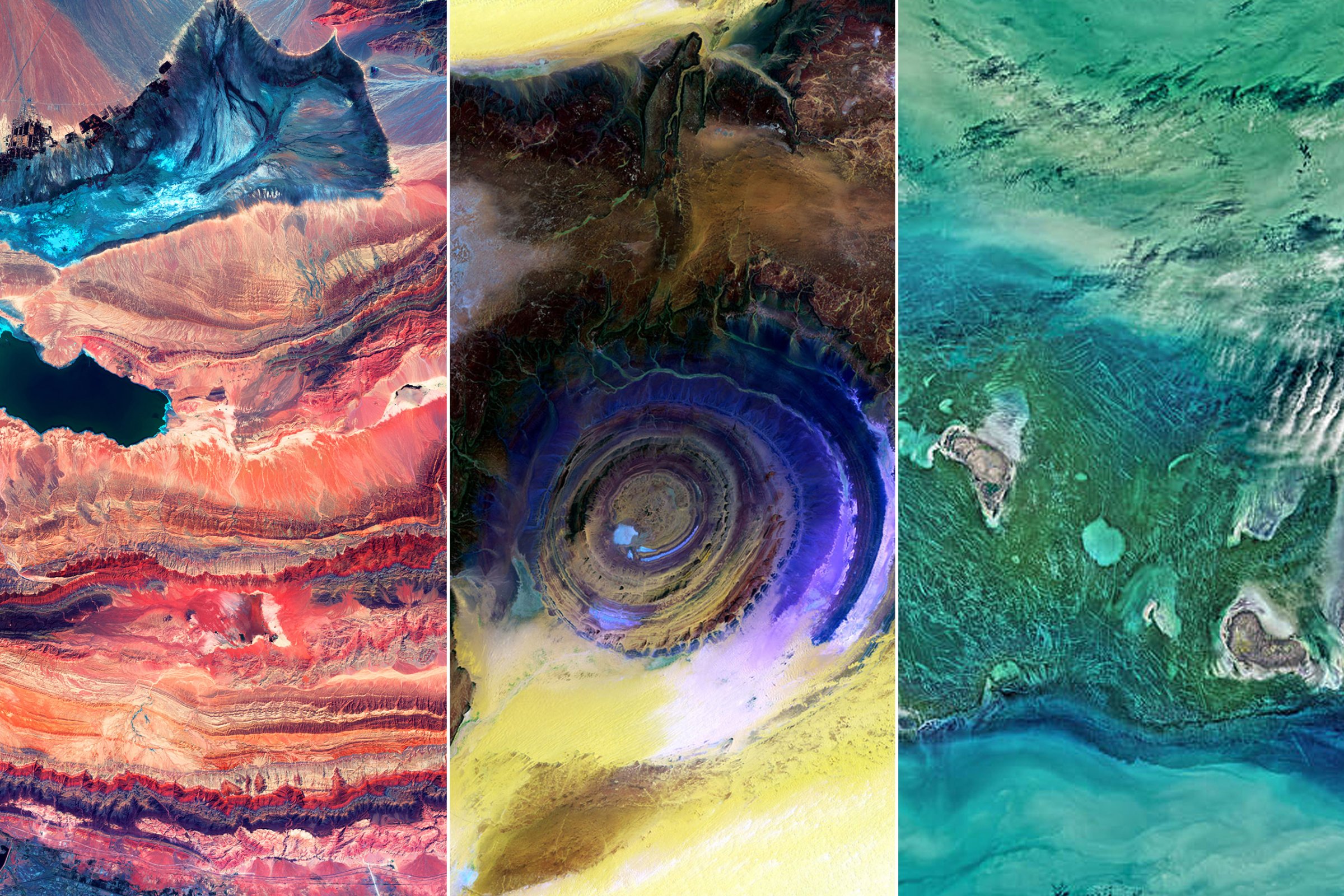
The sensors on these satellites capture more than your average Earth-photo. In addition to RGB (red, green, and blue) color, they are able to record near infrared, shortwave infrared, and thermal data, among other specialized observations. The resulting images are often not only scientifically valuable, as they allow scientists to reveal features our eyes cannot see, but also spectacularly beautiful.
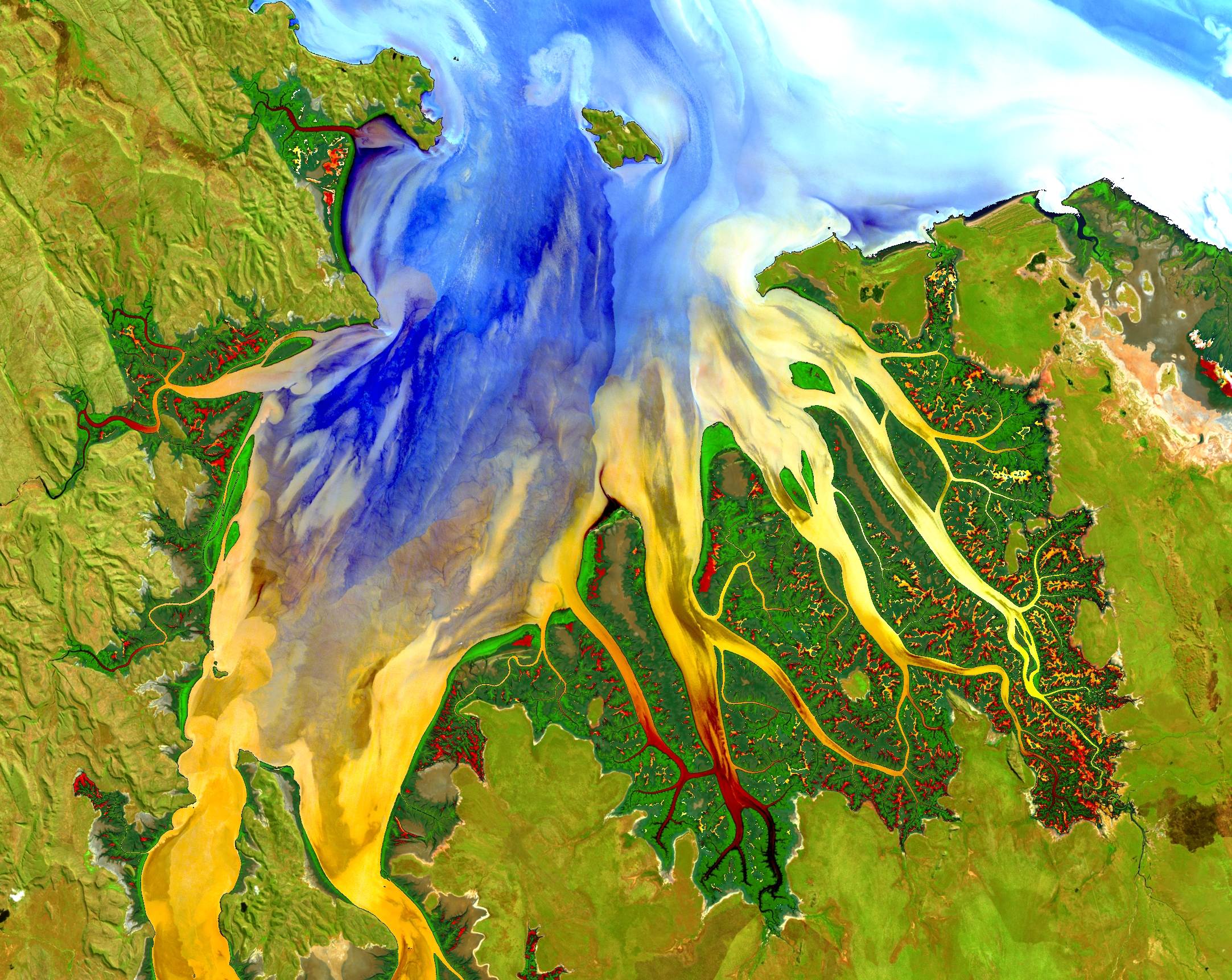
Western AustraliaThis image of a tropical estuary was enhanced to show complex sediment, nutrient and vegetation patterns. May 12, 2013.Geoscience Australia/USGS/NASAEye of the Sahara, Mauritania
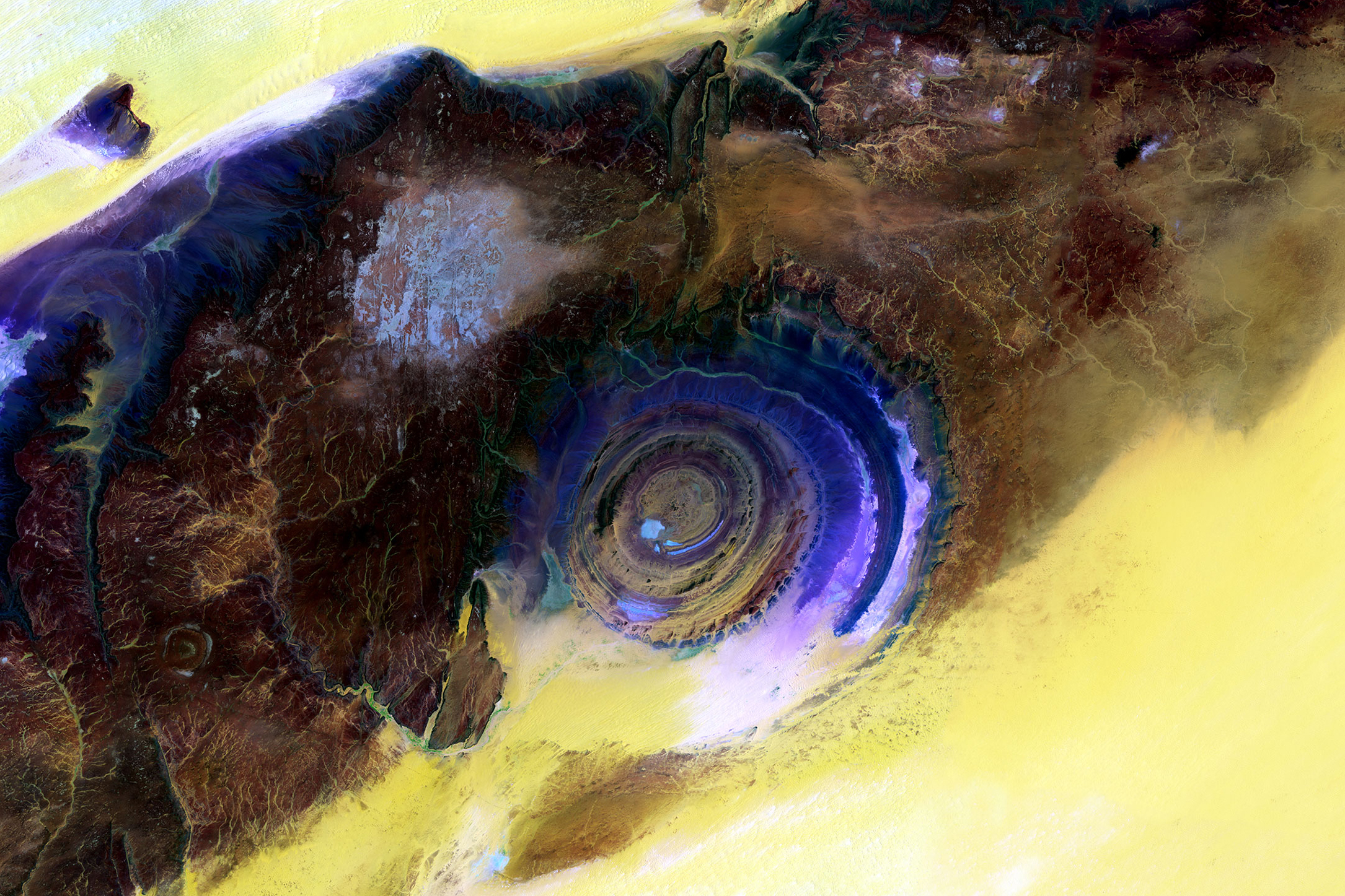
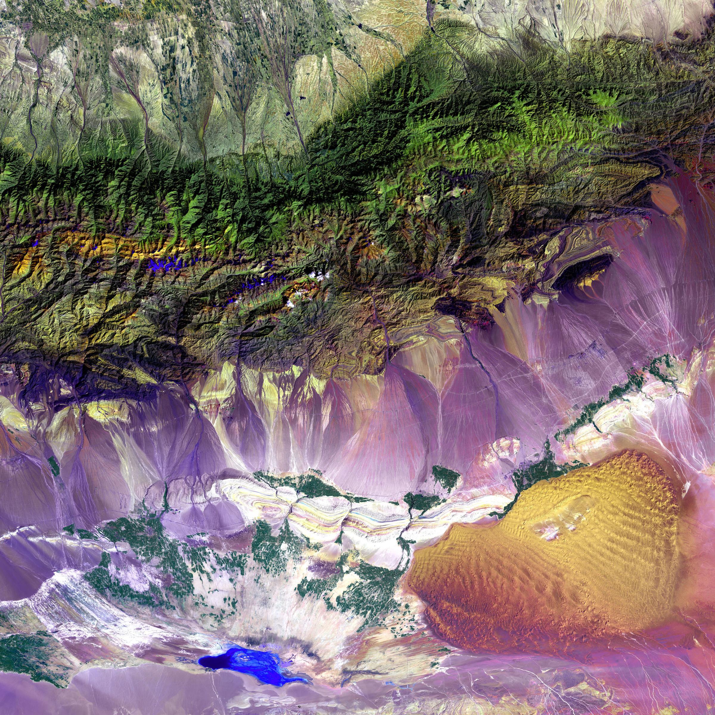
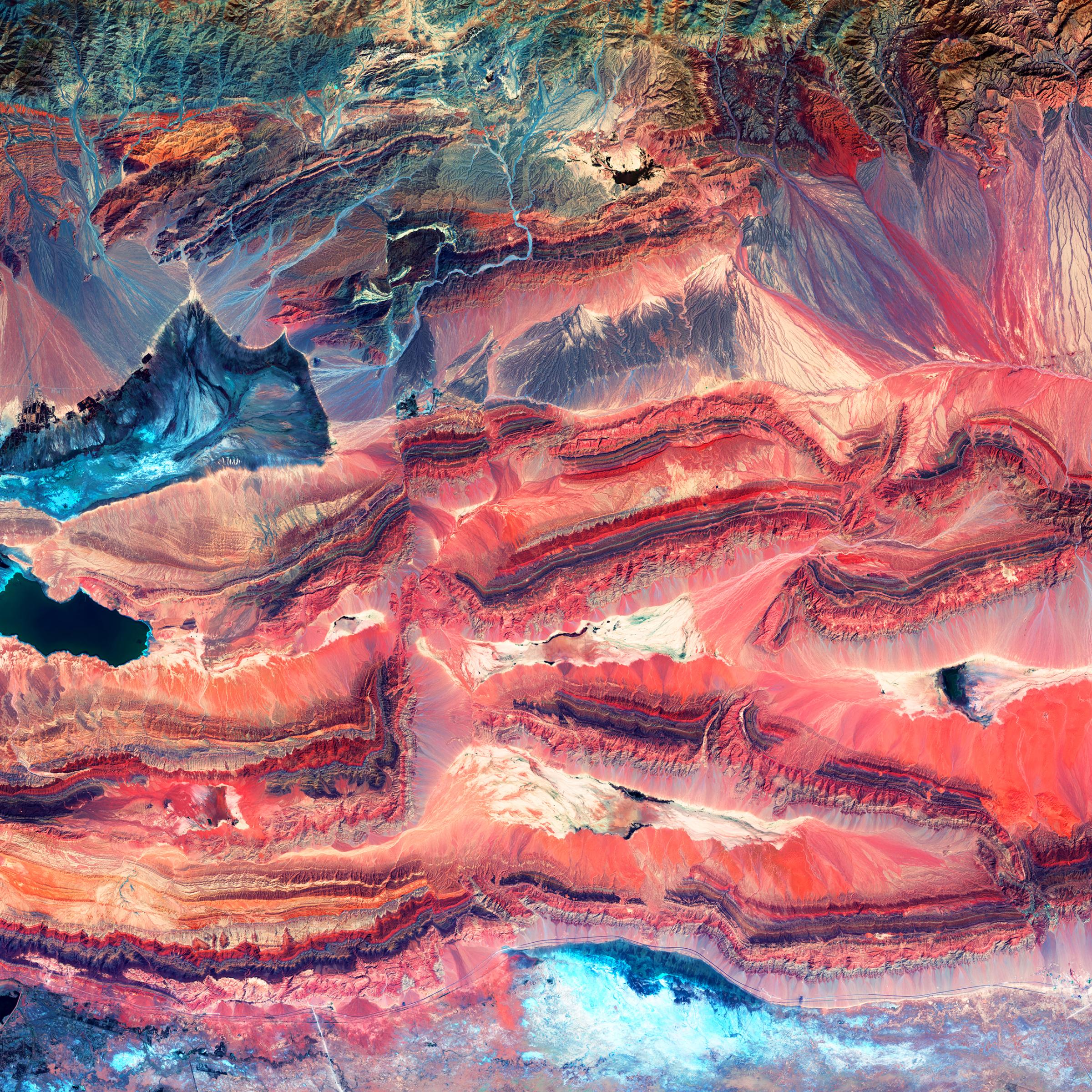
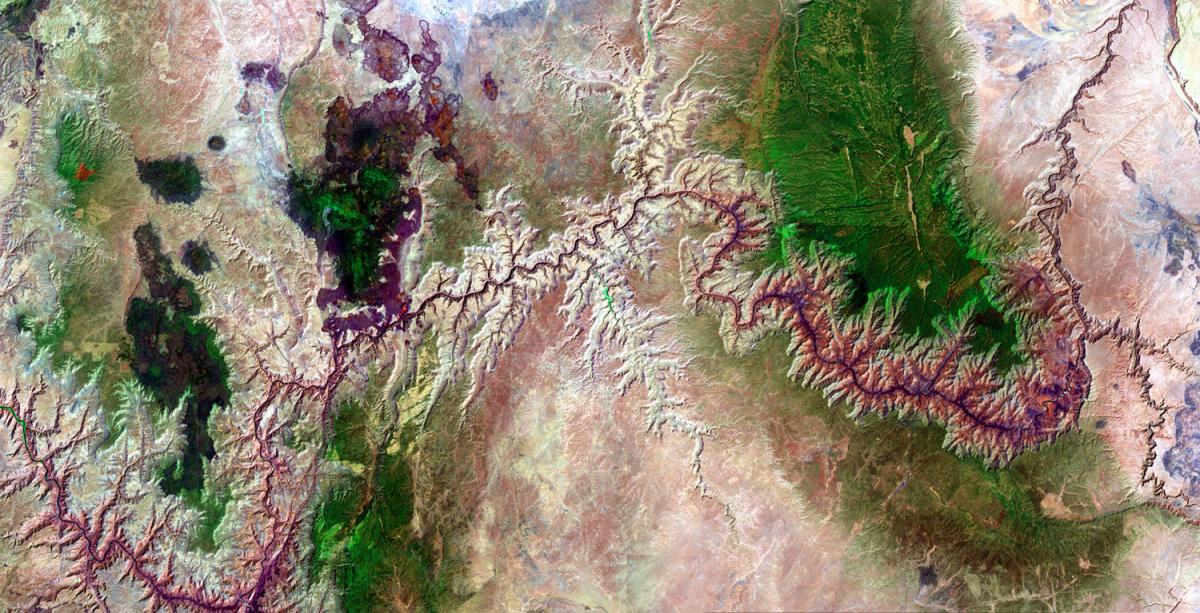
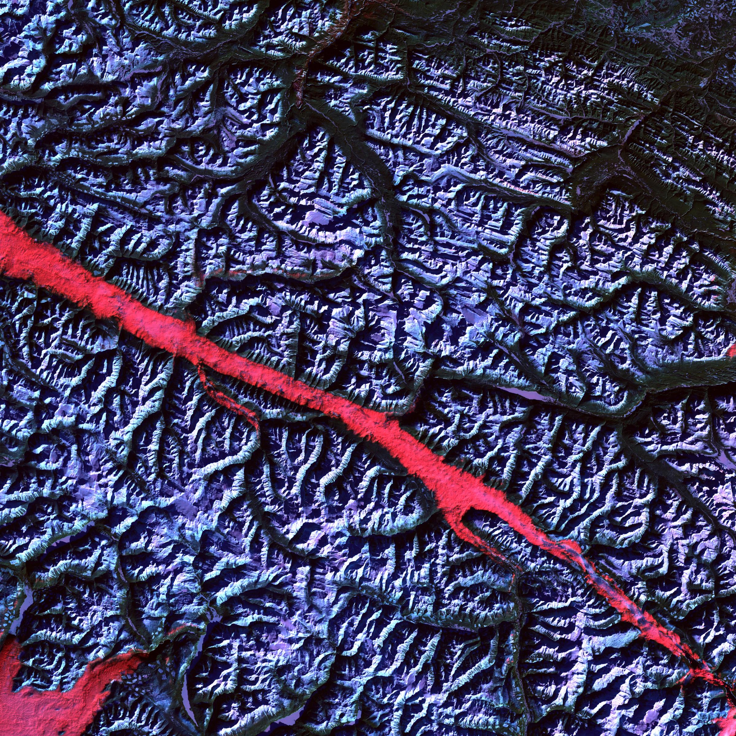
Scientists blended visible and infrared wavelengths to enhance the visibility of the different rock layers of this spectacular rock formation on the western edge of the Sahara desert. June 28 and July 5, 2015.USGS/NASALaguna Pastos Grandes, BoliviaIn this infrared image of a shallow salt lake in a volcanic caldera, captured by Landsat 8, water appears red, while salt and other evaporated deposits appear gold and yellow. June 21, 2015.USGS/NASAThe Turpan Depression, ChinaThe unique landscape at the foot of China's Bogda Mountains, is a mix of salt lakes and sand dunes. It is one of the few landscapes in the world that lies below sea level. Sept. 1, 1999.USGS/NASAWestern ChinaDifferent colors in this image of geologic faults indicate rocks that formed at different times and in different environments. July 30, 2013.USGS/NASAGrand Canyon, Arizona, USALandsat 7 captured this image of the 277-mile long canyon on June 19, 2002.USGS/NASARocky Mountain Trench, CanadaThe high reflectance of clouds compared to the surrounding land, coupled with the low sun elevation when this image was acquired, causes low clouds to appear red as they fill a portion of the trench. February 2004.USGS/NASALake Chad, Africa
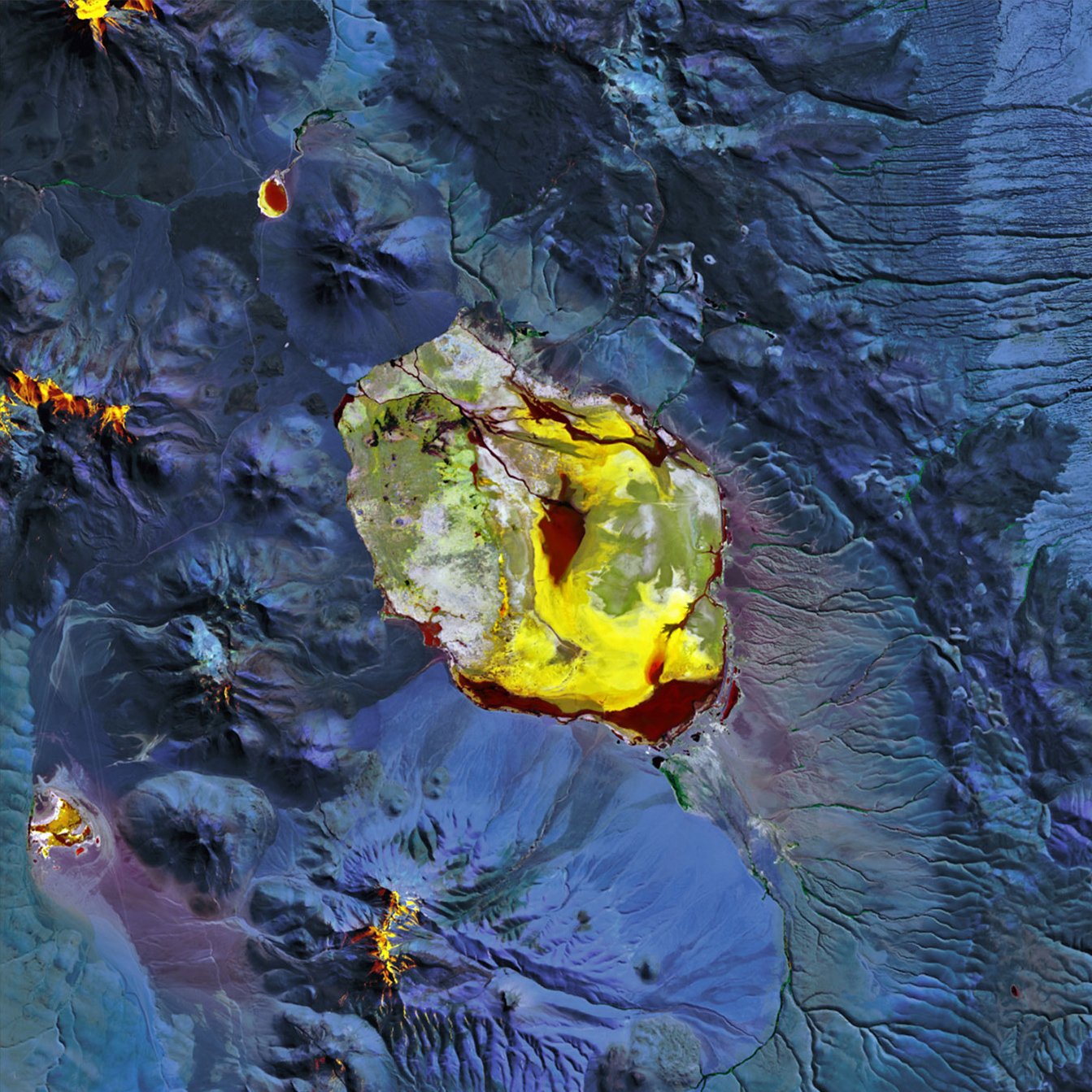
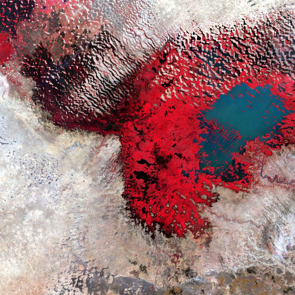
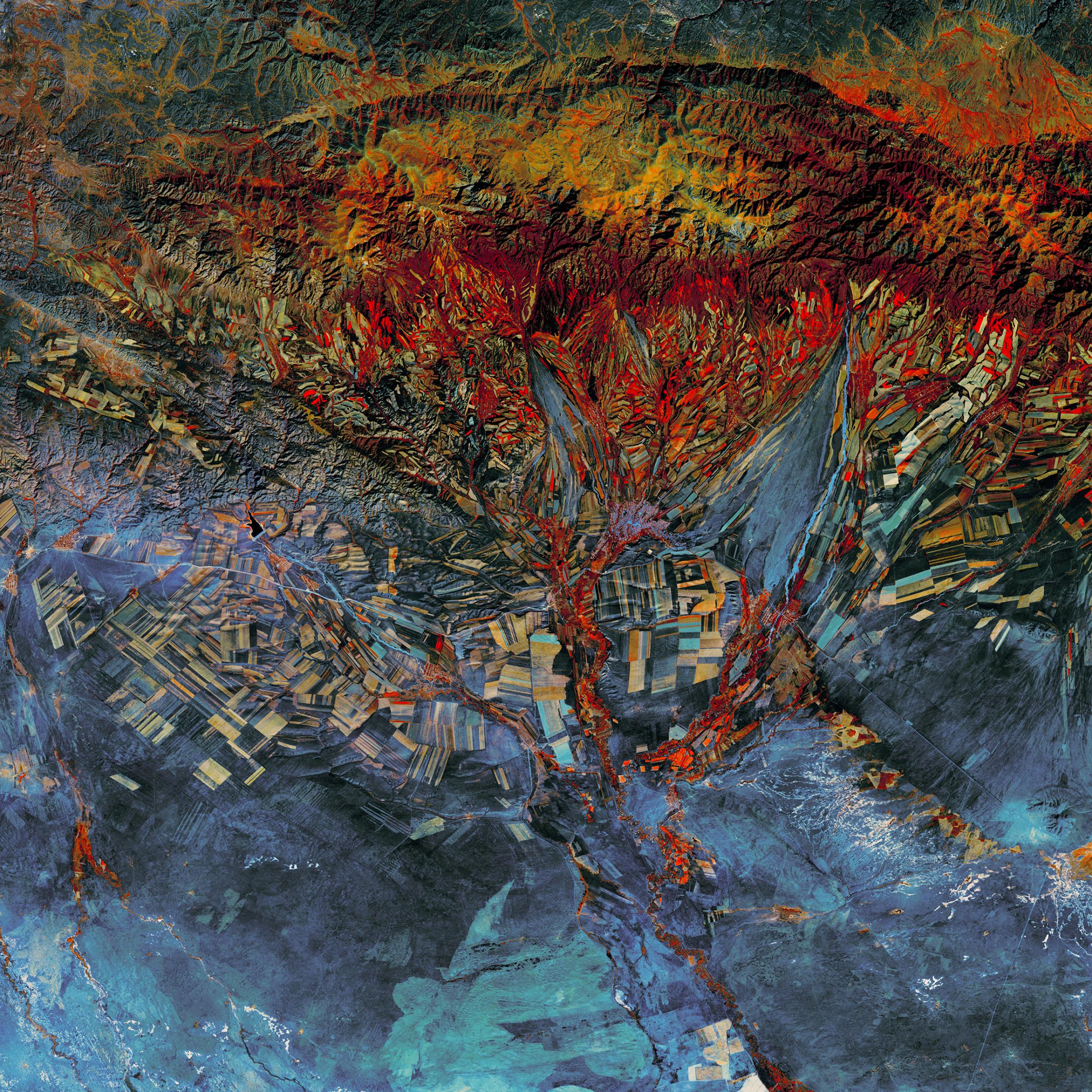
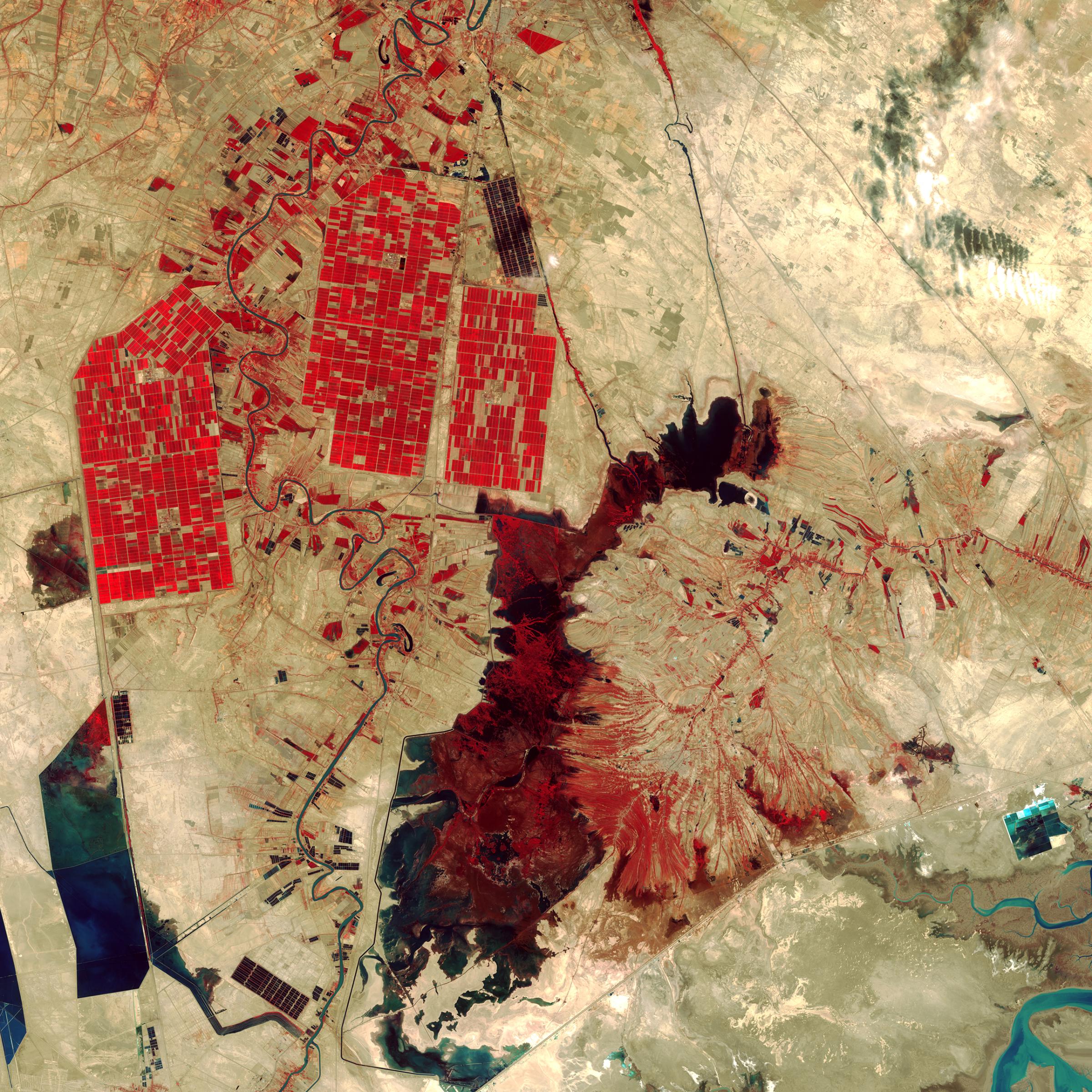
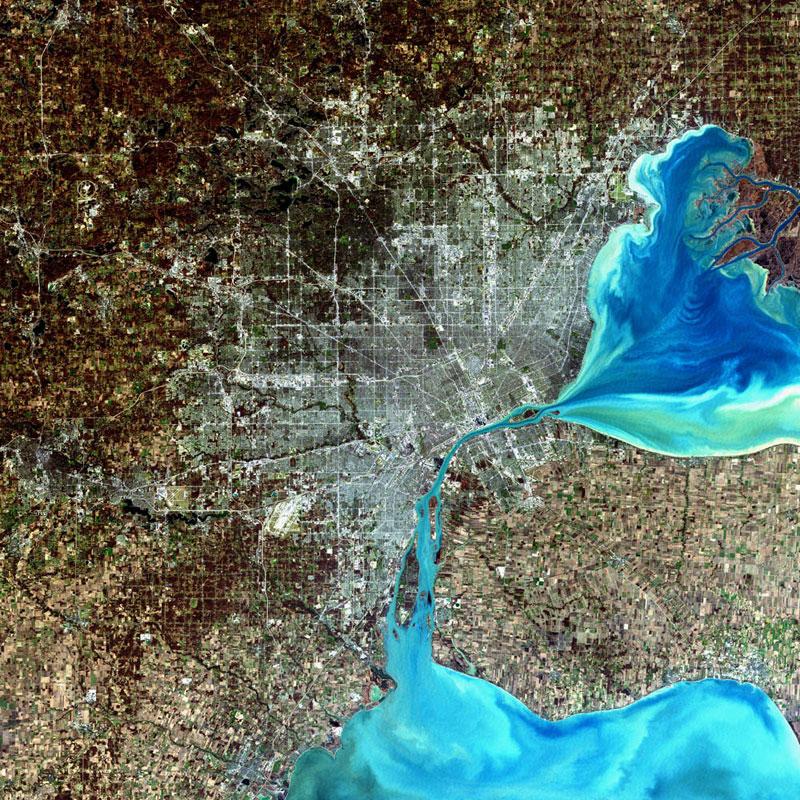
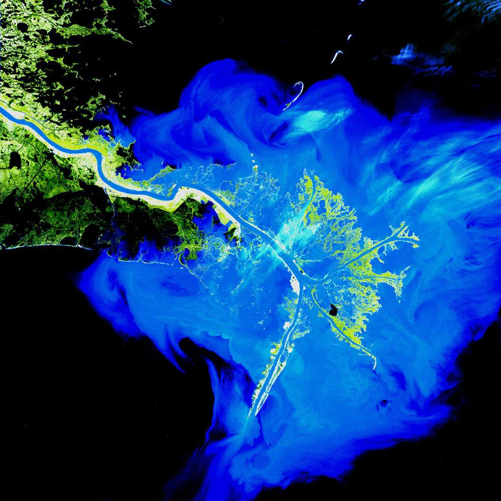
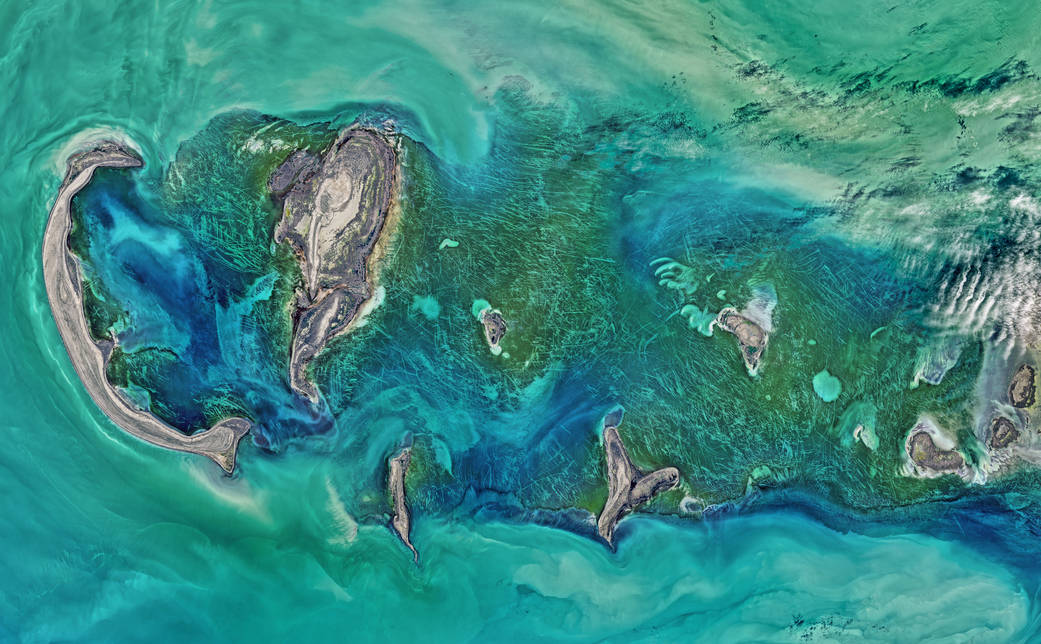
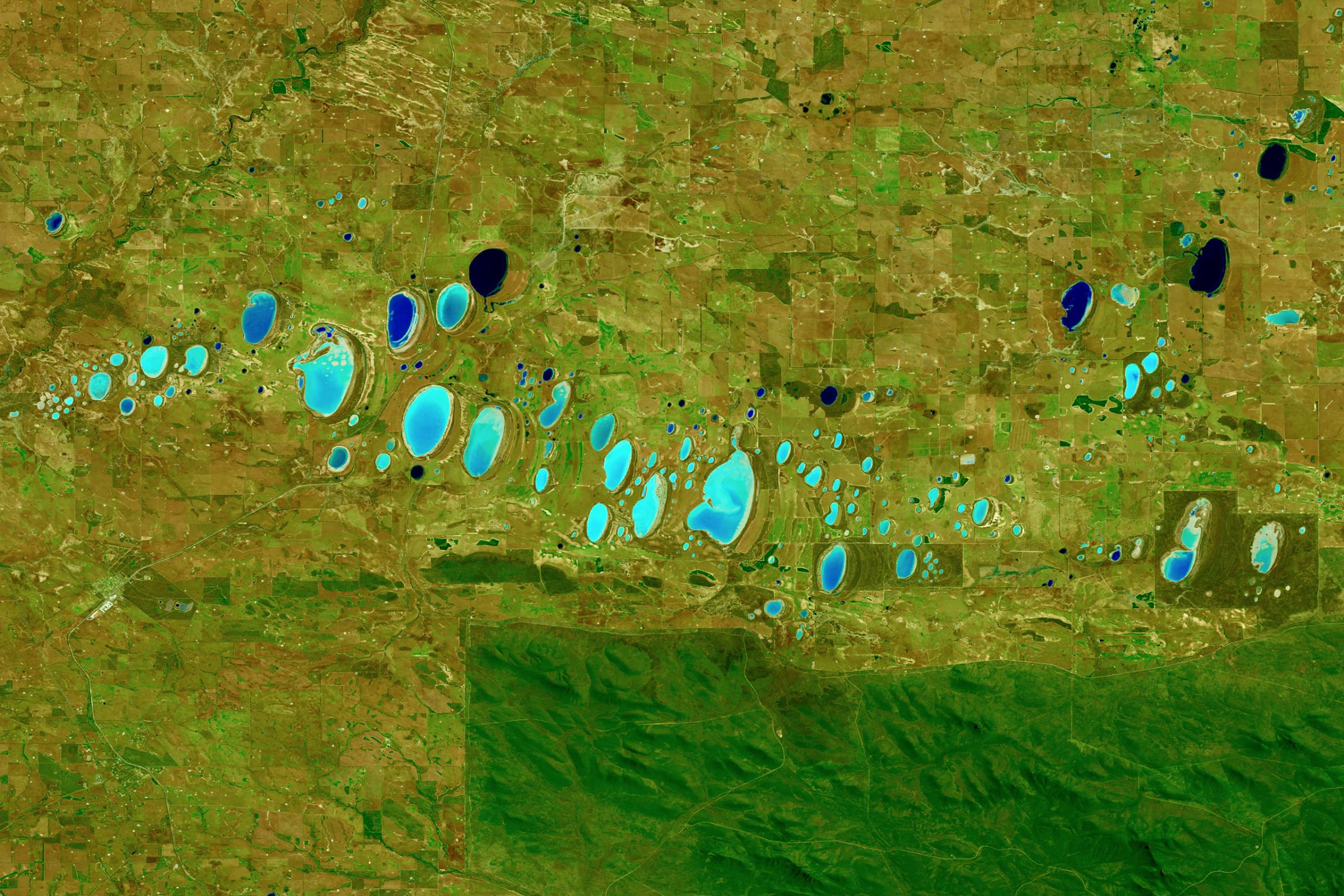
Infrared reveals the extent to which this lake has shrunk over the decades. As the water becomes more shallow, wetlands, shown here in red, replace open water. Dec. 18, 2002.USGS/NASAEastern KazakhstanThe fields in this part of eastern Kazakhstan follow the contours of the land—long and narrow in mountain valleys, and large and rectangular over the plains. Sept. 9, 2013.USGS/NASAShadegan Wetlands, IranRed areas in this Landsat 8 image depict actively growing vegetation. The rectangular shapes in the upper left reveal irrigated farmland while the dark red shape in the center of the image is Shadegan Pond. Oct. 12, 2014.USGS/NASADetroit, Michigan, USALandsat 7 captured this image of the largest city in Michigan on Dec. 11, 2001.USGS/NASAMississippi Delta, USALandsat has been observing the birdsfoot delta of the Mississippi River, which collects eroded debris from the entire central half of the United States, for more than three decades. March 12, 1989.USGS/NASACaspian Sea, Tyuleniy ArchipelagoShallow waters surrounding the Tyuleniy Archipelago allow you to see the dark green vegetation on the sea bottom, which has been gouged by moving ice. April 16, 2016Norman Kuring—NASAStirling Range National Park, AustraliaA shortwave infrared image of chain of saline lakes, which vary in color as a result of differing sediments, aquatic and terrestrial plant growth, water chemistry, algae, and hydrology. Shortwave infrared is helpful in differentiating wet earth from dry earth. Oct. 21, 2015.Joshua Stevens—USGS/NASA Earth ObservatoryMount Sourabaya, Bristol IslandA combination of shortwave-infrared, near-infrared, and red light helped detect the heat signatures of an eruption on this remote stratovolcano, observed for the first time in 60 years. May 1, 2016.Jesse Allen—USGS/NASA Earth Observatory