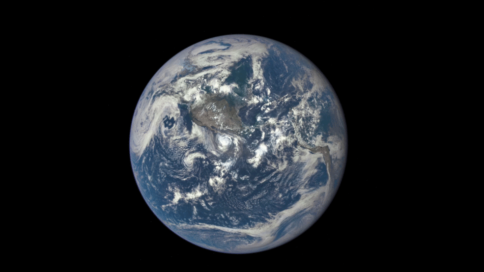
NASA’s Deep Space Climate Observatory (DSCOVR) has captured a view of the moon that is impossible to see from Earth—the “dark side,” illuminated as it passes between our planet and the Sun. The images were made by DSCOVR’s four megapixel Earth Polychromatic Imaging Camera (EPIC), from the satellite’s position a million miles away from the Earth on July 16.
Though this is not the first time the far side of the moon has been captured, it is the first illuminated view from this distance. The far side was first seen and recorded by the Soviet Luna 3 spacecraft in 1959. It has since been recorded and photographed in several NASA missions, including the Apollo 8 crew who were the first humans to see this side of the moon.
“It is surprising how much brighter Earth is than the moon,” Adam Szabo, DSCOVR project scientist at NASA’s Goddard Space Flight Center, said in a statement. “Our planet is a truly brilliant object in dark space compared to the lunar surface.”
DSCOVR was launched on Feb. 11 from Cape Canaveral, aboard a SpaceX Falcon 9 launch vehicle. Beginning next month, the satellite will provide daily color images to the public of the surface of the Earth just 12 to 36 hours from the time they are captured.
See the Evolution of the Iconic Blue Marble Photo
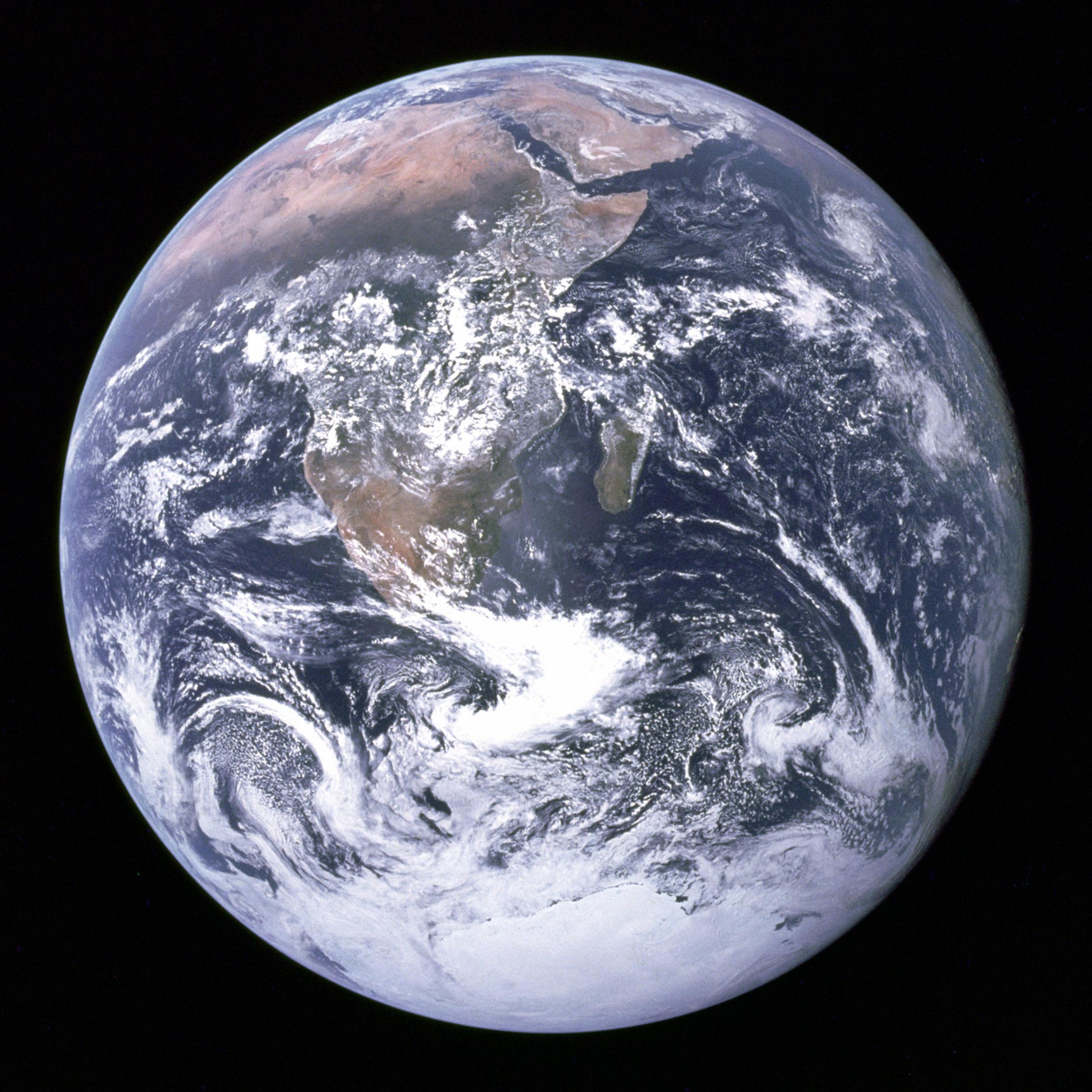
Blue Marble, 1972; The original "Blue Marble" was taken on Dec. 7, 1972, by the crew of the Apollo 17 spacecraft en route to the Moon at a distance of about 29,000 kilometres (18,000 mi). It shows Africa, Antarctica, and the Arabian Peninsula.NASANASA created these two images to exhibit high-resolution global composites of Moderate Resolution Imaging Spectroradiometer (MODIS) data. The land surface data were acquired from June through Sep. of 2001. The clouds were acquired on two separate days - July 29, 2001, for the northern hemisphere and Nov. 16, 2001 for the southern hemisphere. The images were rendered in late January 2002.
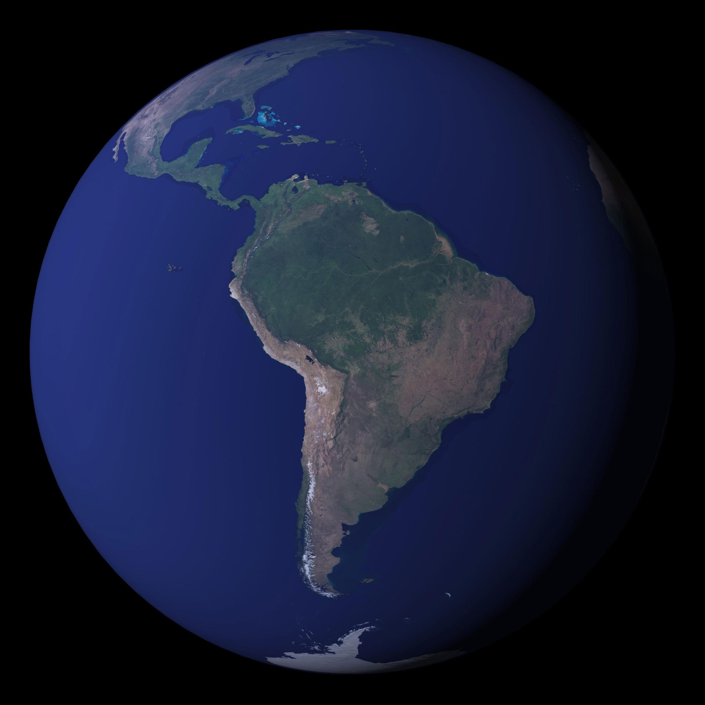
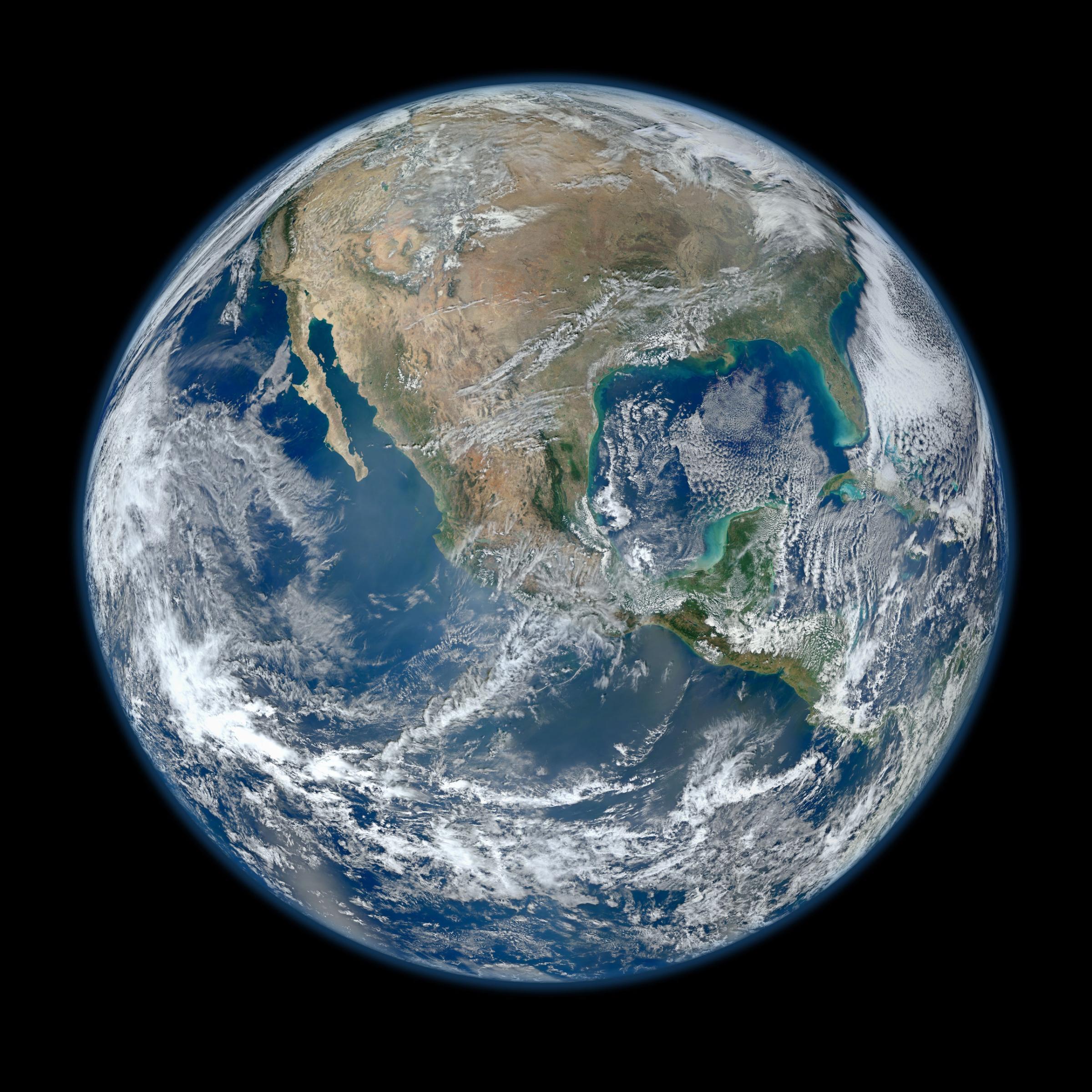
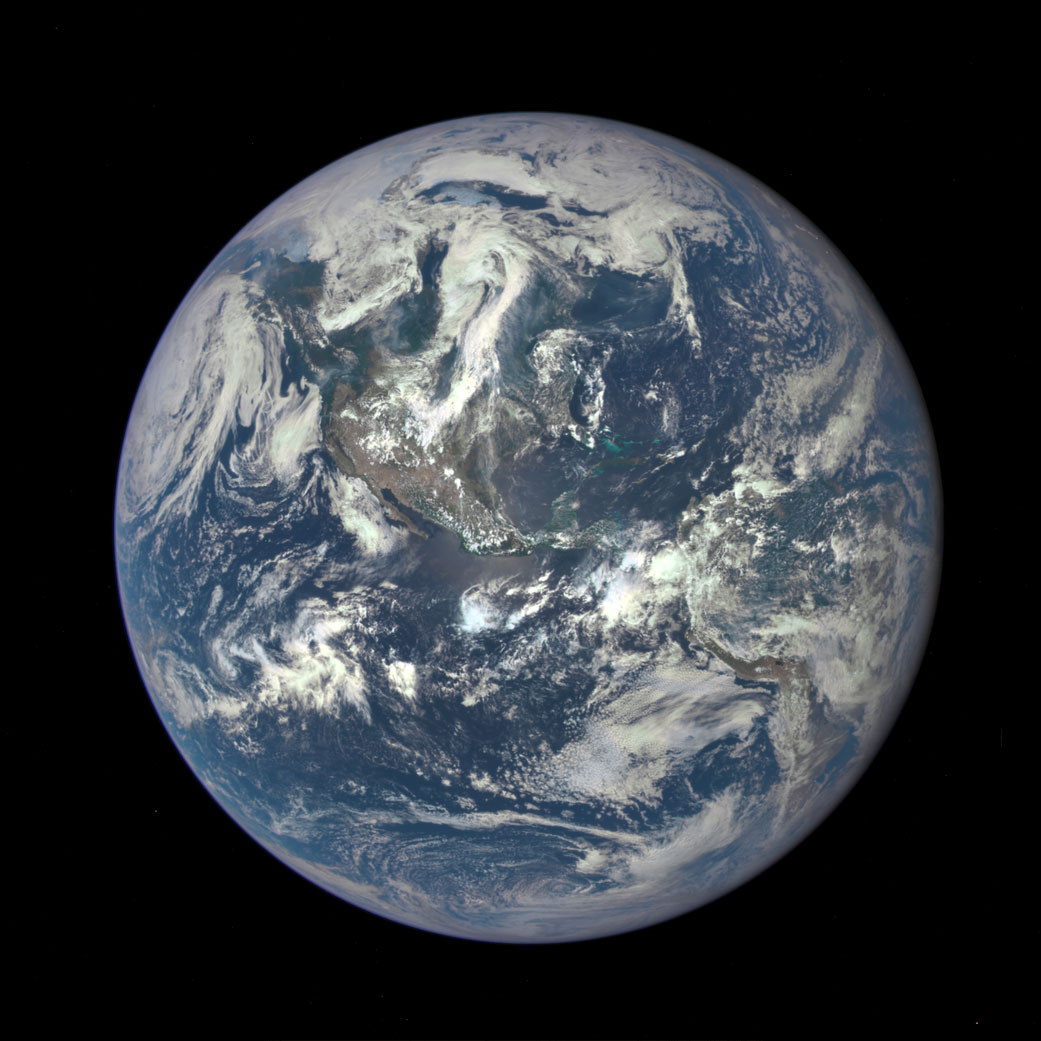
NASAIn 2002, NASA released the most detailed true-color image of the Earth’s surface ever produced up to that point. Scientists and data visualizers created the image by stitching together data collected over 4 months from NASA’s Terra satellite.The 2002 Blue Marble featured land surfaces, clouds, topography, and city lights at a maximum resolution of 1 kilometer per pixel. (NASA image by Robert Simmon and Reto Stöckli)The Blue Marble: Next Generation was a series of images that show the color of the Earth’s surface for each month of 2004 at very high resolution (500 meters/pixel) at a global scale. This image is a mosaic showing South America from September 2004 (with clouds removed). Reto Stöckli and Robert Simmon/NASAKnown as the "Black Marble", this image of North and South America at night is a composite assembled from data acquired by the Suomi NPP satellite in April and October 2012.NOAA/NASA/SuomiNPPAn image of the Earth taken from the VIIRS instrument aboard NASA's Earth-observing research satellite, Suomi NPP. This composite image uses a number of swaths of the Earth's surface taken on 4 Jan. 4, 2012. NASA/NOAA/GSFC/Suomi NPP/VIIRS/Norman KuringThe newest "Blue Marble", Earth seen from a distance of one million miles captured by a NASA scientific camera aboard the Deep Space Climate Observatory (DSCOVR) spacecraft on July 6, 2015.NASA