Correction appended, March 14
Cartography just got a much tastier look. Artists Caitlin Levin and Henry Hargreaves created a series of maps made entirely out of the foods for which the countries and continents are known.
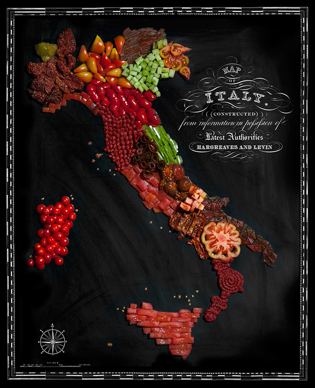
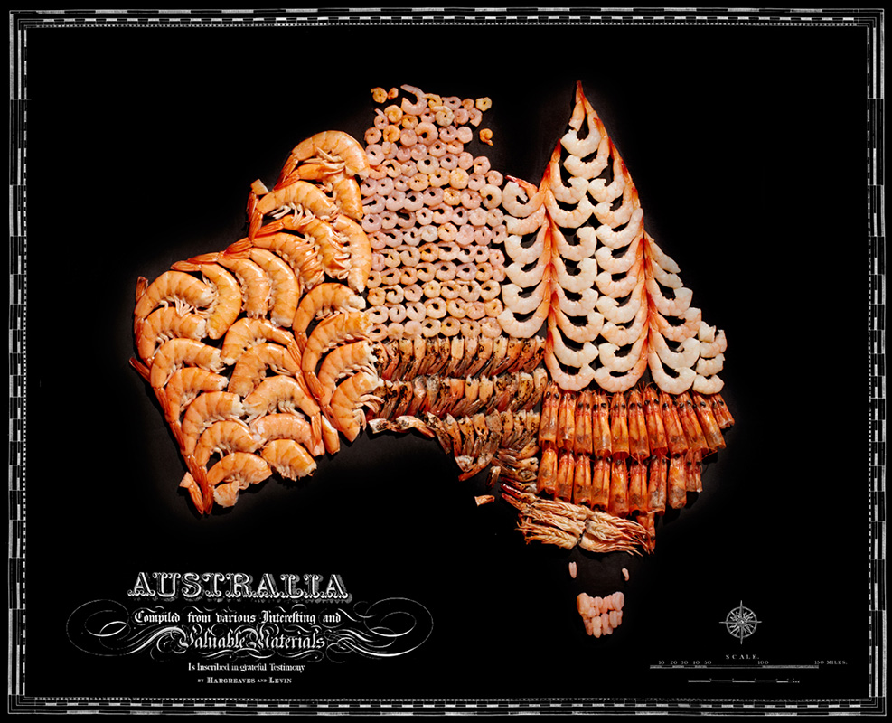
“Exploring new places through the food you eat is often a portal to the cultural complexities of that place,” Hargreaves told TIME in an email. “While we know that tomatoes originally came from the Andes in South America, Italy has become the tomato king. These maps show how food has traveled the globe—transforming and becoming a part of the cultural identity of that place. Who doesn’t know the saying “throw some shrimp on the barbie” and not think of Australia? Who goes to France without eating bread and cheese? And who makes a Brazilian caipirinha without a fistful of limes?”
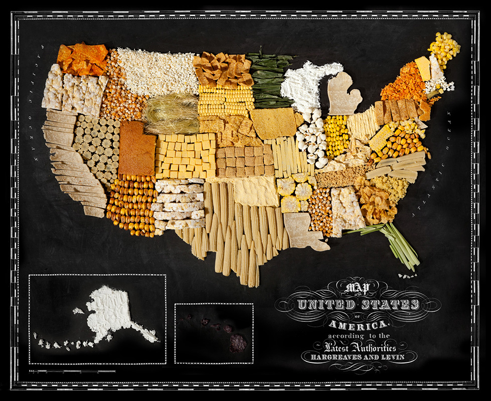
The United States, Corn
Italy, Tomatoes
Australia, Shrimp
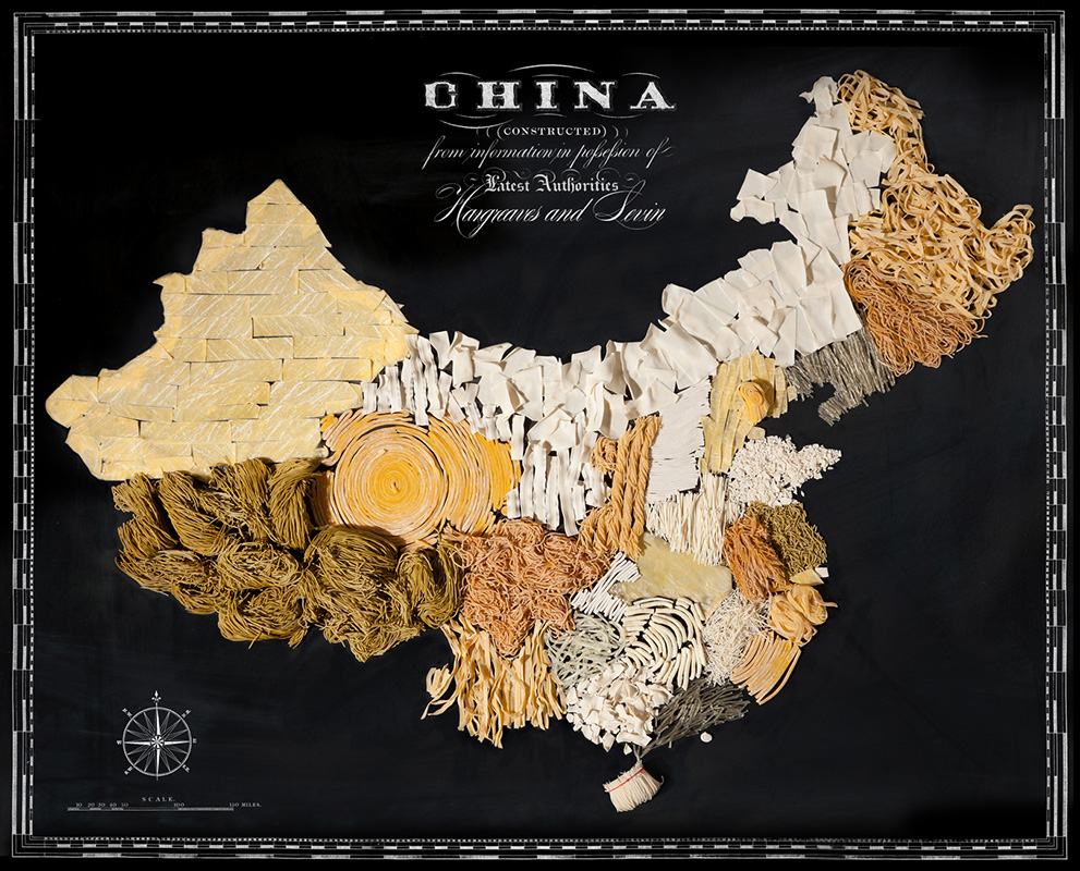
China, Noodles
France, Cheese and Bread

Japan, Seaweed

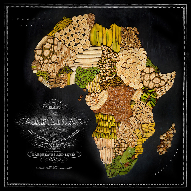
Africa, Bananas and Plantains
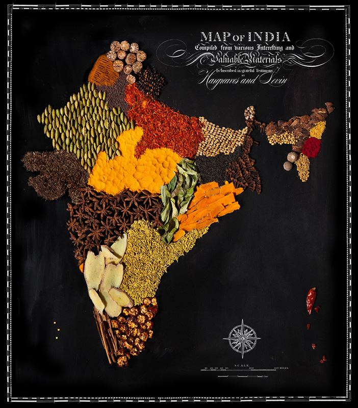
India, Spices
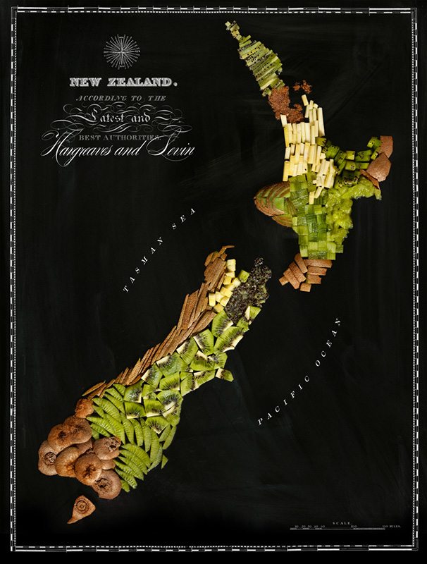
New Zealand, Kiwi
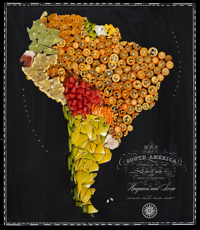
South America, Citrus
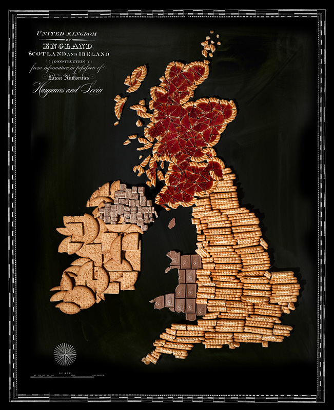
Ireland the United Kingdom, Biscuits
Correction: The original version of this story and headline incorrectly described all of the places depicted as countries. The story was also updated to clarify that Ireland is not part of the United Kingdom.
More Must-Reads From TIME
- The 100 Most Influential People of 2024
- Coco Gauff Is Playing for Herself Now
- Scenes From Pro-Palestinian Encampments Across U.S. Universities
- 6 Compliments That Land Every Time
- If You're Dating Right Now , You're Brave: Column
- The AI That Could Heal a Divided Internet
- Fallout Is a Brilliant Model for the Future of Video Game Adaptations
- Want Weekly Recs on What to Watch, Read, and More? Sign Up for Worth Your Time
Contact us at letters@time.com